RSS feed source: US Energy Information Administration

In-brief analysis

April 14, 2025

In our April Short-Term Energy Outlook, we forecast U.S. annual natural gas production from the Eagle Ford region in southwest Texas will grow from 6.8 billion cubic feet per day (Bcf/d) in 2024 to 7.0 Bcf/d in 2026. The increase in natural gas production comes as natural gas prices rise and demand for liquefied natural gas exports grows. Oil production in the Eagle Ford, on the other hand, has hovered around 1.1 million barrels per day (b/d) since 2020, and we forecast it will remain about the same through 2026.

This increase in natural gas production with stable oil production in the Eagle Ford region is a result of increasing gas-oil ratios. As more oil and natural gas are produced, pressure within the reservoir declines, allowing more natural gas relative to oil

Click this link to continue reading the article on the source website.

RSS feed source: US Energy Information Administration

…The Flood Advisory continues for the following rivers in Michigan… Sturgeon River near Alston affecting Baraga and Houghton Counties. .Forecast rainfall on top of the snowpack will cause runoff and increased snowmelt, resulting in river rises. The latest forecast shows the Sturgeon River at Alston reaching action stage but remaining below minor flood stage. * WHAT…Elevated river levels caused by rain and snowmelt will occur. * WHERE…Sturgeon River near Alston. * WHEN…Until Wednesday evening. * IMPACTS…At 8.0 feet, Homes and structures along the low lying areas and numerous roads become impacted by flood water. In Houghton County…Sturgeon River Road…Aho Road…and Rajala Road are impacted. In Baraga County…Sturgeon Road…Halonen Road and Usitalo

Click this link to continue reading the article on the source website.

RSS feed source: US Energy Information Administration

* WHAT…West winds 20 to 30 mph with gusts up to 50 mph expected. * WHERE…Northwest Pocahontas and Southeast Randolph Counties. * WHEN…From 10 AM Tuesday to 2 PM EDT Wednesday. * IMPACTS…Gusty winds will blow around unsecured objects. Tree limbs could be blown down and a few power outages may result.

Click this link to continue reading the article on the source website.
RSS feed source: US Energy Information Administration

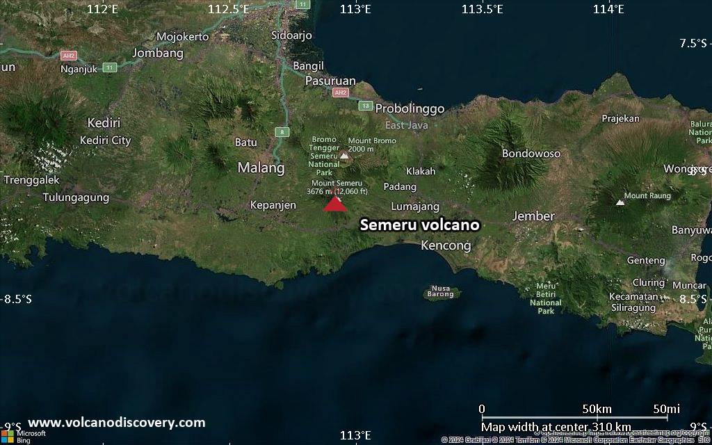
<!–div style="font-size:14px;text-align:center;border:3px solid blue;border-radius:5px;padding:3px;margin:5px;background:#eee"><a href="https://www.volcanoesandearthquakes.com/app/volcano-report.php?volcanoId=44" style="text-decoration:none" target="_blank" rel="noopener noreferrer nofollow" title="Share a volcano (activity) report, submit a photo or other interesting news!” onclick=”window.open(this.href,’Volcano Report’,’status=0,toolbar=0,location=0,directories=0,menubar=0,resizable=1,scrollbars=1,height=500,width=450′);return false”>Send Volcano Report</div–> Stratovolcano 3676 m (12,060 ft)
East Java, Indonesia, -8.11°S / 112.92°E
Current status: erupting (4 out of 5) Semeru volcano eruptions:
1818, 1829, 1830, 1832, 1836, 1838, 1842, 1844, 1845, 1848, 1849(?), 1851, 1856, 1857, 1865, 1866(?), 1887, 1887, 1888, 1889-91, 1892, 1893, 1893-94, 1895, 1896, 1897, 1899, 1899, 1900, 1901, 1903, 1904, 1905, 1907, 1908, 1909-10, 1910-11, 1911, 1912, 1913, 1941-42, 1945, 1946, 1946-47, 1950-64, 1967-ongoing
Typical eruption style
Explosive. Near constant strombolian activity, occasionally stronger explosions, lava flows and pyroclastic flows.

Click this link to continue reading the article on the source website.