RSS feed source: US National Weather Service

…The Flood Warning is extended for the following rivers in Alabama… Tombigbee River Near Coffeeville Dam affecting Washington, Choctaw and Clarke Counties. For the Tombigbee River…including Coffeeville Dam – Pool, Coffeeville Dam, Leroy…Minor flooding is forecast. * WHAT…Minor flooding is occurring. * WHERE…Tombigbee River near Coffeeville Dam. * WHEN…Until late tonight. * IMPACTS…At 29.0 feet, Pastureland becomes flooded. Livestock should be moved to higher ground. Old Ferry Road near the river begins to flood. * ADDITIONAL DETAILS… – At 8:30 AM CDT Tuesday the stage was 30.9 feet. – Forecast…The river is expected to fall below flood stage late this evening and continue falling to 17.5 feet Sunday morning. – Flood

Click this link to continue reading the article on the source website.

RSS feed source: US National Weather Service

* WHAT…Southwest winds 15 to 20 knots with gusts up to 25 knots, becoming west this afternoon, and waves 1 to 2 feet expected on Lake Moultrie. * WHERE…Lake Moultrie. * WHEN…Until 9 PM EDT this evening. * IMPACTS…Strong winds and rough waves on Lake Moultrie will create hazardous conditions for small craft.

Click this link to continue reading the article on the source website.
RSS feed source: US National Weather Service

…The Flood Warning continues for the following rivers in Kentucky… Rough River near Dundee affecting Ohio County. * WHAT…Minor flooding is occurring and minor flooding is forecast. * WHERE…Rough River near Dundee. * WHEN…Until further notice. * IMPACTS…At 25.0 feet, County roads between Dundee and Narrows flood. At 26.0 feet, County roads near Sunnydale flood. At 27.0 feet, KY 919 flood at Underwood and Clifty Huff Roads near Narrows. * ADDITIONAL DETAILS… – At 8:00 AM CDT Tuesday the stage was 26.6 feet. – Bankfull stage is 23.0 feet. – Recent Activity…The maximum river stage in the 24 hours ending at 8:00 AM CDT Tuesday was 26.8 feet. – Forecast…The river

Click this link to continue reading the article on the source website.

RSS feed source: US National Weather Service

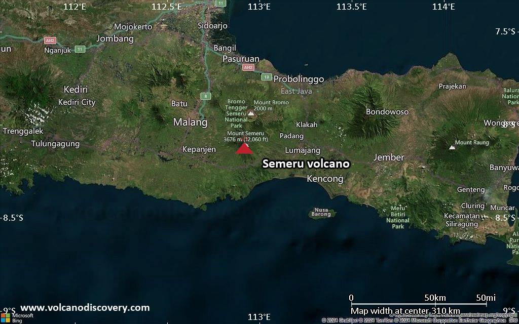
<!–div style="font-size:14px;text-align:center;border:3px solid blue;border-radius:5px;padding:3px;margin:5px;background:#eee"><a href="https://www.volcanoesandearthquakes.com/app/volcano-report.php?volcanoId=44" style="text-decoration:none" target="_blank" rel="noopener noreferrer nofollow" title="Share a volcano (activity) report, submit a photo or other interesting news!” onclick=”window.open(this.href,’Volcano Report’,’status=0,toolbar=0,location=0,directories=0,menubar=0,resizable=1,scrollbars=1,height=500,width=450′);return false”>Send Volcano Report</div–> Stratovolcano 3676 m (12,060 ft)
East Java, Indonesia, -8.11°S / 112.92°E
Current status: erupting (4 out of 5) Semeru volcano eruptions:
1818, 1829, 1830, 1832, 1836, 1838, 1842, 1844, 1845, 1848, 1849(?), 1851, 1856, 1857, 1865, 1866(?), 1887, 1887, 1888, 1889-91, 1892, 1893, 1893-94, 1895, 1896, 1897, 1899, 1899, 1900, 1901, 1903, 1904, 1905, 1907, 1908, 1909-10, 1910-11, 1911, 1912, 1913, 1941-42, 1945, 1946, 1946-47, 1950-64, 1967-ongoing
Typical eruption style
Explosive. Near constant strombolian activity, occasionally stronger explosions, lava flows and pyroclastic flows.

Click this link to continue reading the article on the source website.