RSS feed source: Volcano Discovery.com--Global earthquake monitor

Date and TimeMag
DepthDistanceLocationDetailsMap Jul 29, 02:31 pm (GMT +3)

4.7

10 km20 km (12 mi) to the SE Red Sea, 61 km southwest of Sindi Sarso Island, Jazan Region, Saudi ArabiaI FELT IT InfoJul 29, 01:19 pm (GMT +3)

4.4

10 km9.9 km (6.1 mi) to the S Red Sea, 72 km southwest of Sindi Sarso Island, Jazan Region, Saudi ArabiaI FELT IT InfoJul 29, 11:27 am (GMT +3)

4.6

1.9 km21 km (13 mi) to the E Red Sea, 45 km southwest of Sindi Sarso Island, Jazan Region, Saudi ArabiaI FELT IT InfoJul 29, 09:02 am (GMT +3)

4.3

10 km15 km (9.2 mi) to the NE Red Sea, 50 km southwest of Sindi Sarso Island, Jazan Region, Saudi ArabiaI FELT IT InfoJul 29, 08:32 am (GMT +3)

4.3

10 km9.8 km (6.1 mi) to the W Red Sea, 70 km southwest of Sindi Sarso Island, Jazan Region, Saudi ArabiaI FELT IT InfoApr 29, 2024 09:20 am (GMT +3)

4.2

10 km14 km (8.6 mi) to the S Red Sea, 70 km southwest of Sindi Sarso Island, Jazan Region, Saudi Arabia InfoJan 10, 2023 12:28 am (GMT +3)

4.9

10 km96 km (60 mi) to the SE Red Sea, 105 km south of Sindi Sarso Island, Jazan Region, Saudi Arabia InfoJan 9, 2023 08:31 pm (GMT +3)

4.7

10 km86 km (53 mi) to the SE Red Sea, 97 km south of Sindi Sarso Island, Jazan Region, Saudi Arabia InfoJan 27, 2020 04:58 pm (GMT +3)

4.3

10 km84 km (52 mi) to the NW Red Sea, 260 km northeast of

Click this link to continue reading the article on the source website.

RSS feed source: Volcano Discovery.com--Global earthquake monitor

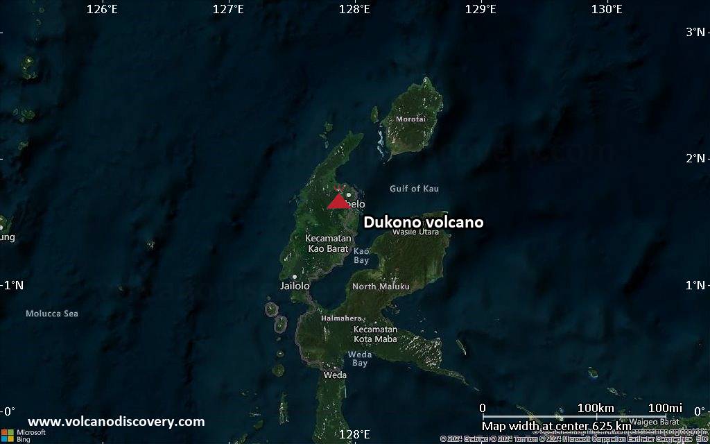
Volcanoes Today, 29 Jul 2025: Popocatépetl volcano, Semeru, Ibu, Dukono, Svartsengi, Reventador, Sangay, Sakurajima

Tue, 29 Jul 2025, 12:00 1753790404 | BY: VN

The spatter cone from which the lava emanates toward the east and southeast (image: Artanis/x.com)

Satellite image of Kirishima volcano on 29 Jul 2025

Satellite image of Ibu volcano on 29 Jul 2025

Svartsengi (Reykjanes peninsula, SW Iceland): The eruption continues.
Lava flows, pouring out from the cinder cone, remain active towards the east and southeast, making the lava flow field. Some activity is being observed on the north at the edges.
The spatter cone continues to be formed as molten material accumulates during constant spattering.

Kirishima (Kyushu): Volcanic Ash Advisory Center Tokyo (VAAC) issued the following report: ERUPTED AT 20250729/1057Z FL060 EXTD W OBS VA DTG:29/1100Z

Sakurajima (Kyushu, Japan): Volcanic Ash Advisory Center Tokyo (VAAC) issued the following report: EXPLODED AT 20250729/0111Z OVER FL050 EXTD W OBS VA DTG:29/0100Z

Ibu

Click this link to continue reading the article on the source website.

RSS feed source: Volcano Discovery.com--Global earthquake monitor

Date and TimeMag
DepthDistanceLocationDetailsMap Jul 24, 11:14 pm (GMT +11)

4.8

68 km81 km (50 mi) to the NE North Pacific Ocean, 74 km south of Iturup Island, Kurilsky District, Sakhalin Oblast, RussiaI FELT IT InfoJul 24, 02:15 am (GMT +11)

4.5

152 km100 km (62 mi) to the NW Sea of Okhotsk, 72 km north of Shikotan, Sakhalin Oblast, RussiaI FELT IT InfoJul 24, 12:15 am (GMT +9)

4.2

131 km76 km (47 mi) to the NW Sea of Okhotsk, 51 km north of Shikotan Island, Yuzhno-Kurilsky District, Sakhalin Oblast, RussiaI FELT IT InfoJul 6, 08:40 pm (GMT +11)

5.0

68 km48 km (30 mi) to the SW North Pacific Ocean, 23 km southeast of Shikotan Island, Yuzhno-Kurilsky District, Sakhalin Oblast, Russia 1 reportInfoJun 25, 04:19 pm (GMT +11)

4.1

74 km97 km (60 mi) to the W Sea of Okhotsk, 1.8 km north of Taraku-jima Island, Sakhalin Oblast, Russia InfoMay 30, 09:23 am (GMT +11)

5.4

63 km14 km (8.8 mi) to the W North Pacific Ocean, 49 km east of Shikotan, Sakhalin Oblast, Russia 5 reportsInfoApr 15, 06:42 pm (GMT +9)

4.8

30 km27 km (17 mi) to the S North Pacific Ocean, 63 km east of Shikotan, Sakhalin Oblast, Russia InfoFeb 18, 12:38 am (Universal Time)

4.7

65 km24 km (15 mi) to the W North Pacific Ocean, 39 km east of Shikotan, Sakhalin Oblast, Russia InfoAug 7, 2022 11:40 pm (GMT +10)

5.9

62 km48 km (30 mi) to the E 109 km E of Shikotan, Russia 24 reportsInfoMar 3, 2021 07:22 am (GMT +10)

5.8

39 km38 km (24 mi) to the NE North

Click this link to continue reading the article on the source website.
RSS feed source: Volcano Discovery.com--Global earthquake monitor

Support us – Help us upgrade our services! We truly love working to bring you the latest volcano and earthquake data from around the world. Maintaining our website and our free apps does require, however, considerable time and resources.
We need financing to increase hard- and software capacity as well as support our editor team. We’re aiming to achieve uninterrupted service wherever an earthquake or volcano eruption unfolds, and your donations can make it happen! Every donation will be highly appreciated. If you find the information useful and would like to support our team in integrating further features, write great content, and in upgrading our soft- and hardware, please make a donation (PayPal).

Planned features:

Improved multilanguage supportTsunami alertsFaster responsivenessThanks to your past donations, these features have been added recently:Design upgradeDetailed quake statsAdditional seismic data sourcesDownload and Upgrade the Volcanoes & Earthquakes app to get one of

Click this link to continue reading the article on the source website.