RSS feed source: Volcano Discovery.com--Global earthquake monitor

Date and TimeMag
DepthDistanceLocationDetailsMap Jun 16, 04:52 am (Lima)

4.4

203 km104 km (65 mi) to the W 52 km west of Puno, Puno, Peru InfoMay 4, 10:13 pm (Lima)

4.2

243 km43 km (26 mi) to the NW 27 km northeast of Puno, Puno, Peru InfoMar 27, 02:12 am (Lima)

4.1

196 km24 km (15 mi) to the SW 9.6 km south of Ilave, Puno, Peru InfoMar 9, 04:59 pm (Lima)

4.5

259 km24 km (15 mi) to the N 10 km E of Taquile, Peru InfoMar 3, 04:30 am (Lima)

4.6

162 km85 km (53 mi) to the S 72 km south of Ilave, Puno, Peru InfoFeb 17, 04:34 pm (Universal Time)

4.7

262 km37 km (23 mi) to the N 24 km S of Putina, Peru 2 reportsInfoFeb 7, 02:24 am (Lima)

4.8

214 km84 km (52 mi) to the NW 13 km southwest of Juliaca, Puno, Peru InfoJan 30, 05:17 pm (Lima)

4.5

169 km88 km (55 mi) to the SW 72 km south of Ilave, Puno, Peru InfoDec 31, 2022 06:04 pm (Lima)

4.9

190 km60 km (37 mi) to the S 83 km southeast of Puno, Puno, Peru InfoMay 26, 2022 07:02 am (Lima)

7.2

236 km145 km (90 mi) to the NW 32 km east of Ayaviri, Puno, Peru 227 reportsInfoSep 13, 2021 11:33 am (Lima)

5.0

200 km95 km (59 mi) to the NW 40 km northwest of Puno, Puno, Peru 1 reportInfoMar 1, 2019 03:50 am (Lima)

7.0

267 km157 km (97 mi) to the NW 22 km north of Azangaro, Puno, Peru 128 reportsInfoJun 1, 2016 07:01 pm (Lima)

5.0

10 km126 km (78 mi) to the SW 4.7 km northwest of Callapa, Tacna, Peru InfoAug 28, 2015

Click this link to continue reading the article on the source website.

RSS feed source: Volcano Discovery.com--Global earthquake monitor

Support us – Help us upgrade our services! We truly love working to bring you the latest volcano and earthquake data from around the world. Maintaining our website and our free apps does require, however, considerable time and resources.
We need financing to increase hard- and software capacity as well as support our editor team. We’re aiming to achieve uninterrupted service wherever an earthquake or volcano eruption unfolds, and your donations can make it happen! Every donation will be highly appreciated. If you find the information useful and would like to support our team in integrating further features, write great content, and in upgrading our soft- and hardware, please make a donation (PayPal).

Planned features:

Improved multilanguage supportTsunami alertsFaster responsivenessThanks to your past donations, these features have been added recently:Design upgradeDetailed quake statsAdditional seismic data sourcesDownload and Upgrade the Volcanoes & Earthquakes app to get one of

Click this link to continue reading the article on the source website.

RSS feed source: Volcano Discovery.com--Global earthquake monitor

Date and TimeMag
DepthDistanceLocationDetailsMap May 31, 11:41 am (GMT -11)

4.6

35 km22 km (14 mi) to the E North Pacific Ocean, 62 mi south of Sanak Island, Aleutians East Borough, Alaska, United States InfoMay 30, 02:51 am (GMT -11)

4.2

10 km84 km (52 mi) to the N North Pacific Ocean, 24 mi west of Sanak Island, Aleutians East Borough, Alaska, United States InfoMay 23, 03:54 am (GMT -8)

4.6

35 km64 km (40 mi) to the SW North Pacific Ocean, 50 mi southeast of Tigalda Island, Aleutians East Borough, Alaska, United States InfoMay 22, 05:30 pm (GMT -9)

5.2

10 km70 km (44 mi) to the SW North Pacific Ocean, 57 mi southeast of Tigalda Island, Aleutians East Borough, Alaska, United States InfoMar 20, 06:36 pm (GMT -8)

4.1

35 km87 km (54 mi) to the NE 64 mi south of King Cove, Aleutians East Borough, Alaska, United States InfoFeb 4, 08:27 am (GMT -11)

5.0

8.2 km37 km (23 mi) to the SW North Pacific Ocean, 65 mi southeast of Tigalda Island, Aleutians East Borough, Alaska, United States InfoDec 9, 2024 05:34 pm (GMT +0)

5.0

35 km95 km (59 mi) to the NE 61 mi south of King Cove, Aleutians East Borough, Alaska, United States InfoJul 12, 2024 05:28 pm (GMT -9)

4.7

30 km84 km (52 mi) to the W North Pacific Ocean, 38 mi south of Tigalda Island, Aleutians East Borough, Alaska, United States InfoSep 12, 2023 12:48 pm (GMT -9)

4.9

47 km44 km (28 mi) to the NW North Pacific Ocean, 41 mi east of Tigalda Island, Aleutians East Borough,

Click this link to continue reading the article on the source website.
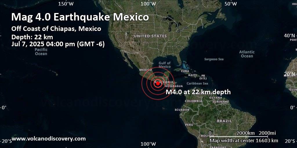
RSS feed source: Volcano Discovery.com--Global earthquake monitor

150 km (93 mi)

NE of epicenter

Costa Azul

(pop: 139)

II: Very weak

Pijijiapan, Estado de Chiapas 151 km (94 mi)

NE of epicenter

La Conquista

(pop: 473)

II: Very weak

Pijijiapan, Estado de Chiapas 153 km (95 mi)

NE of epicenter

El Palmarcito

(pop: 1,140)

II: Very weak

Pijijiapan, Estado de Chiapas 153 km (95 mi)

NE of epicenter

Manuel Avila Camacho (Ponte Duro)

(pop: 1,780)

II: Very weak

Tonala, Estado de Chiapas 155 km (97 mi)

NE of epicenter

Barrita de Pajon

(pop: 375)

II: Very weak

Mapastepec, Estado de Chiapas 157 km (98 mi)

N of epicenter

Cabeza de Toro

(pop: 3,410)

II: Very weak

Tonala, Estado de Chiapas 160 km (100 mi)

NE of epicenter

La Piaña

(pop: 118)

II: Very weak

Pijijiapan, Estado de Chiapas 161 km (100 mi)

N of epicenter

Cachimbo

(pop: 124)

II: Very weak

San Francisco del Mar, Estado de Oaxaca 161 km (100 mi)

NE of epicenter

Tamaulipas

(pop: 1,570)

II: Very weak

Pijijiapan, Estado de Chiapas 162 km (101 mi)

NE of epicenter

Las Brisas

(pop: 1,720)

II: Very weak

Pijijiapan, Estado de Chiapas 164 km (102 mi)

NE of epicenter

Tres Picos

(pop: 4,400)

II: Very weak

Tonala, Estado de Chiapas 164 km (102 mi)

NE of epicenter

Colonia

Click this link to continue reading the article on the source website.