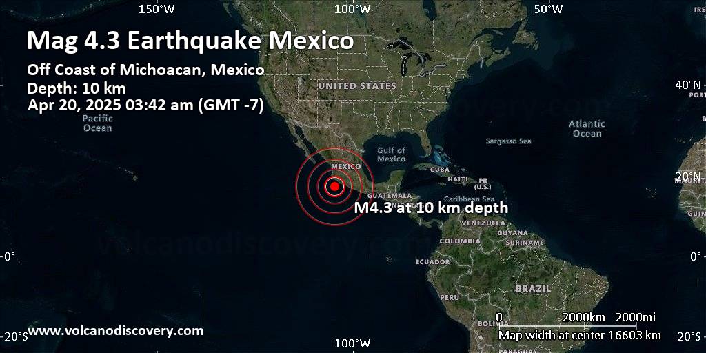
RSS feed source: Volcano Discovery.com--Global earthquake monitor

Support us – Help us upgrade our services! We truly love working to bring you the latest volcano and earthquake data from around the world. Maintaining our website and our free apps does require, however, considerable time and resources.
We need financing to increase hard- and software capacity as well as support our editor team. We’re aiming to achieve uninterrupted service wherever an earthquake or volcano eruption unfolds, and your donations can make it happen! Every donation will be highly appreciated. If you find the information useful and would like to support our team in integrating further features, write great content, and in upgrading our soft- and hardware, please make a donation (PayPal).

Planned features:

Improved multilanguage supportTsunami alertsFaster responsivenessThanks to your past donations, these features have been added recently:Design upgradeDetailed quake statsAdditional seismic data sourcesDownload and Upgrade the Volcanoes & Earthquakes app to get one of the fastest seismic and volcano alerts online:
Android | IOSThank you!

Click this link to continue reading the article on the source website.

RSS feed source: Volcano Discovery.com--Global earthquake monitor

53 km (33 mi)

SW of epicenter

Bangsal

(pop: 100)

I: Not felt

West Nusa Tenggara 59 km (37 mi)

SW of epicenter

Labuan Lombok

(pop: 10,000)

I: Not felt

59 km (37 mi)

SW of epicenter

Labuan Lombok

(pop: 10,000)

I: Not felt

59 km (37 mi)

SW of epicenter

Labuan Lombok

(pop: 10,000)

I: Not felt

West Nusa Tenggara 73 km (45 mi)

SE of epicenter

Pototano

(pop: 5,000)

I: Not felt

Kabupaten Sumbawa, West Nusa Tenggara 73 km (46 mi)

SE of epicenter

Sumbawa Besar

(pop: 62,800)

I: Not felt

Kabupaten Sumbawa, West Nusa Tenggara 79 km (49 mi)

S of epicenter

Taliwang

(pop: 55,300)

I: Not felt

West Sumbawa Regency, West Nusa Tenggara 81 km (51 mi)

SW of epicenter

Selong

(pop: 92,500)

I: Not felt

Kabupaten Lombok Timur, West Nusa Tenggara 101 km (63 mi)

W of epicenter

Gili Air

(pop: 1,800)

I: Not felt

North Lombok Regency, West Nusa Tenggara 104 km (65 mi)

SW of epicenter

Praya

(pop: 35,200)

I: Not felt

Kabupaten Lombok Tengah, West Nusa Tenggara 109 km (68 mi)

SW of epicenter

Mataram

(pop: 429,700)

I: Not felt

West Nusa Tenggara 111 km (69 mi)

SW of epicenter

Senggigi

(pop: 5,000)

I: Not felt

West Lombok Regency, West Nusa Tenggara

Click this link to continue reading the article on the source website.

RSS feed source: Volcano Discovery.com--Global earthquake monitor

Support us – Help us upgrade our services! We truly love working to bring you the latest volcano and earthquake data from around the world. Maintaining our website and our free apps does require, however, considerable time and resources.
We need financing to increase hard- and software capacity as well as support our editor team. We’re aiming to achieve uninterrupted service wherever an earthquake or volcano eruption unfolds, and your donations can make it happen! Every donation will be highly appreciated. If you find the information useful and would like to support our team in integrating further features, write great content, and in upgrading our soft- and hardware, please make a donation (PayPal).

Planned features:

Improved multilanguage supportTsunami alertsFaster responsivenessThanks to your past donations, these features have been added recently:Design upgradeDetailed quake statsAdditional seismic data sourcesDownload and Upgrade the Volcanoes & Earthquakes app to get one of the fastest seismic and volcano alerts online:
Android | IOSThank you!

Click this link to continue reading the article on the source website.

RSS feed source: Volcano Discovery.com--Global earthquake monitor

21 km (13 mi)

NW of epicenter

Concepcion Bamba

(pop: 312)

IV: Light

Santo Domingo Tehuantepec, Oaxaca 27 km (17 mi)

NW of epicenter

Zaachilac

(pop: 222)

III: Weak

Santiago Astata, Oaxaca 31 km (19 mi)

N of epicenter

Guelaguechi

(pop: 515)

III: Weak

Santo Domingo Tehuantepec, Oaxaca 33 km (21 mi)

N of epicenter

San Vicente

(pop: 443)

III: Weak

Santo Domingo Tehuantepec, Oaxaca 36 km (22 mi)

NW of epicenter

Santa Clara

(pop: 371)

III: Weak

Santo Domingo Tehuantepec, Oaxaca 40 km (25 mi)

N of epicenter

Salina Cruz

(pop: 76,600)

III: Weak

Oaxaca 41 km (26 mi)

NW of epicenter

Santiago Astata

(pop: 2,210)

III: Weak

Oaxaca 43 km (27 mi)

N of epicenter

Rincon Moreno

(pop: 1,020)

III: Weak

Santo Domingo Tehuantepec, Oaxaca 46 km (28 mi)

NW of epicenter

El Gavilan

(pop: 107)

III: Weak

San Pedro Huamelula, Oaxaca 47 km (29 mi)

N of epicenter

Las Cruces

(pop: 141)

III: Weak

Santo Domingo Tehuantepec, Oaxaca 47 km (29 mi)

NE of epicenter

La Reforma

(pop: 210)

III: Weak

53 km (33 mi)

W of epicenter

El Coyul

(pop: 2,200)

III: Weak

San Pedro Huamelula, Oaxaca 55 km (34 mi)

N of epicenter

Santo Domingo Tehuantepec

(pop: 42,100)

III: Weak

Oaxaca 55 km

Click this link to continue reading the article on the source website.