RSS feed source: Volcano Discovery.com--Global earthquake monitor

Sat, 19 Apr 2025, 19:20 | BY: EARTHQUAKEMONITOR

Worldwide earthquakes above magnitude 3 during the past 24 hours on 19 Apr 2025

Summary: 9 quakes 5.0+, 46 quakes 4.0+, 152 quakes 3.0+, 361 quakes 2.0+ (568 total)
This report is being updated every hour.
Magnitude 5+: 9 earthquakes
Magnitude 4+: 46 earthquakes
Magnitude 3+: 152 earthquakes
Magnitude 2+: 361 earthquakes
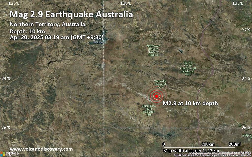
No quakes of magnitude 6 or higherTotal seismic energy estimate: 1.1 x 10¹⁴ joules (29.9 gigawatt hours, equivalent to 25695 tons of TNT or 1.6 atomic bombs!) | equivalent to ONE quake of magnitude 6.2 learn more10 largest earthquakes in the world (past 24 hours)#1: Mag 5.9 Celebes Sea, 96 km southwest of Surallah, PhilippinesSunday, Apr 20, 2025, at 12:11 am (GMT +8) – #2: Mag 5.7 Badakhshan, AfghanistanSaturday, Apr 19, 2025, at 11:17 am (GMT +4:30) – #3: Mag 5.3 South Pacific Ocean, 241 km southwest of Apia, Tuamasaga, SamoaSunday, Apr 20, 2025, at 05:55 am (GMT +13) – #4: Mag 5.2 Celebes Sea, 97 km southwest of Banga, PhilippinesSunday, Apr 20, 2025, at 01:37 am (GMT +8) – #5: Mag 5.2 36 km SSW of Malisbeng, PhilippinesSunday, Apr 20, 2025, at 12:50 am (GMT +8) – #6: Mag 5.2 23 km southwest of Tingo Maria, Huanuco, PeruSaturday, Apr 19, 2025, at 06:56 am (Lima time) – #7: Mag 5.1 Central Mid-Atlantic RidgeSaturday, Apr 19, 2025, at 11:50 am

Click this link to continue reading the article on the source website.

RSS feed source: Volcano Discovery.com--Global earthquake monitor

Sat, 19 Apr 2025, 18:50 | BY: EARTHQUAKEMONITOR

World map showing volcanoes with shallow (less than 50 km) earthquakes within 20 km radius during the past 24 hours on 19 Apr 2025 Number in brackets indicate nr of quakes.

Quakes detected near: Almolonga (1 quake mag 3.0), Aso (1 quake mag 1.4), Barva (1 quake mag 1.8), Biliran (1 quake mag 2.1), Cabalian (1 quake mag 2.7), Camiguin de Babuyanes (1 quake mag 2.4)
Canlaon (3 quakes between mag 1.7-3.8), Clear Lake (37 quakes between mag 0.2-2.1), Colima (4 quakes between mag 3.2-3.5), Coso (1 quake mag 1.0), Eldey (3 quakes between mag 1.2-1.4), Eyafjallajökull (3 quakes between mag 0.3-1.1), Fagradalsfjall (60 quakes between mag 0.0-1.0), Gareloi (1 quake mag 1.3), Hiuchi (3 quakes between mag 0.1-1.1), Hrómundartindur (17 quakes between mag 0.1-1.3), Katla (4 quakes between mag 0.5-1.6), Kolumbo (12 quakes between mag 1.3-1.7), Koruhüyüğü (1 quake mag 1.7), Kurikoma (3 quakes between mag 0.5-1.0), Langjökull (1 quake mag 1.5), Ljósufjöll (2 quakes between mag 1.0-1.2), Malang Plain (1 quake mag 3.0), Marapi (1 quake mag 4.5), Nantai (7 quakes between mag 0.1-1.9), Nipesotsu-Maruyama (3 quakes between mag 0.6-1.4), Ontake-san (4 quakes between mag 0.2-1.2), Paco (1 quake mag 2.1), Pelée (1 quake mag 3.0), Reporoa (1 quake mag 1.6), Roundtop (8 quakes between mag 0.6-1.4), Soda Lakes (1 quake mag 1.3), Sorikmarapi

Click this link to continue reading the article on the source website.

RSS feed source: Volcano Discovery.com--Global earthquake monitor

Date and TimeMag
DepthDistanceLocationDetailsMap Apr 19, 09:51 am (GMT -6)

3.6

24 km64 km (40 mi) to the SE North Pacific Ocean, 58 km south of Retalhuleu, Retalhuleu, GuatemalaI FELT IT

Info

Apr 19, 02:43 am (GMT -6)

4.3

17 km94 km (59 mi) to the S North Pacific Ocean, 93 km southwest of Tiquisate, Escuintla, GuatemalaI FELT IT InfoApr 18, 09:25 pm (GMT -6)

3.1

24 km34 km (21 mi) to the SW North Pacific Ocean, 76 km southwest of Coatepeque, GuatemalaI FELT IT

Info

Apr 18, 09:17 pm (Guatemala)

4.4

181 km79 km (49 mi) to the N 26 km north of Malacatan, Departamento de San Marcos, GuatemalaI FELT IT InfoApr 18, 03:46 pm (GMT -6)

3.9

5 km55 km (34 mi) to the SW North Pacific Ocean, 69 km west of Champerico, Retalhuleu, GuatemalaI FELT IT

Info

Apr 18, 08:51 pm (Universal Time)

3.9

3.9 km53 km (33 mi) to the W North Pacific Ocean, 53 km southwest of Tapachula, Chiapas, MexicoI FELT IT

Info

Apr 18, 08:33 am (GMT -6)

4.0

40 km42 km (26 mi) to the SE North Pacific Ocean, 61 km southwest of Retalhuleu, Retalhuleu, GuatemalaI FELT IT InfoMay 12, 2024 05:39 am (GMT -6)

6.2

10 km63 km (39 mi) to the W North Pacific Ocean, 87 km southwest of Tapachula, Chiapas, Mexico 312 reportsInfoFeb 16, 2022 01:12 am (Guatemala)

6.2

60 km86 km (53 mi) to the E 12 km WSW of Nueva Concepción, Guatemala 773 reportsInfoFeb 1, 2019 10:19 am (Mexico City)

6.7

0 km44 km (27 mi) to the NW North Pacific Ocean, 33 km southwest of Tapachula, Chiapas,

Click this link to continue reading the article on the source website.

RSS feed source: Volcano Discovery.com--Global earthquake monitor

Support us – Help us upgrade our services! We truly love working to bring you the latest volcano and earthquake data from around the world. Maintaining our website and our free apps does require, however, considerable time and resources.
We need financing to increase hard- and software capacity as well as support our editor team. We’re aiming to achieve uninterrupted service wherever an earthquake or volcano eruption unfolds, and your donations can make it happen! Every donation will be highly appreciated. If you find the information useful and would like to support our team in integrating further features, write great content, and in upgrading our soft- and hardware, please make a donation (PayPal).

Planned features:

Improved multilanguage supportTsunami alertsFaster responsivenessThanks to your past donations, these features have been added recently:Design upgradeDetailed quake statsAdditional seismic data sourcesDownload and Upgrade the Volcanoes & Earthquakes app to get one of the fastest seismic and volcano alerts online:
Android | IOSThank you!

Click this link to continue reading the article on the source website.