RSS feed source: Volcano Discovery.com--Global earthquake monitor

Fri, 9 May 2025, 08:52 | BY: EARTHQUAKEMONITOR

A magnitude 5.3 earthquake near Meiktila, Meiktila District, Mandalay Region, Myanmar (Burma), was reported only 14 minutes ago by Thailand’s Earthquake Observation Division (TMD), considered the main national agency that monitors seismic activity in this part of the world. The earthquake occurred at a shallow depth of 10. km beneath the epicenter early afternoon on Friday, May 9th, 2025, at 2:37 pm local time. The exact magnitude, epicenter, and depth of the quake might be revised within the next few hours or minutes as seismologists review data and refine their calculations, or as other agencies issue their report.
Based on the preliminary seismic data, the quake was probably felt by many people in the area of the epicenter. It should not have caused significant damage, other than objects falling from shelves, broken windows, etc.
In Meiktila (pop. 177,400) located 27 km from the epicenter, and Yamethin (pop. 59,900) 42 km away, the quake should have been felt as light shaking.
Weak shaking might have been felt in Kyaukse (pop. 50,500) located 89 km from the epicenter, Taunggyi (pop. 160,100) 97 km away, Myingyan (pop. 141,700) 104 km away, Nay Pyi Taw (pop. 925,000) 118 km away, Pyinmana (pop. 97,400) 119 km away, and Mandalay (pop. 1,208,100) 130 km away.
VolcanoDiscovery will automatically update magnitude and depth if

Click this link to continue reading the article on the source website.

RSS feed source: Volcano Discovery.com--Global earthquake monitor

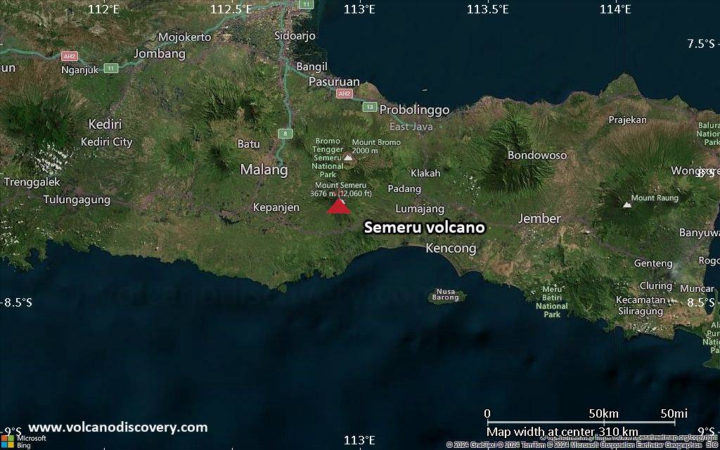
<!–div style="font-size:14px;text-align:center;border:3px solid blue;border-radius:5px;padding:3px;margin:5px;background:#eee"><a href="https://www.volcanoesandearthquakes.com/app/volcano-report.php?volcanoId=44" style="text-decoration:none" target="_blank" rel="noopener noreferrer nofollow" title="Share a volcano (activity) report, submit a photo or other interesting news!” onclick=”window.open(this.href,’Volcano Report’,’status=0,toolbar=0,location=0,directories=0,menubar=0,resizable=1,scrollbars=1,height=500,width=450′);return false”>Send Volcano Report</div–> Stratovolcano 3676 m (12,060 ft)
East Java, Indonesia, -8.11°S / 112.92°E
Current status: erupting (4 out of 5) Semeru volcano eruptions:
1818, 1829, 1830, 1832, 1836, 1838, 1842, 1844, 1845, 1848, 1849(?), 1851, 1856, 1857, 1865, 1866(?), 1887, 1887, 1888, 1889-91, 1892, 1893, 1893-94, 1895, 1896, 1897, 1899, 1899, 1900, 1901, 1903, 1904, 1905, 1907, 1908, 1909-10, 1910-11, 1911, 1912, 1913, 1941-42, 1945, 1946, 1946-47, 1950-64, 1967-ongoing
Typical eruption style
Explosive. Near constant strombolian activity, occasionally stronger explosions, lava flows and pyroclastic flows.

Click this link to continue reading the article on the source website.
RSS feed source: Volcano Discovery.com--Global earthquake monitor

Volcanoes Today, 8 May 2025: Santiaguito volcano, Fuego, Semeru, Ibu, Dukono, Reventador, Poas, Sangay

Thu, 8 May 2025, 18:00 1746727205 | BY: VN

Satellite image of Ibu volcano on 8 May 2025

Satellite image of Semeru volcano on 8 May 2025

Satellite image of Dukono volcano on 8 May 2025

Canlaon (Central Philippines): Volcanic Ash Advisory Center Tokyo (VAAC) issued the following report: ERUPTION AT 20250508/0830Z FL090 EXTD NW REPORTED OBS VA DTG:08/0830Z

Ibu (Halmahera, Indonesia): Explosive activity continues. Volcanic Ash Advisory Center (VAAC) Darwin warned about a volcanic ash plume that rose up to estimated 7000 ft (2100 m) altitude or flight level 070 and is moving at 05 kts in W direction.
The full report is as follows: VA TO FL070 LAST REPORTED AT 08/0912Z EST VA DTG:08/1120Z to 7000 ft (2100 m)

Semeru (East Java, Indonesia): Explosive activity continues. Volcanic Ash Advisory Center (VAAC) Darwin warned about a volcanic

Click this link to continue reading the article on the source website.