RSS feed source: Volcano Discovery.com--Global earthquake monitor

Date and TimeMag
DepthDistanceLocationDetailsMap May 27, 04:53 pm (El Salvador)

4.4

66 km58 km (36 mi) to the E North Pacific Ocean, 30 km southwest of Sonsonate, El Salvador 3 reportsInfoMay 27, 01:11 am (GMT -6)

4.5

79 km78 km (48 mi) to the W North Pacific Ocean, 79 km south of Santa Lucia Cotzumalguapa, Guatemala InfoMay 26, 06:15 am (GMT -6)

4.1

34 km96 km (59 mi) to the W North Pacific Ocean, 63 km southwest of La Gomera, Guatemala InfoMay 26, 12:08 am (El Salvador)

4.1

71 km77 km (48 mi) to the E 9.5 km southwest of Sonsonate, Departamento de Sonsonate, El Salvador 3 reportsInfoMay 23, 06:02 am (GMT -6)

4.2

25 km98 km (61 mi) to the SE North Pacific Ocean, 74 km southwest of Santa Tecla, El Salvador 2 reportsInfoJan 26, 2024 11:52 pm (Guatemala)

6.1

90 km65 km (40 mi) to the N 15 km W of Taxisco, Guatemala 263 reportsInfoOct 28, 2018 04:23 pm (GMT -6)

6.1

10 km50 km (31 mi) to the S Near Coast of Guatemala 2 reportsInfoJun 22, 2017 06:31 am (Guatemala)

6.7

34 km50 km (31 mi) to the NW North Pacific Ocean, 16 km east of Puerto San Jose, Guatemala 47 reportsInfoMay 12, 2017 04:41 am (GMT -6)

6.1

16 km78 km (49 mi) to the SE North Pacific Ocean, 120 km southwest of San Salvador, El Salvador 10 reportsInfoOct 13, 2014 09:51 pm (GMT -6)

7.2

43 km280 km (174 mi) to the E Off Coast of Central America 88 reportsInfoNov 7, 2012 10:35 am (GMT -6)

7.4

24 km164 km (102 mi) to the W North Pacific Ocean, 34 km south of Champerico,

Click this link to continue reading the article on the source website.
RSS feed source: Volcano Discovery.com--Global earthquake monitor

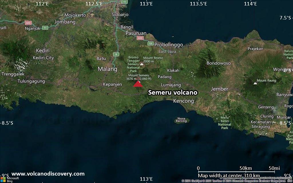
<!–div style="font-size:14px;text-align:center;border:3px solid blue;border-radius:5px;padding:3px;margin:5px;background:#eee"><a href="https://www.volcanoesandearthquakes.com/app/volcano-report.php?volcanoId=44" style="text-decoration:none" target="_blank" rel="noopener noreferrer nofollow" title="Share a volcano (activity) report, submit a photo or other interesting news!” onclick=”window.open(this.href,’Volcano Report’,’status=0,toolbar=0,location=0,directories=0,menubar=0,resizable=1,scrollbars=1,height=500,width=450′);return false”>Send Volcano Report</div–> Stratovolcano 3676 m (12,060 ft)
East Java, Indonesia, -8.11°S / 112.92°E
Current status: erupting (4 out of 5) Semeru volcano eruptions:
1818, 1829, 1830, 1832, 1836, 1838, 1842, 1844, 1845, 1848, 1849(?), 1851, 1856, 1857, 1865, 1866(?), 1887, 1887, 1888, 1889-91, 1892, 1893, 1893-94, 1895, 1896, 1897, 1899, 1899, 1900, 1901, 1903, 1904, 1905, 1907, 1908, 1909-10, 1910-11, 1911, 1912, 1913, 1941-42, 1945, 1946, 1946-47, 1950-64, 1967-ongoing
Typical eruption style
Explosive. Near constant strombolian activity, occasionally stronger explosions, lava flows and pyroclastic flows.

Click this link to continue reading the article on the source website.

RSS feed source: Volcano Discovery.com--Global earthquake monitor

Date and TimeMag
DepthDistanceLocationDetailsMap Mar 29, 06:36 pm (GMT +3)

4.0

10 km33 km (20 mi) to the NW 50.0 km S of Milos InfoMar 27, 07:51 pm (Athens)

4.5

9.5 km92 km (57 mi) to the NE Aegean Sea, 25 km northwest of Nisi Anafi Island, Greece 12 reportsInfoFeb 19, 07:13 am (Athens)

4.0

8.7 km97 km (60 mi) to the NE 28 km E of Íos, Greece InfoFeb 18, 08:08 am (Athens)

5.1

10 km95 km (59 mi) to the NE Aegean Sea, 27 km east of Nisi Ios Island, Nomos Kykladon, South Aegean, Greece 10 reportsInfoFeb 17, 10:44 pm (Athens)

4.0

12 km92 km (57 mi) to the NE Greece: 22 km NNW From Anafi 1 reportInfoFeb 17, 10:49 am (Athens)

5.0

10 km94 km (58 mi) to the NE Aegean Sea, 28 km northeast of Santorini Island, Greece 23 reportsInfoFeb 17, 10:46 am (Athens)

4.5

10 km97 km (60 mi) to the NE 30 km ESE of Íos, Greece 5 reportsInfoFeb 16, 11:08 pm (Universal Time)

4.4

10 km98 km (61 mi) to the NE 29 km SW of Amorgós, Greece 6 reportsInfoFeb 12, 10:29 am (Athens)

5.0

10 km87 km (54 mi) to the NE Aegean Sea, 22 km northeast of Santorini Island, Greece 13 reportsInfoFeb 12, 03:14 am (Athens)

5.1

10 km84 km (52 mi) to the NE Aegean Sea, 19 km northeast of Santorini Island, Greece 17 reportsInfoFeb 11, 12:37 am (Athens)

5.1

10 km94 km (59 mi) to the NE 28 km NE of Oía, Greece 94 reportsInfoFeb 8, 12:00 pm (Athens)

5.1

10 km80 km (50 mi) to the NE Aegean Sea, 12 km northeast of Santorini Island, Greece 12 reportsInfoFeb 7, 09:16 am

Click this link to continue reading the article on the source website.