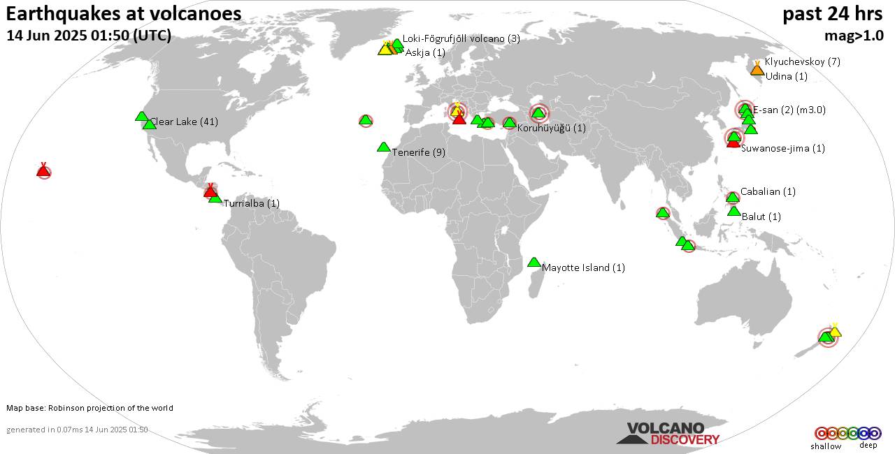
RSS feed source: Volcano Discovery.com
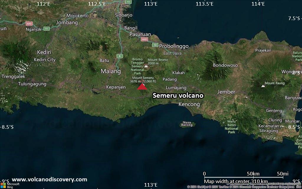
<!–div style="font-size:14px;text-align:center;border:3px solid blue;border-radius:5px;padding:3px;margin:5px;background:#eee"><a href="https://www.volcanoesandearthquakes.com/app/volcano-report.php?volcanoId=168" style="text-decoration:none" target="_blank" rel="noopener noreferrer nofollow" title="Share a volcano (activity) report, submit a photo or other interesting news!” onclick=”window.open(this.href,’Volcano Report’,’status=0,toolbar=0,location=0,directories=0,menubar=0,resizable=1,scrollbars=1,height=500,width=450′);return false”>Send Volcano Report</div–> Stratovolcano 3332 m (10,932 ft)
East Java (Indonesia), -8.13°S / 114.04°E
Current status: minor activity or eruption warning (3 out of 5) Raung volcano eruptions:
1586 (?), 1593 (large sub-plinian eruption), 1597, 1638, 1730, 1804+-4y, 1812-14, 1815 +-1y, 1817, 1838, 1849, 1859, 1860, 1864, 1881, 1885, 1890, 1896, 1897, 1902, 1903, 1913, 1915, 1916, 1917, 1921, 1924, 1924, 1927-28, 1928, 1929, 1933, 1936, 1937, 1938-39, 1940, 1941, 1943, 1944-45, 1953, 1955, 1956, 1971, 1973, 1974, 1975, 1976, 1977, 1978, 1982, 1985, 1987-89, 1990, 1991, 1993, 1994, 1995, 1995 (?), 1997, 1999, Jul 2000, Jun-Aug 2002, Apr-Oct 2004 (?), Jul-Aug 2005 (?), Aug 2007 (?), 2012, 2014-15, 2020-ongoing
Typical eruption style
Explosive
Click this link to continue reading the article on the source website.