RSS feed source: Volcano Discovery.com--Global earthquake monitor

Sun, 4 May 2025, 07:13 | BY: EARTHQUAKEMONITOR

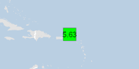
An earthquake of magnitude 5.1 occurred only 13 minutes ago 8 km northwest of Charlotte Amalie, U.S. Virgin Islands, the United States Geological Survey reported.
The quake hit at a shallow depth of 28. km beneath the epicenter near Charlotte Amalie, Saint Thomas Island, U.S. Virgin Islands, early morning on Sunday, May 4th, 2025, at 2:58 am local time. The exact magnitude, epicenter, and depth of the quake might be revised within the next few hours or minutes as seismologists review data and refine their calculations, or as other agencies issue their report.
Our monitoring service identified a second report from France’s Réseau National de Surveillance Sismique (RéNaSS) which listed the quake at magnitude 5.2. Other agencies reporting the same quake include the European-Mediterranean Seismological Centre (EMSC) at magnitude 5.5, the German Research Centre for Geosciences (GFZ) at magnitude 5.6, and The Incorporated Research Institutions for Seismology (IRIS) at magnitude 5.1.
Based on the preliminary seismic data, the quake was probably felt by many people in the area of the epicenter. It should not have caused significant damage, other than objects falling from shelves, broken windows, etc.
In Charlotte Amalie (pop. 20,000) located 8 km from the epicenter, and Cruz Bay (pop. 2,700) 22 km away, the quake should have been felt as light shaking.
Weak shaking might

Click this link to continue reading the article on the source website.

RSS feed source: Volcano Discovery.com--Global earthquake monitor

Date and TimeMag
DepthDistanceLocationDetailsMap Mar 31, 05:43 am (GMT +7)

4.4

10 km45 km (28 mi) to the SE Indian Ocean, 316 km south of Bengkulu, Kota Bengkulu, Bengkulu, Indonesia InfoMar 11, 10:48 pm (GMT +7)

4.0

10 km80 km (50 mi) to the E Indian Ocean, 253 km west of Bandar Lampung, Bandar Lampung, Lampung, Indonesia InfoFeb 25, 10:08 am (GMT +7)

4.8

15 km22 km (14 mi) to the SW Indian Ocean, 297 km south of Bengkulu, Kota Bengkulu, Bengkulu, Indonesia InfoFeb 23, 12:16 pm (GMT +7)

5.0

10 km38 km (24 mi) to the SW Indian Ocean, 294 km south of Bengkulu, Kota Bengkulu, Bengkulu, Indonesia 1 reportInfoFeb 23, 11:27 am (GMT +7)

5.1

10 km27 km (16 mi) to the S Indian Ocean, 298 km south of Pagar Alam, Indonesia 2 reportsInfoJul 26, 2024 12:11 am (GMT +7)

5.2

10 km63 km (39 mi) to the NE Indian Ocean, 256 km south of Bengkulu, Kota Bengkulu, Bengkulu, Indonesia InfoMar 4, 2024 09:48 am (GMT +7)

5.6

10 km67 km (42 mi) to the N Indian Ocean, 215 km south of Bengkulu, Kota Bengkulu, Bengkulu, Indonesia InfoFeb 10, 2021 12:52 pm (Universal Time)

5.6

10 km107 km (67 mi) to the NWIndian Ocean, 302 km southeast of Pulau Taitaitanopo Island, Indonesia 1 reportInfoMar 10, 2020 09:06 pm (GMT +7)

5.5

26 km77 km (48 mi) to the NE Southern Sumatra, Indonesia 4 reportsInfoMar 7, 2017 10:45 pm (GMT +7)

5.3

28 km13 km (8.4 mi) to the NW Indian Ocean, 268 km south of Bengkulu, Kota Bengkulu, Bengkulu, Indonesia InfoApr 20, 2015 04:05 pm (Jakarta)

5.6

30 km78 km (49 mi) to the N Southern

Click this link to continue reading the article on the source website.

RSS feed source: Volcano Discovery.com--Global earthquake monitor

Volcanoes Today, 4 May 2025: Semeru volcano, Ibu, Dukono, Marapi, Poas, Sangay, White Island, Lewotolo

Sun, 4 May 2025, 07:00 1746342004 | BY: VN

Satellite image of Lewotolo volcano on 3 May 2025

Satellite image of Semeru volcano on 4 May 2025

Satellite image of Dukono volcano on 4 May 2025

Ibu (Halmahera, Indonesia): Explosive activity continues. Volcanic Ash Advisory Center (VAAC) Darwin warned about a volcanic ash plume that rose up to estimated 7000 ft (2100 m) altitude or flight level 070 and is moving at 05 kts in SE direction.
The full report is as follows: VA TO FL070 OBS AT 03/1600Z EST VA DTG:03/2200Z to 7000 ft (2100 m)

Lewotolo (Lesser Sunda Islands): Volcanic Ash Advisory Center Darwin (VAAC) issued the following report: GROUND REPORT OF ERUPTION WITH VA TO FL070 MOV W

Semeru (East Java, Indonesia): Explosive activity continues. Volcanic Ash Advisory Center (VAAC) Darwin warned about a

Click this link to continue reading the article on the source website.