RSS feed source: US Energy Information Administration

In-brief analysis

April 7, 2025

U.S. propane consumption reached 1.48 million barrels per day (b/d) in January 2025, the most January consumption on record since January 2005 and the most for any month since February 2007, as severe cold drove up heating demand across much of the country.

U.S. propane consumption, which we measure as product supplied, is closely correlated with temperatures during the winter because propane is primarily used for space heating in the United States. January is typically the coldest month of the year. January 2025 was the coldest month recorded in the United States since January 2014, measured by heating degree days (HDDs).

January 2025 had 946 HDDs, just 26 fewer than in January 2014. Strong heating demand this winter due to cold weather caused propane prices to increase slightly, contributing to higher

Click this link to continue reading the article on the source website.

RSS feed source: US Energy Information Administration

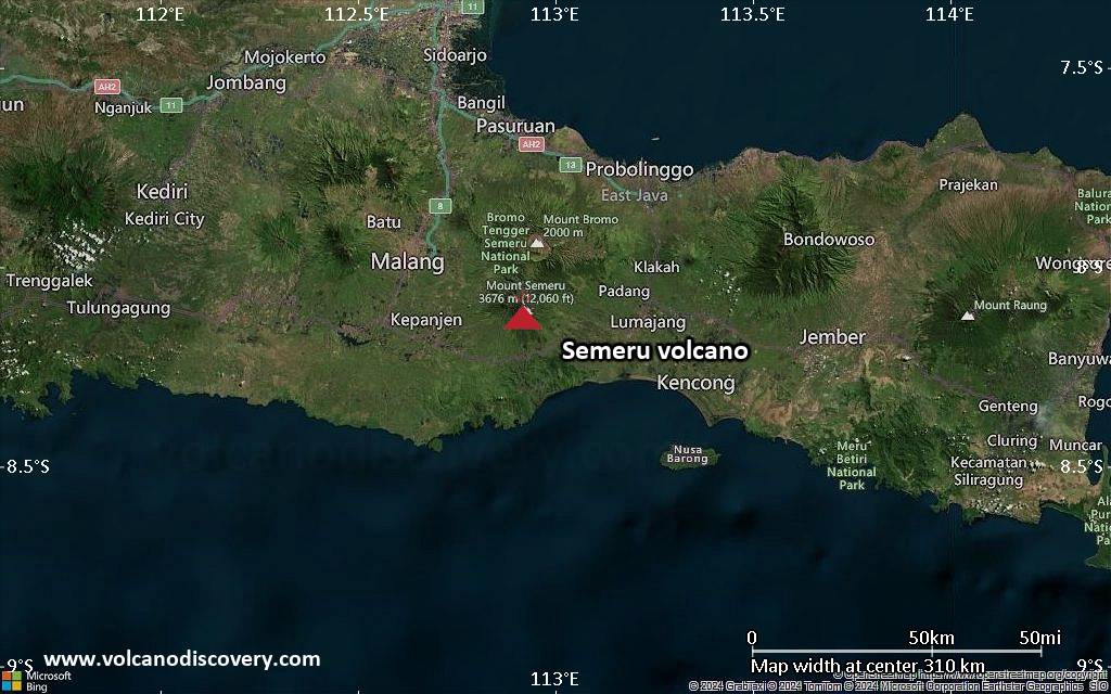
<!–div style="font-size:14px;text-align:center;border:3px solid blue;border-radius:5px;padding:3px;margin:5px;background:#eee"><a href="https://www.volcanoesandearthquakes.com/app/volcano-report.php?volcanoId=44" style="text-decoration:none" target="_blank" rel="noopener noreferrer nofollow" title="Share a volcano (activity) report, submit a photo or other interesting news!” onclick=”window.open(this.href,’Volcano Report’,’status=0,toolbar=0,location=0,directories=0,menubar=0,resizable=1,scrollbars=1,height=500,width=450′);return false”>Send Volcano Report</div–> Stratovolcano 3676 m (12,060 ft)
East Java, Indonesia, -8.11°S / 112.92°E
Current status: erupting (4 out of 5) Semeru volcano eruptions:
1818, 1829, 1830, 1832, 1836, 1838, 1842, 1844, 1845, 1848, 1849(?), 1851, 1856, 1857, 1865, 1866(?), 1887, 1887, 1888, 1889-91, 1892, 1893, 1893-94, 1895, 1896, 1897, 1899, 1899, 1900, 1901, 1903, 1904, 1905, 1907, 1908, 1909-10, 1910-11, 1911, 1912, 1913, 1941-42, 1945, 1946, 1946-47, 1950-64, 1967-ongoing
Typical eruption style
Explosive. Near constant strombolian activity, occasionally stronger explosions, lava flows and pyroclastic flows.

Click this link to continue reading the article on the source website.
RSS feed source: US Energy Information Administration

Date and TimeMag
DepthDistanceLocationDetailsMap Mar 20, 01:48 am (GMT +11)

4.9

10 km117 km (73 mi) to the N Coral Sea, 143 km west of New Jersey Island, Solomon Islands InfoFeb 1, 10:57 am (GMT +11)

4.5

57 km119 km (74 mi) to the N Coral Sea, 92 km west of Lata, Temotu, Solomon Islands InfoJan 17, 03:24 pm (GMT +11)

4.9

10 km126 km (78 mi) to the NW Coral Sea, 184 km west of New Jersey Island, Solomon Islands InfoOct 29, 2024 01:35 am (GMT +11)

4.7

10 km109 km (67 mi) to the NW Coral Sea, 194 km west of New Jersey Island, Solomon Islands InfoOct 18, 2024 11:30 am (GMT +11)

4.1

10 km132 km (82 mi) to the NW Coral Sea, 234 km east of Kirakira, Makira-Ulawa, Solomon Islands InfoMay 13, 2024 11:24 am (GMT +11)

5.1

10 km25 km (16 mi) to the E Coral Sea, 127 km southwest of New Jersey Island, Solomon Islands InfoMar 7, 2024 06:27 am (GMT +11)

5.0

46 km111 km (69 mi) to the NE Coral Sea, 30 km west of Lata, Temotu, Solomon Islands InfoAug 31, 2023 08:20 am (GMT +11)

5.0

10 km111 km (69 mi) to the NW Coral Sea, 175 km west of New Jersey Island, Solomon Islands InfoJul 18, 2015 01:27 pm (GMT +11)

6.8

10 km150 km (93 mi) to the N Coral Sea, 95 km northwest of Lata, Temotu, Solomon Islands InfoMay 21, 2015 09:48 am (GMT +11)

6.8

11 km127 km (79 mi) to the NW Coral Sea, 207 km west of New Jersey Island, Solomon Islands InfoApr 18, 2014 03:13 pm (GMT

Click this link to continue reading the article on the source website.