RSS feed source: Federal Emergency Management Agency

FRANKFORT, Ky. — Kentucky residents who were affected by the April 2 severe storms, straight-line winds, tornadoes, landslides and mudslides may be eligible for disaster assistance even if you have insurance

Under federal law, FEMA cannot duplicate insurance settlements or other benefits, but there are cases where insured survivors might still be eligible for FEMA help. For example:

Your settlement was delayed longer than 30 days after you filed a claim.The settlement does not fully cover all your losses and needs.You exhausted the additional living expenses provided in your policy.You cannot locate suitable rental resources in your community.

Residents of Anderson, Butler, Carroll, Christian, Clark, Franklin, Hardin, Hopkins, Jessamine, McCracken, Mercer, Owen and Woodford counties may apply. 

How To Apply for FEMA Assistance

The first step to receive FEMA assistance is to apply. Survivors of the April storms who live in the designated counties have until June 25 to apply for assistance. 

You can apply in several ways:

Online at DisasterAssistance.gov.Visit any Disaster Recovery Center. To find a center close to you, visit fema.gov/DRC, or text DRC along with your Zip Code to 43362 (Example: “DRC 29169”).Use the FEMA mobile app.Call the FEMA Helpline at 800-621-3362. It is open 7 a.m. to 10 p.m. Eastern Time. Help is available in many languages. If you use a relay service, such as Video Relay Service (VRS), captioned telephone or other service, give FEMA your number for that

Click this link to continue reading the article on the source website.

RSS feed source: Federal Emergency Management Agency

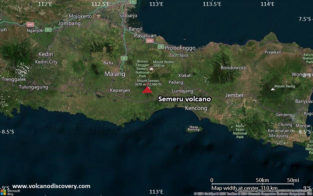
<!–div style="font-size:14px;text-align:center;border:3px solid blue;border-radius:5px;padding:3px;margin:5px;background:#eee"><a href="https://www.volcanoesandearthquakes.com/app/volcano-report.php?volcanoId=44" style="text-decoration:none" target="_blank" rel="noopener noreferrer nofollow" title="Share a volcano (activity) report, submit a photo or other interesting news!” onclick=”window.open(this.href,’Volcano Report’,’status=0,toolbar=0,location=0,directories=0,menubar=0,resizable=1,scrollbars=1,height=500,width=450′);return false”>Send Volcano Report</div–> Stratovolcano 3676 m (12,060 ft)
East Java, Indonesia, -8.11°S / 112.92°E
Current status: erupting (4 out of 5) Semeru volcano eruptions:
1818, 1829, 1830, 1832, 1836, 1838, 1842, 1844, 1845, 1848, 1849(?), 1851, 1856, 1857, 1865, 1866(?), 1887, 1887, 1888, 1889-91, 1892, 1893, 1893-94, 1895, 1896, 1897, 1899, 1899, 1900, 1901, 1903, 1904, 1905, 1907, 1908, 1909-10, 1910-11, 1911, 1912, 1913, 1941-42, 1945, 1946, 1946-47, 1950-64, 1967-ongoing
Typical eruption style
Explosive. Near constant strombolian activity, occasionally stronger explosions, lava flows and pyroclastic flows.

Click this link to continue reading the article on the source website.
RSS feed source: Federal Emergency Management Agency

Date and TimeMag
DepthDistanceLocationDetailsMap May 8, 08:56 am (GMT -3)

3.4

196 km17 km (10.7 mi) to the W Departamento de Los Andes, 190 km west of Salta, Departamento Capital, Salta Province, ArgentinaI FELT IT

Info

May 7, 10:08 pm (GMT -3)

3.3

206 km44 km (27 mi) to the NW Departamento de Los Andes, 218 km west of Salta, Departamento Capital, Salta Province, ArgentinaI FELT IT

Info

May 7, 03:22 am (GMT -3)

3.2

250 km44 km (27 mi) to the NW Departamento de Los Andes, 217 km west of Salta, Departamento Capital, Salta Province, ArgentinaI FELT IT

Info

May 6, 08:03 am (Jujuy)

4.4

208 km41 km (25 mi) to the NE Susques, 61 km northwest of San Antonio de los Cobres, Departamento de Los Andes, Salta Province, ArgentinaI FELT IT InfoMay 6, 05:28 am (Salta)

4.5

166 km11 km (6.9 mi) to the NW Departamento de Los Andes, 185 km west of Salta, Departamento Capital, Salta Province, ArgentinaI FELT IT InfoMay 5, 07:01 am (GMT -3)

3.8

425 km54 km (34 mi) to the S Departamento de Los Andes, 152 km west of Salta, Departamento Capital, Salta Province, ArgentinaI FELT IT

Info

May 4, 07:51 am (GMT -3)

3.9

247 km38 km (23 mi) to the NW Departamento de Los Andes, 204 km northwest of Salta, Departamento Capital, Salta Province, ArgentinaI FELT IT

Info

May 4, 01:55 am (GMT -3)

3.8

252 km23 km (14 mi) to the NW 85 km west of San Antonio de los Cobres, Departamento de Los Andes, Salta Province, ArgentinaI FELT IT

Click this link to continue reading the article on the source website.