RSS feed source: Volcano Discovery.com

Fri, 25 Apr 2025, 21:00 1745614807 | BY: SEVERAL CONTRIBUTORS

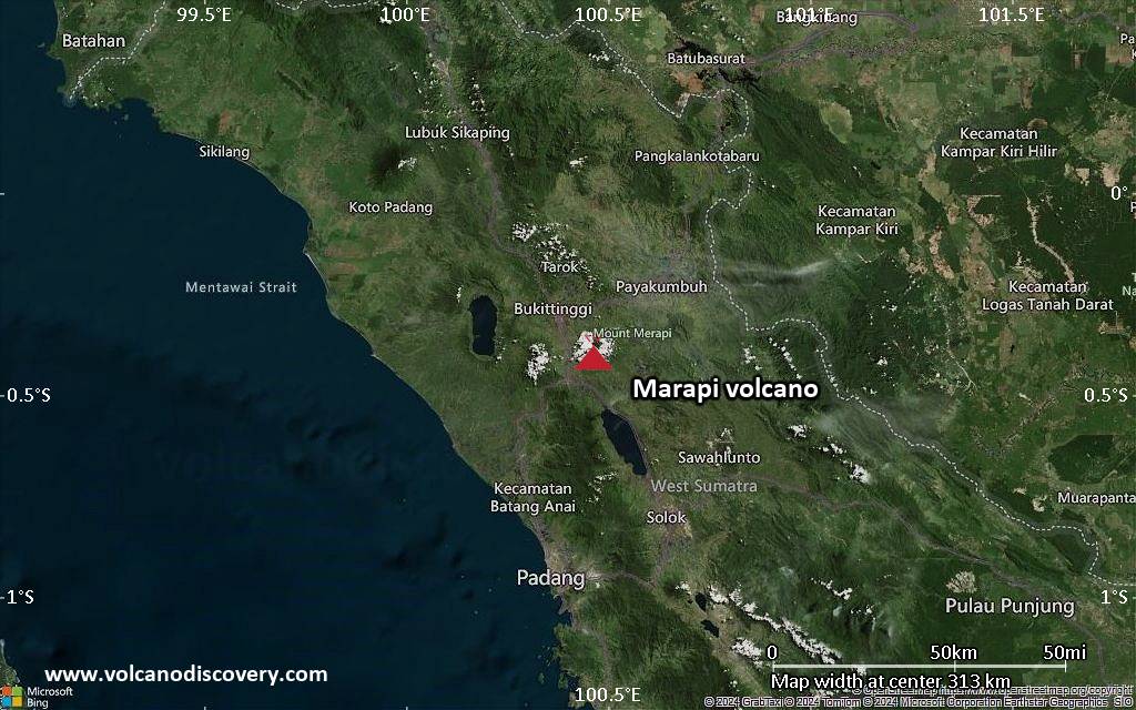
Map of today’s active volcanoes

Hot rock falls from the lava dome at Bezymianny volcano on 14 April (image: Kamchatka Volcanic Eruption Response Team)

Satellite image of Lewotobi volcano on 25 Apr 2025

Satellite image of Lewotolo volcano on 24 Apr 2025

The comparison of the volcano before and after the eruption on 8 February and 24 April (image: Sentinel-2)

Bezymianny (Kamchatka): Volcanic Ash Advisory Center Anchorage (VAAC) issued the following report: VA NOT IDENTIFIABLE FM SATELLITE DATA.
…25 Apr:
The activity at the volcano continues at very high levels.
A webcam footage depicts multiple glowing lava-block avalanches descending from the dome during the night of 24 April between 11:02 and 11:20 PM local time.
… [read more]

Ibu (Halmahera, Indonesia): Volcanic Ash Advisory Center Darwin (VAAC) issued the following report: ERUPTION LAST REPORTED AT 25/0530Z EST VA DTG:25/1730Z

Lewotobi (Flores): (25 Apr) Explosive activity continues.

Click this link to continue reading the article on the source website.

RSS feed source: Volcano Discovery.com

Fri, 25 Apr 2025, 20:58 | BY: EARTHQUAKEMONITOR

Indonesia’s Meteorology, Climatology, and Geophysical Agency reported a magnitude 4.6 quake in the Philippines near Malingao, Province of Cotabato, Soccsksargen, only 9 minutes ago. The earthquake hit early morning on Saturday, April 26th, 2025, at 4:47 am local time at a shallow depth of 24. km. The exact magnitude, epicenter, and depth of the quake might be revised within the next few hours or minutes as seismologists review data and refine their calculations, or as other agencies issue their report.
Based on the preliminary seismic data, the quake should not have caused any significant damage, but was probably felt by many people as light vibration in the area of the epicenter.
Weak shaking might have been felt in Taguisa (pop. 3,100) located 22 km from the epicenter, and Kalamansig (pop. 12,800) 24 km away.
Other towns or cities near the epicenter where the quake might have been felt as very weak shaking include Sultan Kudarat (pop. 105,100) located 80 km from the epicenter, Isulan (pop. 31,700) 83 km away, Malingao (pop. 1,122,000) 91 km away, Budta (pop. 1,273,700) 91 km away, Tacurong (pop. 54,600) 92 km away, Midsayap (pop. 32,900) 98 km away, and Koronadal (pop. 195,400) 111 km away.
VolcanoDiscovery will automatically update magnitude and depth if these change and follow up if other significant news

Click this link to continue reading the article on the source website.

RSS feed source: Volcano Discovery.com

Date and TimeMag
DepthDistanceLocationDetailsMap Apr 20, 07:20 am (GMT +8)

4.4

10 km99 km (61 mi) to the S Celebes Sea, 96 km southwest of Surallah, PhilippinesI FELT IT InfoApr 20, 01:37 am (GMT +8)

5.3

35 km92 km (57 mi) to the S Celebes Sea, 96 km southwest of Banga, PhilippinesI FELT IT8 reportsInfoApr 20, 01:10 am (GMT +8)

4.3

1 km88 km (55 mi) to the S Celebes Sea, 81 km southwest of Lake Sebu, PhilippinesI FELT IT InfoApr 20, 12:50 am (GMT +8)

5.1

45 km96 km (60 mi) to the SE Celebes Sea, 94 km southwest of Banga, PhilippinesI FELT IT13 reportsInfoApr 20, 12:42 am (GMT +8)

4.1

10 km83 km (51 mi) to the S Celebes Sea, 75 km southwest of Lake Sebu, PhilippinesI FELT IT2 reportsInfoApr 20, 12:11 am (GMT +8)

5.9

12 km90 km (56 mi) to the S Celebes Sea, 90 km southwest of Surallah, PhilippinesI FELT IT35 reportsInfoJan 13, 08:21 am (Manila)

4.8

553 km12 km (7.4 mi) to the NE Celebes Sea, 67 km southwest of Cotabato, Philippines InfoJan 13, 08:21 am (Manila)

4.8

553 km8.1 km (5 mi) to the E Celebes Sea, 86 km southwest of Malingao, Cotabato, Soccsksargen, Philippines InfoJul 11, 2024 10:13 am (GMT +8)

7.1

640 km98 km (61 mi) to the SW Celebes Sea, Soccsksargen, 137 km southeast of Basilan Island, Philippines 54 reportsInfoAug 2, 2020 01:09 am (Manila)

6.2

484 km86 km (53 mi) to the NE Mindanao, Philippines 7 reportsInfoMay 11, 2018 02:02 am (Manila)

5.9

535 km28 km (18 mi) to the N29 km WNW

Click this link to continue reading the article on the source website.

RSS feed source: Volcano Discovery.com

<!–div style="font-size:14px;text-align:center;border:3px solid blue;border-radius:5px;padding:3px;margin:5px;background:#eee"><a href="https://www.volcanoesandearthquakes.com/app/volcano-report.php?volcanoId=62" style="text-decoration:none" target="_blank" rel="noopener noreferrer nofollow" title="Share a volcano (activity) report, submit a photo or other interesting news!” onclick=”window.open(this.href,’Volcano Report’,’status=0,toolbar=0,location=0,directories=0,menubar=0,resizable=1,scrollbars=1,height=500,width=450′);return false”>Send Volcano Report</div–> Stratovolcano 2891 m (9,485 ft)
Western Sumatra, Indonesia, -0.39°S / 100.46°E
Current status: erupting (4 out of 5) Marapi volcano eruptions:
2011-ongoing, 2004 (Aug), 2001, 2000, 1999, 1987-94, 1984, 1984, 1983, 1982, 1980, 1975-79, 1973, 1970-71, 1968(?), 1967, 1966, 1958, 1958, 1954-57, 1950-52, 1949, 1949, 1943, 1932, 1930, 1929, 1927, 1925, 1919, 1918, 1918, 1917, 1916, 1915, 1913, 1911, 1910, 1907-08, 1905, 1904, 1889, 1888, 1886, 1885, 1883, 1878(?), 1883, 1876-77, 1876, 1871, 1871, 1863, 1861, 1855-56, 1854, 1845, 1833-34, 1822, 1807, 1770
Typical eruption style
Small to moderate sized explosions

Click this link to continue reading the article on the source website.