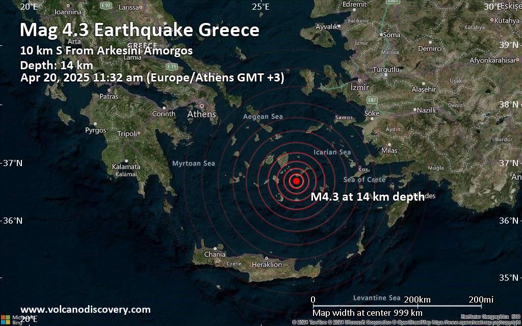
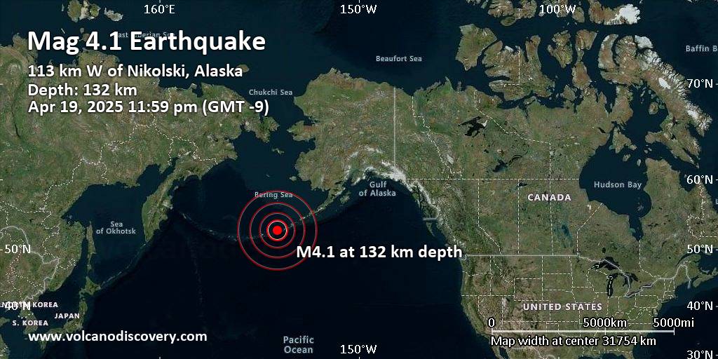
RSS feed source: Volcano Discovery.com
<!–div style="font-size:14px;text-align:center;border:3px solid blue;border-radius:5px;padding:3px;margin:5px;background:#eee"><a href="https://www.volcanoesandearthquakes.com/app/volcano-report.php?volcanoId=790" style="text-decoration:none" target="_blank" rel="noopener noreferrer nofollow" title="Share a volcano (activity) report, submit a photo or other interesting news!” onclick=”window.open(this.href,’Volcano Report’,’status=0,toolbar=0,location=0,directories=0,menubar=0,resizable=1,scrollbars=1,height=500,width=450′);return false”>Send Volcano Report</div–> stratovolcano 2882 m / 9,455 ft
Kamchatka, 55.98°N / 160.59°E
Current status: erupting (4 out of 5) Bezymianny volcano eruptions:
2017-ongoing, 2016, 2012, 2010, 2009, 2008, 2007, 2000-05, 1998, 1997, 1996-97, 1994-95, 1993-94, 1992, 1991, 1990, 1989, 1986-88, 1986, 1985, 1984, 1981-83, 1980, 1980, 1979, 1979, 1978, 1977, 1976, 1971-74, 1965-70, 1964, 1964, 1963, 1962, 1961, 1961, 1961, 1960, 1959, 1958-59, 1958, 1958, 1957, 1955-57
Typical eruption style
Explosive
Click this link to continue reading the article on the source website.