RSS feed source: Volcano Discovery.com

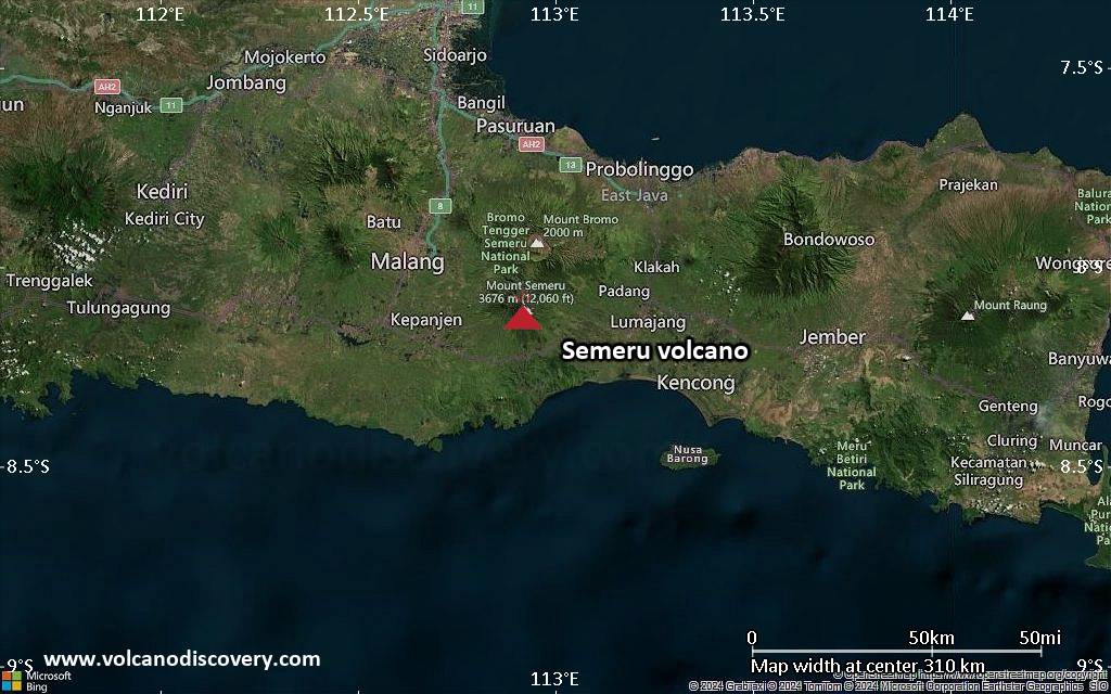
<!–div style="font-size:14px;text-align:center;border:3px solid blue;border-radius:5px;padding:3px;margin:5px;background:#eee"><a href="https://www.volcanoesandearthquakes.com/app/volcano-report.php?volcanoId=44" style="text-decoration:none" target="_blank" rel="noopener noreferrer nofollow" title="Share a volcano (activity) report, submit a photo or other interesting news!” onclick=”window.open(this.href,’Volcano Report’,’status=0,toolbar=0,location=0,directories=0,menubar=0,resizable=1,scrollbars=1,height=500,width=450′);return false”>Send Volcano Report</div–> Stratovolcano 3676 m (12,060 ft)
East Java, Indonesia, -8.11°S / 112.92°E
Current status: erupting (4 out of 5) Semeru volcano eruptions:
1818, 1829, 1830, 1832, 1836, 1838, 1842, 1844, 1845, 1848, 1849(?), 1851, 1856, 1857, 1865, 1866(?), 1887, 1887, 1888, 1889-91, 1892, 1893, 1893-94, 1895, 1896, 1897, 1899, 1899, 1900, 1901, 1903, 1904, 1905, 1907, 1908, 1909-10, 1910-11, 1911, 1912, 1913, 1941-42, 1945, 1946, 1946-47, 1950-64, 1967-ongoing
Typical eruption style
Explosive. Near constant strombolian activity, occasionally stronger explosions, lava flows and pyroclastic flows.

Click this link to continue reading the article on the source website.
RSS feed source: Volcano Discovery.com

Sun, 6 Apr 2025, 19:50 | BY: EARTHQUAKEMONITOR

World map showing volcanoes with shallow (less than 50 km) earthquakes within 20 km radius during the past 24 hours on 6 Apr 2025 Number in brackets indicate nr of quakes.

Quakes detected near: Abu (88 quakes between mag 0.1-1.6), Akita-Komagatake (3 quakes between mag 0.1-1.7), Bardarbunga (10 quakes between mag 0.1-3.0), Barva (2 quakes between mag 2.0-3.1), Cabalian (1 quake mag 2.4), Clear Lake (45 quakes between mag 0.2-2.5)
Eldey (27 quakes between mag 0.1-3.0), Eyafjallajökull (8 quakes between mag 0.2-2.1), Fagradalsfjall (28 quakes between mag 0.4-1.5), Grímsvötn (1 quake mag 1.4), Hachimantai (1 quake mag 1.3), Hrómundartindur (3 quakes between mag 0.6-1.6), Irazu (2 quakes between mag 1.3-3.0), Kembar (1 quake mag 2.2), Kirishima (10 quakes between mag 0.4-1.9), Kolumbo (29 quakes between mag 0.9-2.5), Krísuvík (51 quakes between mag 0.1-2.5), Kurikoma (7 quakes between mag 0.1-1.0), La Palma (1 quake mag 1.3), Ljósufjöll (1 quake mag 1.9), Loki-Fögrufjöll volcano (9 quakes between mag 0.6-2.8), Maroa (2 quakes between mag 1.6-1.9), Methana (3 quakes between mag 1.1-1.3), Platanar (3 quakes between mag 1.6-3.2), Poas (1 quake mag 1.2), Reporoa (1 quake mag 1.4), Ruapehu (2 quakes between mag 1.0-1.3), Salton Buttes (1 quake mag 1.0), Santorini (3 quakes between mag 0.9-1.7), Svartsengi (6 quakes between mag 0.1-1.8), Takahara (2 quakes between mag 0.3-1.3), Tenerife

Click this link to continue reading the article on the source website.

RSS feed source: Volcano Discovery.com

Date and TimeMag
DepthDistanceLocationDetailsMap Aug 16, 2024 04:46 am (GMT +9)

4.7

37 km98 km (61 mi) to the SE South Pacific Ocean, 70 km north of Pulau Kurudu Island, Indonesia InfoMay 2, 2024 11:32 am (GMT +9)

4.3

10 km76 km (47 mi) to the SESouth Pacific Ocean, 87 km north of Pulau Kurudu Island, Indonesia InfoFeb 10, 2024 08:53 am (GMT +9)

4.6

10 km87 km (54 mi) to the NW 122 km N of Insrom, Indonesia InfoJan 23, 2024 06:54 pm (Jayapura)

4.7

15 km53 km (33 mi) to the W South Pacific Ocean, 156 km north of Pulau Ambai Island, Papua, Indonesia InfoDec 27, 2023 05:31 am (Jayapura)

4.4

23 km77 km (48 mi) to the SESouth Pacific Ocean, 76 km north of Pulau Kurudu Island, Indonesia InfoNov 21, 2023 04:12 pm (Jayapura)

5.2

17 km54 km (34 mi) to the NW South Pacific Ocean, 164 km north of Pulau Ambai Island, Papua, Indonesia InfoApr 17, 2022 08:17 pm (GMT +9)

4.9

33 km95 km (59 mi) to the SE South Pacific Ocean, Papua, 272 km northeast of Nabire, Indonesia InfoMay 8, 2020 07:41 am (Jayapura)

4.8

10 km85 km (53 mi) to the S 61 km southeast of Biak, Papua, Indonesia 1 reportInfoJan 27, 2017 01:33 am (Jayapura)

4.7

19 km54 km (34 mi) to the SE South Pacific Ocean, 13 km north of Pulau Yeri Island, Papua, Indonesia InfoMay 31, 2015 02:10 am (GMT +9)

5.1

10 km56 km (35 mi) to the NW South Pacific Ocean, 52 km northeast of Pulau Pandi Island, Papua, Indonesia InfoMay 27, 2015 08:16 pm (GMT +9)

4.8

31 km59 km (37 mi) to the NW

Click this link to continue reading the article on the source website.