RSS feed source: US National Weather Service

* WHAT…The strongest surge of overnight winds has passed, though gusts of 35 to 40 mph will continue through daybreak. After 11 am, northwest winds will again increase to 25 to 35 mph with gusts up to 45 mph expected. Locally higher gusts may accompany scattered showers and thunderstorms this afternoon. * WHERE…Portions of central, east central, south central, and southeast South Dakota. * WHEN…From 11 AM this morning to 7 PM CDT this evening. * IMPACTS…Gusty winds will blow around unsecured objects. Tree limbs could be blown down and a few power outages may result.

Click this link to continue reading the article on the source website.

RSS feed source: US National Weather Service

From 14/04/2025 to 14/04/2025, a Tropical Storm (maximum wind speed of 102 km/h) THIRTY-25 was active in SEPacific. The cyclone affects these countries: New Caledonia, Vanuatu, Norfolk Island (vulnerability Medium). Estimated population affected by category 1 (120 km/h) wind speeds or higher is 0 (0.316 million in tropical storm).

Click this link to continue reading the article on the source website.

RSS feed source: US National Weather Service

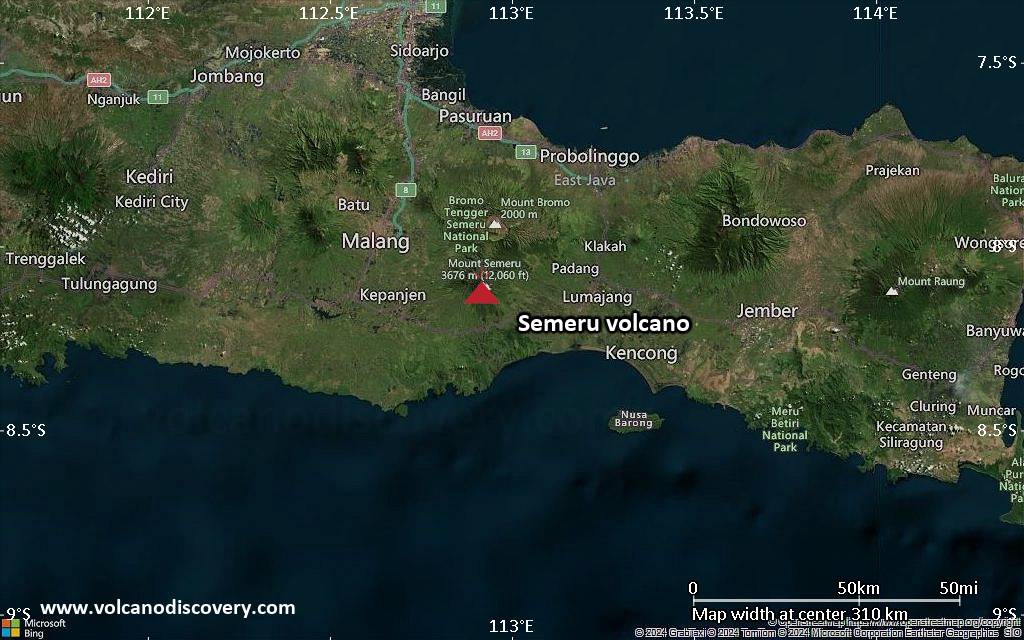
<!–div style="font-size:14px;text-align:center;border:3px solid blue;border-radius:5px;padding:3px;margin:5px;background:#eee"><a href="https://www.volcanoesandearthquakes.com/app/volcano-report.php?volcanoId=44" style="text-decoration:none" target="_blank" rel="noopener noreferrer nofollow" title="Share a volcano (activity) report, submit a photo or other interesting news!” onclick=”window.open(this.href,’Volcano Report’,’status=0,toolbar=0,location=0,directories=0,menubar=0,resizable=1,scrollbars=1,height=500,width=450′);return false”>Send Volcano Report</div–> Stratovolcano 3676 m (12,060 ft)
East Java, Indonesia, -8.11°S / 112.92°E
Current status: erupting (4 out of 5) Semeru volcano eruptions:
1818, 1829, 1830, 1832, 1836, 1838, 1842, 1844, 1845, 1848, 1849(?), 1851, 1856, 1857, 1865, 1866(?), 1887, 1887, 1888, 1889-91, 1892, 1893, 1893-94, 1895, 1896, 1897, 1899, 1899, 1900, 1901, 1903, 1904, 1905, 1907, 1908, 1909-10, 1910-11, 1911, 1912, 1913, 1941-42, 1945, 1946, 1946-47, 1950-64, 1967-ongoing
Typical eruption style
Explosive. Near constant strombolian activity, occasionally stronger explosions, lava flows and pyroclastic flows.

Click this link to continue reading the article on the source website.
RSS feed source: US National Weather Service

Date and TimeMag
DepthDistanceLocationDetailsMap Apr 14, 01:58 pm (Taipei)

3.8

10 km5.4 km (3.3 mi) to the SW Philippine Sea, 47 km northeast of Hualien City, TaiwanI FELT IT1 report

Info

Apr 11, 08:59 am (GMT +9)

4.3

24 km70 km (43 mi) to the SE Philippine Sea, 68 km southwest of Kumi Island, Okinawa, JapanI FELT IT InfoApr 9, 09:53 am (Taipei)

5.0

69 km30 km (19 mi) to the N 21 km southeast of Yilan, TaiwanI FELT IT27 reportsInfoApr 4, 09:12 pm (Taipei)

4.0

25 km47 km (29 mi) to the SW 13 km north of Hualien City, Taiwan 1 reportInfoApr 4, 04:54 pm (Taipei)

4.2

16 km6.7 km (4.2 mi) to the NW Philippine Sea, 45 km south of Yilan, TaiwanI FELT IT InfoApr 3, 02:01 am (Taipei)

4.3

36 km41 km (25 mi) to the SW 14 km north of Hualien City, Taiwan InfoApr 3, 2024 08:11 am (Taipei)

6.4

14 km36 km (23 mi) to the SW Philippine Sea, 16 km northeast of Hualien City, Taiwan 32 reportsInfoApr 3, 2024 07:58 am (Taipei)

7.4

40 km65 km (40 mi) to the SW Philippine Sea, 16 km south of Hualien City, Taiwan 232 reportsInfoFeb 6, 2018 11:50 pm (Taipei)

6.4

17 km36 km (22 mi) to the SW 18 km north of Hualien City, Taiwan 52 reportsInfoApr 20, 2015 10:42 am (GMT +9)

6.6

30 km53 km (33 mi) to the E Philippine Sea, 64 km southwest of Kumi Island, Okinawa, Japan 35 reportsInfoDec 19, 2009 09:02 pm (Taipei)

6.4

43 km68 km (43 mi) to the SW Philippine Sea, 20 km south of Hualien City, Taiwan InfoNov

Click this link to continue reading the article on the source website.