RSS feed source: Volcano Discovery.com--Global earthquake monitor

Date and TimeMag
DepthDistanceLocationDetailsMap Apr 12, 05:48 pm (GMT +13)

4.8

65 km95 km (59 mi) to the NW South Pacific Ocean, 53 km south of Hihifo, Niuas, TongaI FELT IT InfoApr 12, 04:16 pm (GMT +13)
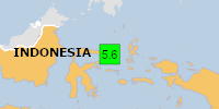
5.3

73 km95 km (59 mi) to the NW South Pacific Ocean, 369 km north of Tofua Island, Ha`apai, TongaI FELT IT InfoApr 3, 10:06 am (GMT +13)

4.9

49 km58 km (36 mi) to the NW South Pacific Ocean, 89 km southeast of Hihifo, Niuas, Tonga InfoFeb 13, 08:33 pm (GMT +13)

4.5

49 km45 km (28 mi) to the NW South Pacific Ocean, 203 km north of Neiafu, Vava’u, Tonga InfoFeb 7, 07:16 am (GMT +13)

4.5

46 km76 km (47 mi) to the NW South Pacific Ocean, 74 km south of Hihifo, Niuas, Tonga InfoOct 6, 2024 12:45 am (GMT +13)

5.2

35 km50 km (31 mi) to the SW 136 km NNE of Neiafu, Tonga 1 reportInfoSep 20, 2024 11:52 pm (GMT +13)

5.1

10 km68 km (42 mi) to the S South Pacific Ocean, 306 km northeast of Tofua Island, Ha`apai, Tonga InfoJun 22, 2024 01:34 pm (GMT +13)

5.2

10 km58 km (36 mi) to the SE South Pacific Ocean, 173 km northeast of Neiafu, Vava’u, Tonga InfoJun 18, 2024 07:40 pm (GMT +13)

5.8

87 km79 km (49 mi) to the NW South Pacific Ocean, 238 km north of Neiafu, Vava’u, Tonga 2 reportsInfoMay 11, 2023 05:02 am (GMT +13)

7.6

210 km218 km (135 mi) to the NW South Pacific Ocean, Tonga 20 reportsInfoNov 10, 2022 11:48 pm (GMT -11)

7.3

37 km263 km (163 mi) to the SE South Pacific

Click this link to continue reading the article on the source website.

RSS feed source: Volcano Discovery.com--Global earthquake monitor

Thu, 17 Apr 2025, 00:58 | BY: EARTHQUAKEMONITOR

A shallow magnitude 5.7 earthquake was reported in the morning near Manado, Kota Manado, Sulawesi Utara, Indonesia.
According to Indonesia’s Meteorology, Climatology, and Geophysical Agency, the quake hit on Thursday, April 17th, 2025, at 8:51 am local time at a shallow depth of 10. km. Shallow earthquakes are felt more strongly than deeper ones as they are closer to the surface. The exact magnitude, epicenter, and depth of the quake might be revised within the next few hours or minutes as seismologists review data and refine their calculations, or as other agencies issue their report.
Based on the preliminary seismic data, the quake was probably felt by many people in the area of the epicenter. It should not have caused significant damage, other than objects falling from shelves, broken windows, etc.
In Modisi (pop. 560) located 53 km from the epicenter, the quake should have been felt as light shaking.
Weak shaking might have been felt in Tondano (pop. 33,300) located 105 km from the epicenter, Tomohon (pop. 27,600) 107 km away, Bitung (pop. 225,100) 123 km away, Manado (pop. 451,900) 125 km away, and Bitung (pop. 137,400) 126 km away.
VolcanoDiscovery will automatically update magnitude and depth if these change and follow up if other significant news about the quake become available. If you’re in the area,

Click this link to continue reading the article on the source website.

RSS feed source: Volcano Discovery.com--Global earthquake monitor

Date and TimeMag
DepthDistanceLocationDetailsMap Apr 16, 01:01 am (GMT +8)

4.0

10 km13 km (8.3 mi) to the N Maluku Sea, 87 km south of Tondano, IndonesiaI FELT IT InfoApr 11, 06:58 am (GMT +8)

4.1

10 km76 km (47 mi) to the SW Maluku Sea, 190 km south of Manado, Kota Manado, Sulawesi Utara, IndonesiaI FELT IT InfoMar 18, 12:03 am (GMT +8)

4.2

10 km15 km (9.3 mi) to the NW Maluku Sea, 95 km south of Tondano, Indonesia 1 reportInfoMar 12, 06:59 am (GMT +8)

4.4

11 km45 km (28 mi) to the NE Maluku Sea, 96 km south of Bitung, Kota Bitung, Sulawesi Utara, Indonesia InfoMar 12, 12:40 am (GMT +8)

4.1

10 km22 km (14 mi) to the NW Maluku Sea, 81 km south of Tondano, Indonesia InfoFeb 26, 06:55 am (GMT +8)

6.1

28 km10.2 km (6.4 mi) to the SW Maluku Sea, 130 km south of Manado, Kota Manado, Sulawesi Utara, Indonesia 19 reportsInfoMar 14, 2024 03:56 am (Jayapura)

6.2

10 km77 km (48 mi) to the SE Maluku Sea, 193 km south of Manado, Kota Manado, Sulawesi Utara, Indonesia 4 reportsInfoAug 4, 2023 07:48 pm (Makassar)

6.0

10 km69 km (43 mi) to the S Maluku Sea, 189 km south of Manado, Kota Manado, Sulawesi Utara, Indonesia 8 reportsInfoAug 18, 2022 03:46 pm (Makassar)

5.7

155 km57 km (35 mi) to the W Maluku Sea, 139 km south of Manado, Kota Manado, Sulawesi Utara, Indonesia 1 reportInfoNov 6, 2021 10:37 pm (Makassar)

6.0

44 km83 km (51 mi) to the SW Maluku Sea, 165 km southeast of Gorontalo, Gorontalo, Indonesia 5 reportsInfoNov 15,

Click this link to continue reading the article on the source website.