RSS feed source: US National Weather Service

* WHAT…Dangerous rip currents expected. * WHERE…Coastal Palm Beach County, Coastal Broward County and Coastal Miami Dade County. * WHEN…From 8 AM EDT Sunday through Monday evening. * IMPACTS…Rip currents can sweep even the best swimmers away from shore into deeper water.

Click this link to continue reading the article on the source website.

RSS feed source: US National Weather Service

At 603 PM MDT, Doppler radar was tracking strong thunderstorm winds along a line extending from 14 miles southwest of Hobson to 14 miles north of Harlowton. HAZARD…Wind gusts up to 50 mph. SOURCE…Radar indicated. IMPACT…Gusty winds could knock down tree limbs and blow around unsecured objects. Locations impacted include… Moore, Buffalo, and Garneill.

Click this link to continue reading the article on the source website.

RSS feed source: US National Weather Service

Sat, 10 May 2025, 23:50 | BY: EARTHQUAKEMONITOR

World map showing volcanoes with shallow (less than 50 km) earthquakes within 20 km radius during the past 24 hours on 10 May 2025 Number in brackets indicate nr of quakes.

Quakes detected near: Abu (30 quakes between mag 0.3-1.5), Akademia Nauk (1 quake mag 2.4), Askja (2 quakes between mag 0.3-1.5), Atka (1 quake mag 1.0), Cabalian (3 quakes between mag 1.5-1.8), Canlaon (5 quakes between mag 2.0-3.1)
Clear Lake (34 quakes between mag 0.3-1.5), Conchagüita (2 quakes between mag 1.7-2.1), Cuilapa-Barbarena (1 quake mag 2.0), Descabezado Grande (1 quake mag 2.7), Haku-san (1 quake mag 1.0), Ilopango (1 quake mag 2.4), Iwate (2 quakes between mag 0.4-1.0), Katla (1 quake mag 1.6), Kilauea (1 quake mag 1.6), Kolumbo (13 quakes between mag 1.1-3.1), Krísuvík (4 quakes between mag 0.1-1.5), Ljósufjöll (11 quakes between mag 0.2-1.4), Megata (1 quake mag 2.6), Methana (2 quakes between mag 1.3-1.8), Sandal (1 quake mag 1.2), Santorini (3 quakes between mag 1.2-1.5), Shiveluch (1 quake mag 1.6), Svartsengi (9 quakes between mag 0.1-1.0), Thordarhyrna (2 quakes between mag 0.8-1.0), Tindfjallajökull (1 quake mag 1.3), Torfajökull (2 quakes between mag 0.8-1.5), Tsurumi (3 quakes between mag 0.2-3.0), Udina (1 quake mag 1.0) (updated 23h50)

Note: Earthquakes within 20 km from and at depths less than 50 km under active volcanoes

Click this link to continue reading the article on the source website.
RSS feed source: US National Weather Service

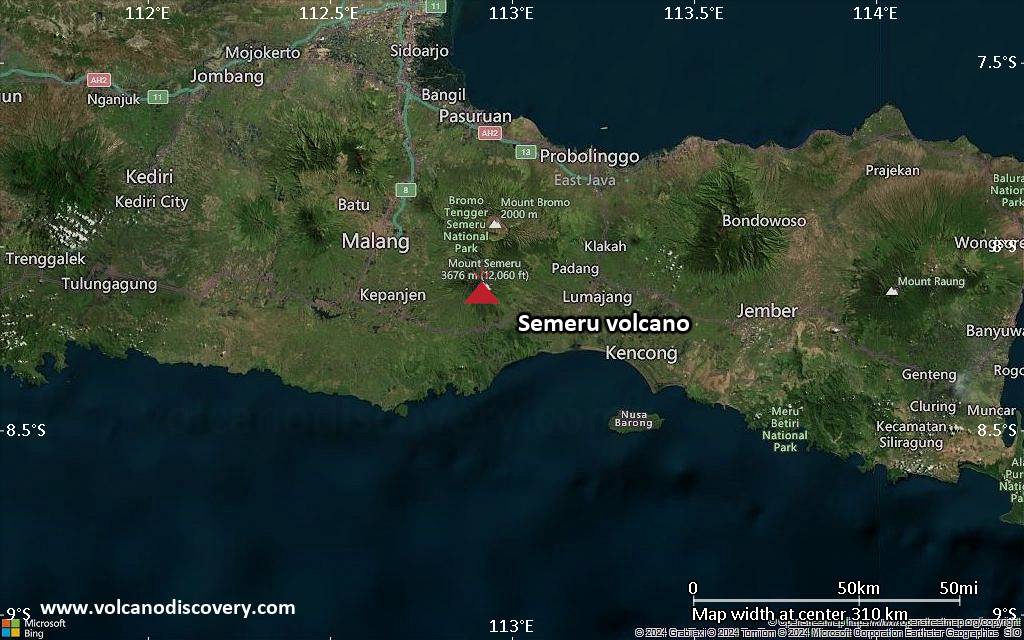
<!–div style="font-size:14px;text-align:center;border:3px solid blue;border-radius:5px;padding:3px;margin:5px;background:#eee"><a href="https://www.volcanoesandearthquakes.com/app/volcano-report.php?volcanoId=44" style="text-decoration:none" target="_blank" rel="noopener noreferrer nofollow" title="Share a volcano (activity) report, submit a photo or other interesting news!” onclick=”window.open(this.href,’Volcano Report’,’status=0,toolbar=0,location=0,directories=0,menubar=0,resizable=1,scrollbars=1,height=500,width=450′);return false”>Send Volcano Report</div–> Stratovolcano 3676 m (12,060 ft)
East Java, Indonesia, -8.11°S / 112.92°E
Current status: erupting (4 out of 5) Semeru volcano eruptions:
1818, 1829, 1830, 1832, 1836, 1838, 1842, 1844, 1845, 1848, 1849(?), 1851, 1856, 1857, 1865, 1866(?), 1887, 1887, 1888, 1889-91, 1892, 1893, 1893-94, 1895, 1896, 1897, 1899, 1899, 1900, 1901, 1903, 1904, 1905, 1907, 1908, 1909-10, 1910-11, 1911, 1912, 1913, 1941-42, 1945, 1946, 1946-47, 1950-64, 1967-ongoing
Typical eruption style
Explosive. Near constant strombolian activity, occasionally stronger explosions, lava flows and pyroclastic flows.

Click this link to continue reading the article on the source website.