RSS feed source: US National Weather Service

* WHAT…Flooding caused by excessive rainfall is expected. * WHERE…A portion of east Tennessee, including the following counties, Blount, Cocke and Sevier. * WHEN…Until 1115 AM EDT. * IMPACTS…Minor flooding in low-lying and poor drainage areas. River or stream flows are elevated. * ADDITIONAL DETAILS… – At 808 AM EDT, Doppler radar indicated heavy rain. Minor flooding is ongoing or expected to begin shortly in the advisory area. – Some locations that will experience flooding include… Maryville, Sevierville, Alcoa, Newport, Gatlinburg, Pigeon Forge, Rockford, Eagleton Village, Pittman Center, Townsend, Harrisburg, Fairgarden, Elkmont, Great Smoky Mountains National Park, Wears Valley, Roundtop Mountain State Park, Cosby, Seymour, Hartford and Walland. – http://www.weather.gov/safety/flood

Click this link to continue reading the article on the source website.

RSS feed source: US National Weather Service

* WHAT…Flooding caused by excessive rainfall is expected. * WHERE…Portions of Panhandle Florida, including the following counties, Bay, Calhoun, Jackson and Washington and southwest Georgia, including the following county, Seminole. * WHEN…Until 1000 AM EDT /900 AM CDT/. * IMPACTS…Minor flooding in low-lying and poor drainage areas. * ADDITIONAL DETAILS… – At 807 AM EDT /707 AM CDT/, Doppler radar indicated heavy rain due to thunderstorms. Minor flooding is ongoing or expected to begin shortly in the advisory area. – Some locations that will experience flooding include… Panama City, Lynn Haven, Panama City Beach, Callaway, Marianna, Springfield, Hiland Park, Malone, Cottondale, Grand Ridge, Greenwood, Altha, Alford, Bascom, Center Lake, Compass Lake,

Click this link to continue reading the article on the source website.
RSS feed source: US National Weather Service

* WHAT…Snow and blowing snow expected. Total snow accumulations of 1 to 3 inches and visibility to one-half mile. Winds gusting as high as 40 mph. * WHERE…St Lawrence Island. * WHEN…From 3 AM to 7 PM AKDT Monday. * IMPACTS…Plan on slippery road conditions. * ADDITIONAL DETAILS…Strongest northeast winds are expected around midday and will persist through the afternoon before weakening during the evening. Falling snow combined with wind will result in visibility as low as one-half mile at times.

Click this link to continue reading the article on the source website.

RSS feed source: US National Weather Service

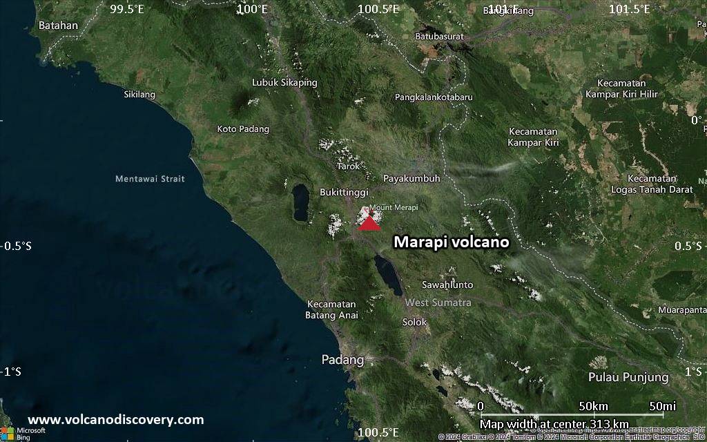
<!–div style="font-size:14px;text-align:center;border:3px solid blue;border-radius:5px;padding:3px;margin:5px;background:#eee"><a href="https://www.volcanoesandearthquakes.com/app/volcano-report.php?volcanoId=62" style="text-decoration:none" target="_blank" rel="noopener noreferrer nofollow" title="Share a volcano (activity) report, submit a photo or other interesting news!” onclick=”window.open(this.href,’Volcano Report’,’status=0,toolbar=0,location=0,directories=0,menubar=0,resizable=1,scrollbars=1,height=500,width=450′);return false”>Send Volcano Report</div–> Stratovolcano 2891 m (9,485 ft)
Western Sumatra, Indonesia, -0.39°S / 100.46°E
Current status: erupting (4 out of 5) Marapi volcano eruptions:
2011-ongoing, 2004 (Aug), 2001, 2000, 1999, 1987-94, 1984, 1984, 1983, 1982, 1980, 1975-79, 1973, 1970-71, 1968(?), 1967, 1966, 1958, 1958, 1954-57, 1950-52, 1949, 1949, 1943, 1932, 1930, 1929, 1927, 1925, 1919, 1918, 1918, 1917, 1916, 1915, 1913, 1911, 1910, 1907-08, 1905, 1904, 1889, 1888, 1886, 1885, 1883, 1878(?), 1883, 1876-77, 1876, 1871, 1871, 1863, 1861, 1855-56, 1854, 1845, 1833-34, 1822, 1807, 1770
Typical eruption style
Small to moderate sized explosions

Click this link to continue reading the article on the source website.