RSS feed source: US National Weather Service

* WHAT…Flooding caused by excessive rainfall continues. * WHERE…A portion of central Missouri, including the following county, Pettis. * WHEN…Until 815 AM CDT. * IMPACTS…Flooding of rivers, creeks, streams, and other low-lying and flood-prone locations is imminent or occurring. * ADDITIONAL DETAILS… – At 458 AM CDT, trained weather spotters reported slow moving thunderstorms with very heavy rainfall across the warned area. Between 1.5 and 3 inches of rain have fallen. – Flooding impacts will continue, but no additional rainfall is expected. – Some locations that will experience flooding include… Sedalia, Windsor, La Monte, Green Ridge, Houstonia, Hughesville and Sedalia Memorial Arpt. – http://www.weather.gov/safety/flood

Click this link to continue reading the article on the source website.

RSS feed source: US National Weather Service

Mon, 21 Apr 2025, 09:50 | BY: EARTHQUAKEMONITOR

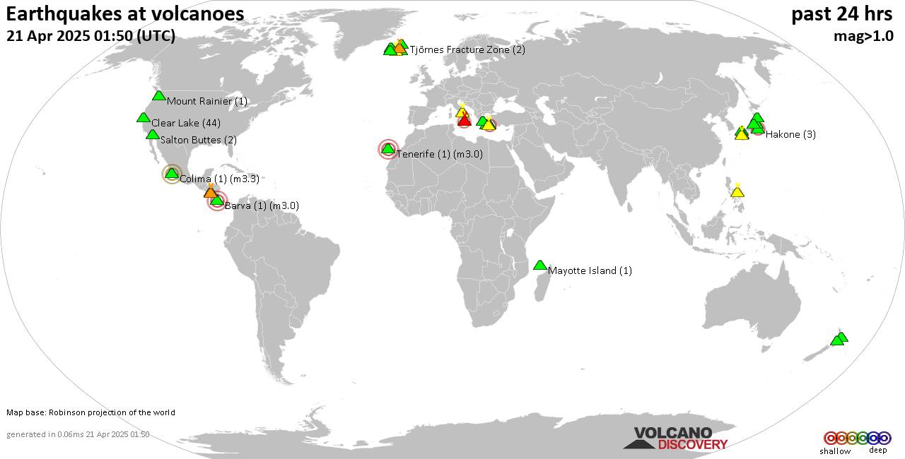
World map showing volcanoes with shallow (less than 50 km) earthquakes within 20 km radius during the past 24 hours on 21 Apr 2025 Number in brackets indicate nr of quakes.

Quakes detected near: Abu (23 quakes between mag 0.3-1.2), Aracar (1 quake mag 3.0), Bardarbunga (5 quakes between mag 0.0-1.8), Barva (1 quake mag 3.0), Bulusan (1 quake mag 1.8), Cabalian (1 quake mag 2.1)
Campi Flegrei (Phlegrean Fields) (8 quakes between mag 0.1-1.3), Clear Lake (38 quakes between mag 0.2-1.4), Etna (1 quake mag 2.2), Fagradalsfjall (29 quakes between mag 0.1-1.0), Hakone (3 quakes between mag 0.1-2.2), Hrómundartindur (8 quakes between mag 0.1-2.3), Jan Mayen (8 quakes between mag 0.9-2.4), Kamen (1 quake mag 1.2), Klyuchevskoy (5 quakes between mag 1.1-2.0), Kolumbo (29 quakes between mag 0.4-2.2), Kurikoma (7 quakes between mag 0.3-1.6), Ljósufjöll (8 quakes between mag 0.3-2.0), Mayotte Island (2 quakes between mag 1.0-1.1), Milos (1 quake mag 2.1), Myoko (1 quake mag 1.1), Okataina (Tarawera) (1 quake mag 1.6), Ruapehu (1 quake mag 1.2), Salton Buttes (5 quakes between mag 1.1-2.1), Santorini (1 quake mag 1.1), Soda Lakes (1 quake mag 1.2), Sousaki (3 quakes between mag 0.7-1.8), Svartsengi (13 quakes between mag 0.0-1.5), Taupo (2 quakes between mag 1.6-2.2), Tenerife (5 quakes between mag 0.7-3.0), Tjörnes Fracture Zone (3 quakes

Click this link to continue reading the article on the source website.
RSS feed source: US National Weather Service

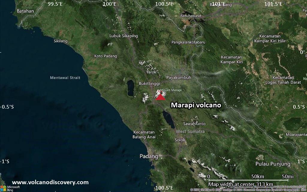
<!–div style="font-size:14px;text-align:center;border:3px solid blue;border-radius:5px;padding:3px;margin:5px;background:#eee"><a href="https://www.volcanoesandearthquakes.com/app/volcano-report.php?volcanoId=62" style="text-decoration:none" target="_blank" rel="noopener noreferrer nofollow" title="Share a volcano (activity) report, submit a photo or other interesting news!” onclick=”window.open(this.href,’Volcano Report’,’status=0,toolbar=0,location=0,directories=0,menubar=0,resizable=1,scrollbars=1,height=500,width=450′);return false”>Send Volcano Report</div–> Stratovolcano 2891 m (9,485 ft)
Western Sumatra, Indonesia, -0.39°S / 100.46°E
Current status: erupting (4 out of 5) Marapi volcano eruptions:
2011-ongoing, 2004 (Aug), 2001, 2000, 1999, 1987-94, 1984, 1984, 1983, 1982, 1980, 1975-79, 1973, 1970-71, 1968(?), 1967, 1966, 1958, 1958, 1954-57, 1950-52, 1949, 1949, 1943, 1932, 1930, 1929, 1927, 1925, 1919, 1918, 1918, 1917, 1916, 1915, 1913, 1911, 1910, 1907-08, 1905, 1904, 1889, 1888, 1886, 1885, 1883, 1878(?), 1883, 1876-77, 1876, 1871, 1871, 1863, 1861, 1855-56, 1854, 1845, 1833-34, 1822, 1807, 1770
Typical eruption style
Small to moderate sized explosions

Click this link to continue reading the article on the source website.
RSS feed source: US National Weather Service

…The Flood Watch continues for the following rivers in Wisconsin… Black River at Black River Falls affecting Jackson County. * WHAT…Flooding is possible. * WHERE…Black River at Black River Falls. * WHEN…From this evening to late Wednesday morning. * IMPACTS…At 47.0 feet, Some rural roads may begin to flood including county Highway VV downstream near the La Crosse County line. * ADDITIONAL DETAILS… – At 4:00 AM CDT Monday the stage was 40.9 feet. – Forecast…Flood stage may be reached late this evening. – Flood stage is 47.0 feet. – http://www.weather.gov/safety/flood

Click this link to continue reading the article on the source website.