RSS feed source: Volcano Discovery.com--Global earthquake monitor

94 km (58 mi)

SE of epicenter

San Rafael

(pop: 118,000)

I: Not felt

Mendoza Province 130 km (81 mi)

NE of epicenter

San Martin

(pop: 82,500)

I: Not felt

Departamento de San Martin, Mendoza Province 138 km (86 mi)

W of epicenter

Machali

(pop: 27,600)

I: Not felt

Cachapoal, Region del Libertador General Bernardo O’Higgins 139 km (86 mi)

N of epicenter

Mendoza

(pop: 114,900)

I: Not felt

Departamento de Guaymallen, Mendoza Province 139 km (86 mi)

N of epicenter

Mendoza

(pop: 114,900)

I: Not felt

Departamento de Guaymallen, Mendoza Province 143 km (89 mi)

W of epicenter

Puente Alto

(pop: 568,100)

I: Not felt

Cordillera, Santiago Metropolitan 145 km (90 mi)

W of epicenter

Graneros

(pop: 23,300)

I: Not felt

Cachapoal, Region del Libertador General Bernardo O’Higgins 147 km (91 mi)

W of epicenter

Rancagua

(pop: 212,700)

I: Not felt

Cachapoal, Region del Libertador General Bernardo O’Higgins 149 km (93 mi)

W of epicenter

La Pintana

(pop: 201,200)

I: Not felt

Santiago, Santiago Metropolitan 151 km (94 mi)

W of epicenter

Paine

(pop: 32,800)

I: Not felt

Maipo, Santiago Metropolitan 153 km (95 mi)

W of epicenter

Buin

(pop: 55,400)

I: Not felt

Maipo, Santiago Metropolitan 154 km (96 mi)

W of epicenter

San Bernardo

(pop: 249,900)

I: Not felt

Maipo,

Click this link to continue reading the article on the source website.

RSS feed source: Volcano Discovery.com--Global earthquake monitor

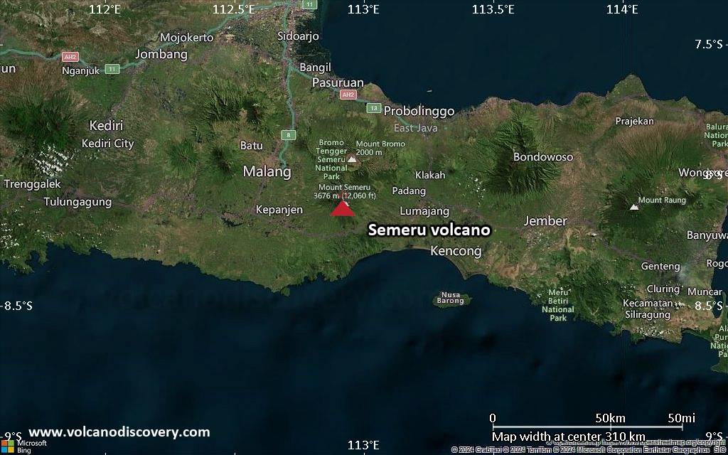
<!–div style="font-size:14px;text-align:center;border:3px solid blue;border-radius:5px;padding:3px;margin:5px;background:#eee"><a href="https://www.volcanoesandearthquakes.com/app/volcano-report.php?volcanoId=44" style="text-decoration:none" target="_blank" rel="noopener noreferrer nofollow" title="Share a volcano (activity) report, submit a photo or other interesting news!” onclick=”window.open(this.href,’Volcano Report’,’status=0,toolbar=0,location=0,directories=0,menubar=0,resizable=1,scrollbars=1,height=500,width=450′);return false”>Send Volcano Report</div–> Stratovolcano 3676 m (12,060 ft)
East Java, Indonesia, -8.11°S / 112.92°E
Current status: erupting (4 out of 5) Semeru volcano eruptions:
1818, 1829, 1830, 1832, 1836, 1838, 1842, 1844, 1845, 1848, 1849(?), 1851, 1856, 1857, 1865, 1866(?), 1887, 1887, 1888, 1889-91, 1892, 1893, 1893-94, 1895, 1896, 1897, 1899, 1899, 1900, 1901, 1903, 1904, 1905, 1907, 1908, 1909-10, 1910-11, 1911, 1912, 1913, 1941-42, 1945, 1946, 1946-47, 1950-64, 1967-ongoing
Typical eruption style
Explosive. Near constant strombolian activity, occasionally stronger explosions, lava flows and pyroclastic flows.

Click this link to continue reading the article on the source website.
RSS feed source: Volcano Discovery.com--Global earthquake monitor

Date and TimeMag
DepthDistanceLocationDetailsMap Feb 17, 03:41 pm (Universal Time)

4.3

10 km17 km (10.6 mi) to the W 41 km east of Malatya, Malatya, Turkey 7 reportsInfoNov 9, 2024 08:11 pm (Istanbul)

4.1

10 km10 km (6.2 mi) to the SW 48 km east of Malatya, Malatya, Turkey InfoNov 8, 2024 05:04 pm (Istanbul)

5.1

10 km73 km (45 mi) to the NE 46 km east of Elazig, Elazig, Turkey 2 reportsInfoNov 3, 2024 01:58 am (Istanbul)

4.2

10.5 km37 km (23 mi) to the SW Adiyaman, 32 km southeast of Malatya, Malatya, Turkey 2 reportsInfoOct 16, 2024 10:46 am (Istanbul)

6.0

10 km13 km (8.4 mi) to the W 43 km east of Malatya, Malatya, Turkey 43 reportsInfoJan 25, 2024 04:04 pm (Istanbul)

5.0

16 km51 km (32 mi) to the SW 19 km WNW of Sincik, Turkey 14 reportsInfoNov 23, 2023 05:46 pm (Istanbul)

5.3

10 km44 km (27 mi) to the SW 43 km northeast of Adıyaman, Adiyaman, Turkey 27 reportsInfoAug 10, 2023 08:48 pm (Istanbul)

5.2

10 km66 km (41 mi) to the W 14 km southwest of Malatya, Malatya, Turkey 30 reportsInfoFeb 27, 2023 12:04 pm (Istanbul)

5.2

10 km61 km (38 mi) to the W 15 km south of Malatya, Malatya, Turkey 12 reportsInfoFeb 7, 2023 01:18 pm (Istanbul)

5.3

13 km47 km (29 mi) to the SW 38 km northeast of Adıyaman, Adiyaman, Turkey 3 reportsInfoFeb 7, 2023 10:11 am (Istanbul)

5.4

9.1 km37 km (23 mi) to the SW 40 km southeast of Malatya, Malatya, Turkey 4 reportsInfoFeb 6, 2023 06:33 pm (Istanbul)

5.4

7.4 km70 km (43 mi) to the W 22 km southwest of Malatya, Malatya, Turkey 2 reportsInfoFeb 6, 2023 01:51

Click this link to continue reading the article on the source website.

RSS feed source: Volcano Discovery.com--Global earthquake monitor

* WHAT…Dangerous rip currents. * WHERE…Southeast Georgia and Northeast Florida Beaches. * WHEN…Through late Monday night. * IMPACTS…Rip currents can sweep even the best swimmers away from shore into deeper water.

Click this link to continue reading the article on the source website.