RSS feed source: USGS Earthquake Hazards Program
Time2025-10-04 20:30:53 UTC2025-10-04 20:30:53 UTC at epicenterLocation35.581°S 104.078°WDepth10.00 km (6.21 mi)
Click this link to continue reading the article on the source website.
RSS feed source: USGS Earthquake Hazards Program
Time2025-10-04 20:30:53 UTC2025-10-04 20:30:53 UTC at epicenterLocation35.581°S 104.078°WDepth10.00 km (6.21 mi)
Click this link to continue reading the article on the source website.
RSS feed source: USGS Earthquake Hazards Program
Sat, 4 Oct 2025, 21:00 1759611605 | BY: SEVERAL CONTRIBUTORS
Map of today’s active volcanoes
Krasheninnikov (Kamchatka, Russia): (4 Oct) Explosive activity continues. Volcanic Ash Advisory Center (VAAC) Tokyo warned about a volcanic ash plume that rose up to estimated 8000 ft (2400 m) altitude or flight level 080 and is moving at 20 kts in SE direction.
The full report is as follows: VA EMISSIONS CONTINUING OBS VA DTG:04/0520Z to 8000 ft (2400 m)
Shiveluch (Kamchatka): Explosive activity continues. Volcanic Ash Advisory Center (VAAC) Tokyo warned about a volcanic ash plume that rose up to estimated 12000 ft (3700 m) altitude or flight level 120 and is moving at 20 kts in SE direction.
The full report is as follows: VA EMISSIONS CONTINUING OBS VA DTG:04/1720Z to 12000 ft (3700 m)
Suwanose-jima (Ryukyu Islands): Volcanic Ash Advisory Center Tokyo (VAAC) issued the following report: ERUPTED AT 20251004/1436Z OVER FL060
Click this link to continue reading the article on the source website.
RSS feed source: USGS Earthquake Hazards Program
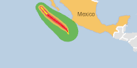
From 04/10/2025 to 04/10/2025, a Tropical Storm (maximum wind speed of 157 km/h) PRISCILLA-25 was active in EastPacific. The cyclone affects these countries: Mexico (vulnerability Medium). Estimated population affected by category 1 (120 km/h) wind speeds or higher is 0 (0 in tropical storm).
Click this link to continue reading the article on the source website.
RSS feed source: USGS Earthquake Hazards Program
<!–div style="font-size:14px;text-align:center;border:3px solid blue;border-radius:5px;padding:3px;margin:5px;background:#eee"><a href="https://www.volcanoesandearthquakes.com/app/volcano-report.php?volcanoId=26" style="text-decoration:none" target="_blank" rel="noopener noreferrer nofollow" title="Share a volcano (activity) report, submit a photo or other interesting news!” onclick=”window.open(this.href,’Volcano Report’,’status=0,toolbar=0,location=0,directories=0,menubar=0,resizable=1,scrollbars=1,height=500,width=450′);return false”>Send Volcano Report</div–> Stratovolcano 3,763 m / 12,346 ft
Guatemala, 14.47°N / -90.88°W
Current status: erupting (4 out of 5) Fuego volcano eruptions:
1581, 1585, 1586, 1587, 1614, 1617, 1620, 1623, 1629, 1679(?), 1685, 1686, 1689(?), 1699, 1702, 1705, 1706, 1709(?), 1710,1717,1730, 1732, 1737, 1751(?), 1765(?), 1773(?), 1799, 1826, 1829, 1850(?), 1852(?), 1855, 1856, 1857, 1860, 1861(?), 1867(?), 1880, 1896, 1932, 1944, 1949, 1953, 1955, 1957, 1962, 1963, 1966, 1967, 1971, 1973, 1974, 1975, 1977, 1987, 1999, 2002 – ongoing
Typical eruption style
Dominantly explosive, construction of lava domes and extrusion of viscous lava flows. In near constant activity, at least during the past centuries.
Click this link to continue reading the article on the source website.