RSS feed source: Global Disaster Alert and Coordination Systems (GDACS).
Date and TimeMag
DepthDistanceLocationDetailsMap Jul 9, 11:23 am (Port Moresby)
4.5
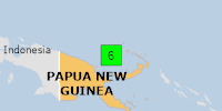
10 km70 km (43 mi) to the W Admiralty Islands Region, P.N.G. InfoJul 9, 03:22 am (GMT +10)
5.3
10 km53 km (33 mi) to the W 113 km SSE of Lorengau, Papua New Guinea InfoJul 9, 03:11 am (GMT +10)
5.2
10 km53 km (33 mi) to the W 110 km SSE of Lorengau, Papua New Guinea InfoJul 9, 12:38 am (GMT +10)
5.2
10 km61 km (38 mi) to the W 120 km S of Lorengau, Papua New Guinea InfoJan 22, 06:00 am (GMT +10)
5.3
10 km56 km (35 mi) to the E 173 km SE of Lorengau, Papua New Guinea InfoOct 9, 2023 04:07 am (GMT +10)
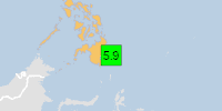
5.9
7 km54 km (34 mi) to the E Bismarck Sea 2 reportsInfoAug 2, 2020 07:29 pm (GMT +10)
5.8
10 km101 km (63 mi) to the E Bismarck Sea InfoAug 2, 2020 05:22 am (GMT +10)
5.9
10 km81 km (51 mi) to the E Bismarck Sea InfoJul 26, 2016 05:38 am (GMT +10)
6.3
10 km8.5 km (5.3 mi) to the NE Bismarck Sea, 133 km southeast of Lorengau, Manus Province, Papua New Guinea InfoMar 12, 2014 08:03 am (GMT +10)
6.1
7 km65 km (41 mi) to the E 183 km SE of Lorengau, Papua New Guinea InfoNov 15, 2012 06:21 pm (GMT +10)
5.9
10 km35 km (22 mi) to the E 162 km SE of Lorengau, Papua New Guinea InfoNov 1, 2008 11:13 am (GMT +10)
6.0
10 km92 km (57 mi) to the SE Bismarck Sea (Papua New Guinea) InfoOct 1, 2007 11:50 pm (GMT +10)
5.9
10 km32 km (20 mi) to the SE Bismarck Sea (Papua New Guinea)
Click this link to continue reading the article on the source website.