RSS feed source: Global Disaster Alert and Coordination Systems (GDACS).

Thu, 17 Apr 2025, 00:58 | BY: EARTHQUAKEMONITOR

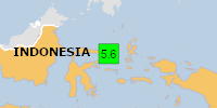
A shallow magnitude 5.7 earthquake was reported in the morning near Manado, Kota Manado, Sulawesi Utara, Indonesia.
According to Indonesia’s Meteorology, Climatology, and Geophysical Agency, the quake hit on Thursday, April 17th, 2025, at 8:51 am local time at a shallow depth of 10. km. Shallow earthquakes are felt more strongly than deeper ones as they are closer to the surface. The exact magnitude, epicenter, and depth of the quake might be revised within the next few hours or minutes as seismologists review data and refine their calculations, or as other agencies issue their report.
Based on the preliminary seismic data, the quake was probably felt by many people in the area of the epicenter. It should not have caused significant damage, other than objects falling from shelves, broken windows, etc.
In Modisi (pop. 560) located 53 km from the epicenter, the quake should have been felt as light shaking.
Weak shaking might have been felt in Tondano (pop. 33,300) located 105 km from the epicenter, Tomohon (pop. 27,600) 107 km away, Bitung (pop. 225,100) 123 km away, Manado (pop. 451,900) 125 km away, and Bitung (pop. 137,400) 126 km away.
VolcanoDiscovery will automatically update magnitude and depth if these change and follow up if other significant news about the quake become available. If you’re in the area,

Click this link to continue reading the article on the source website.

RSS feed source: Global Disaster Alert and Coordination Systems (GDACS).

DENTON, Texas – New flood maps have been finalized and will become effective on Oct. 16, 2025, for Allen Parish, Louisiana. During the next six months, a FEMA compliance specialist will work with the community to update each floodplain ordinance and adopt these new flood maps. 

Residents are encouraged to examine the maps to determine if they are in a low-to-moderate or high-risk flood zone. The current and future Flood Insurance Rate Map can be viewed on FEMA’s Flood Map Changes Viewer at https://msc.fema.gov/fmcv.

By understanding flood risks, individuals can decide which insurance option is best for their situation. Community leaders can use these maps to make informed decisions about building standards and development to help lessen the impacts of a flooding event.

Anyone without flood insurance risks uninsured losses to their home, personal property and business. Flood insurance is available either through a private policy or through the National Flood Insurance Program (NFIP) for those in communities who participate in the NFIP. Residents with federally backed mortgages must have flood insurance if their structures are in the Special Flood Hazard Area.

Contact your local floodplain administrator (FPA) to review the new flood maps and learn more about your risk of flooding. A FEMA Map Specialist can help identify your community FPA and answer questions about the maps as well. Contact them by phone or online chat.

There

Click this link to continue reading the article on the source website.

RSS feed source: Global Disaster Alert and Coordination Systems (GDACS).

Support us – Help us upgrade our services! We truly love working to bring you the latest volcano and earthquake data from around the world. Maintaining our website and our free apps does require, however, considerable time and resources.
We need financing to increase hard- and software capacity as well as support our editor team. We’re aiming to achieve uninterrupted service wherever an earthquake or volcano eruption unfolds, and your donations can make it happen! Every donation will be highly appreciated. If you find the information useful and would like to support our team in integrating further features, write great content, and in upgrading our soft- and hardware, please make a donation (PayPal).

Planned features:

Improved multilanguage supportTsunami alertsFaster responsivenessThanks to your past donations, these features have been added recently:Design upgradeDetailed quake statsAdditional seismic data sourcesDownload and Upgrade the Volcanoes & Earthquakes app to get one of

Click this link to continue reading the article on the source website.