RSS feed source: Global Disaster Alert and Coordination Systems (GDACS).
Date and TimeMag
DepthDistanceLocationDetailsMap Apr 28, 10:28 am (Auckland)
3.1
250 km1232 km (765 mi) to the SW South Pacific Ocean, Manawatu-Wanganui, 45 km north of Whakatane, New Zealand I FELT IT
Info
Apr 28, 04:16 am (Auckland)
3.3
70 km1190 km (739 mi) to the SW South Pacific Ocean, 91 km northeast of Whakatane, Bay of Plenty, New Zealand I FELT IT
Info
Apr 24, 10:01 am (GMT +12)
3.1
146 km1196 km (743 mi) to the SW South Pacific Ocean, 78 km northeast of Whakatane, Bay of Plenty, New Zealand I FELT IT
Info
Apr 22, 09:47 am (Auckland)
3.1
17 km1288 km (800 mi) to the SW 20 km northwest of Gisborne, Gisborne, New Zealand
Info
Apr 21, 07:55 pm (Auckland)
3.0
12 km1170 km (727 mi) to the SW South Pacific Ocean, 20 km northwest of Hicks Bay, Gisborne, New Zealand I FELT IT
Info
Apr 20, 06:48 am (GMT +12)
3.4
33 km1122 km (697 mi) to the SW South Pacific Ocean, 71 km north of Hicks Bay, Gisborne, New Zealand
Info
Apr 17, 05:11 am (GMT +12)
3.5
24 km1271 km (790 mi) to the SW 35 km north of Gisborne, Gisborne, New Zealand
Info
Apr 15, 08:15 am (Auckland)
3.5
20 km1271 km (790 mi) to the SW 34 km north of Gisborne, Gisborne, New Zealand
Info
Apr 13, 06:41 am (GMT +12)
3.3
12 km1117 km (694 mi) to the SW 64 km northeast of Hicks Bay, Gisborne, New Zealand
Info
Apr 29, 2021 03:58 pm (Auckland)
5.8
33 km1285 km (798 mi) to the SW 30 km northwest of Gisborne, Gisborne, New Zealand 6 reportsInfoMar 5, 2021 01:27 am (GMT +12)
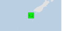
7.1
90 km1110 km (690 mi) to
Click this link to continue reading the article on the source website.