RSS feed source: Volcano Discovery.com--Global earthquake monitor

Date and TimeMag
DepthDistanceLocationDetailsMap Apr 7, 07:54 pm (Manila)

4.6

76 km81 km (50 mi) to the N Philippine Sea, 37 km northeast of Bislig, Surigao del Sur, Caraga, Philippines 1 reportInfoMar 27, 10:10 pm (Manila)

4.6

76 km102 km (63 mi) to the N Philippine Sea, 46 km north of Bislig, Surigao del Sur, Caraga, Philippines 1 reportInfoMar 20, 06:35 am (GMT +8)

4.1

11 km88 km (55 mi) to the NW 12 km west of Bunawan, Agusan del Sur, Caraga, Philippines InfoMar 16, 03:50 am (Manila)

4.6

77 km135 km (84 mi) to the N 18 km south of Tandag, Surigao del Sur, Caraga, Philippines InfoMar 13, 10:11 am (Manila)

4.3

14 km72 km (45 mi) to the N Mindanao, Philippines 1 reportInfoAug 3, 2024 06:23 am (Manila)

6.8

32 km49 km (30 mi) to the N Philippine Sea, 33 km east of Bislig, Surigao del Sur, Caraga, Philippines 88 reportsInfoFeb 10, 2024 11:22 am (Manila)

5.8

32 km150 km (93 mi) to the NW Agusan del Sur, 30 km south of Butuan, Agusan del Norte, Caraga, Philippines 117 reportsInfoDec 3, 2023 06:39 pm (GMT +8)

5.7

45 km90 km (56 mi) to the N37 km ENE of Hinatuan, Philippines InfoDec 3, 2023 06:35 pm (GMT +8)

6.6

19 km85 km (53 mi) to the N Philippine Sea, 56 km northeast of Bislig, Surigao del Sur, Caraga, Philippines 63 reportsInfoDec 3, 2023 01:40 am (GMT +8)

6.1

36 km77 km (48 mi) to the N Philippine Sea, 50 km northeast of Bislig, Surigao del Sur, Caraga, Philippines 9 reportsInfoDec 2, 2023 10:37 pm (Manila)

7.6

40 km88 km (54 mi) to the N Philippine Sea, 36

Click this link to continue reading the article on the source website.

RSS feed source: Volcano Discovery.com--Global earthquake monitor

Date and TimeMag
DepthDistanceLocationDetailsMap Apr 7, 07:54 pm (Manila)

4.6

76 km74 km (46 mi) to the E Philippine Sea, 37 km northeast of Bislig, Surigao del Sur, Caraga, Philippines 1 reportInfoMar 27, 10:10 pm (Manila)

4.6

76 km50 km (31 mi) to the NE Philippine Sea, 46 km north of Bislig, Surigao del Sur, Caraga, Philippines 1 reportInfoMar 20, 06:35 am (GMT +8)

4.1

11 km27 km (17 mi) to the S 12 km west of Bunawan, Agusan del Sur, Caraga, Philippines InfoMar 16, 03:50 am (Manila)

4.6

77 km68 km (42 mi) to the NE 18 km south of Tandag, Surigao del Sur, Caraga, Philippines InfoMar 13, 10:11 am (Manila)

4.3

14 km79 km (49 mi) to the E Philippine Sea, 35 km northeast of Bislig, Surigao del Sur, Caraga, Philippines 1 reportInfoAug 3, 2024 06:23 am (Manila)

6.8

32 km88 km (55 mi) to the E Philippine Sea, 33 km east of Bislig, Surigao del Sur, Caraga, Philippines 88 reportsInfoFeb 10, 2024 11:22 am (Manila)

5.8

32 km43 km (26 mi) to the NW Agusan del Sur, 30 km south of Butuan, Agusan del Norte, Caraga, Philippines 117 reportsInfoDec 3, 2023 06:39 pm (GMT +8)

5.7

45 km86 km (53 mi) to the E37 km ENE of Hinatuan, Philippines InfoDec 3, 2023 06:35 pm (GMT +8)

6.6

19 km99 km (61 mi) to the E Philippine Sea, 56 km northeast of Bislig, Surigao del Sur, Caraga, Philippines 63 reportsInfoDec 3, 2023 01:40 am (GMT +8)

6.1

36 km96 km (60 mi) to the E Philippine Sea, 50 km northeast of Bislig, Surigao del Sur, Caraga, Philippines 9 reportsInfoDec 2, 2023

Click this link to continue reading the article on the source website.
RSS feed source: Volcano Discovery.com--Global earthquake monitor

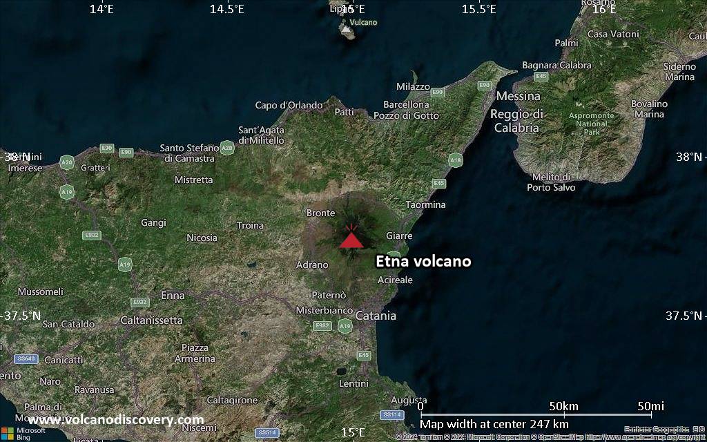
<!–div style="font-size:14px;text-align:center;border:3px solid blue;border-radius:5px;padding:3px;margin:5px;background:#eee"><a href="https://www.volcanoesandearthquakes.com/app/volcano-report.php?volcanoId=16" style="text-decoration:none" target="_blank" rel="noopener noreferrer nofollow" title="Share a volcano (activity) report, submit a photo or other interesting news!” onclick=”window.open(this.href,’Volcano Report’,’status=0,toolbar=0,location=0,directories=0,menubar=0,resizable=1,scrollbars=1,height=500,width=450′);return false”>Send Volcano Report</div–> Complex stratovolcano Currently 3,369 m / 11,053 ft (changing due to eruptive activity and collapse of its crater rims)
Sicily, Italy, 37.75°N / 14.99°E
Current status: erupting (4 out of 5) Etna volcano eruptions:
Near continuously active; some major historic eruptions include 122 BC (large Plinian outbursts that created the small caldera of the “Cratere del Piano”), 1669 AD (devastating flank eruption that destroyed 15 villages and part of Catania), 1787 (Subplinian eruption and one of the most spectacular summit eruptions on record – lava fountains reportedly up to 3000 m high).
Eruptions since 1950 (f: flank / s: summit activity): 1950 (s), 1950-51(f), 1955 (s), 1956 (s), 1956 (f), 1957 (s),1960 (s), 1961 (s), 1964 (f), 1964 (s), 1966

Click this link to continue reading the article on the source website.
RSS feed source: Volcano Discovery.com--Global earthquake monitor

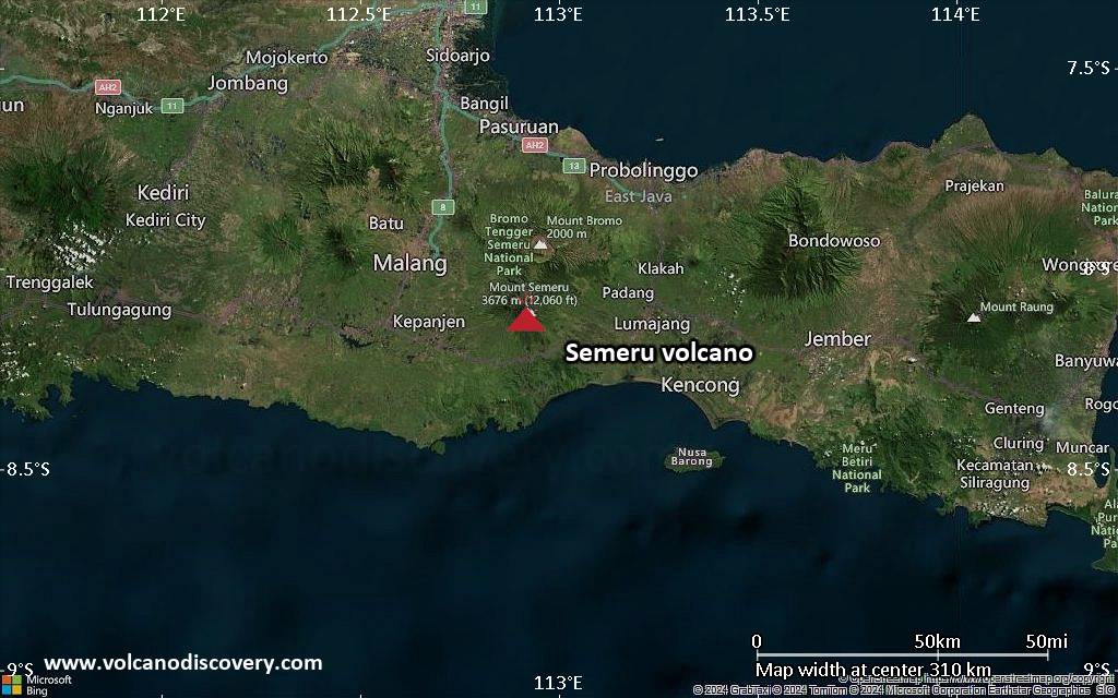
<!–div style="font-size:14px;text-align:center;border:3px solid blue;border-radius:5px;padding:3px;margin:5px;background:#eee"><a href="https://www.volcanoesandearthquakes.com/app/volcano-report.php?volcanoId=44" style="text-decoration:none" target="_blank" rel="noopener noreferrer nofollow" title="Share a volcano (activity) report, submit a photo or other interesting news!” onclick=”window.open(this.href,’Volcano Report’,’status=0,toolbar=0,location=0,directories=0,menubar=0,resizable=1,scrollbars=1,height=500,width=450′);return false”>Send Volcano Report</div–> Stratovolcano 3676 m (12,060 ft)
East Java, Indonesia, -8.11°S / 112.92°E
Current status: erupting (4 out of 5) Semeru volcano eruptions:
1818, 1829, 1830, 1832, 1836, 1838, 1842, 1844, 1845, 1848, 1849(?), 1851, 1856, 1857, 1865, 1866(?), 1887, 1887, 1888, 1889-91, 1892, 1893, 1893-94, 1895, 1896, 1897, 1899, 1899, 1900, 1901, 1903, 1904, 1905, 1907, 1908, 1909-10, 1910-11, 1911, 1912, 1913, 1941-42, 1945, 1946, 1946-47, 1950-64, 1967-ongoing
Typical eruption style
Explosive. Near constant strombolian activity, occasionally stronger explosions, lava flows and pyroclastic flows.

Click this link to continue reading the article on the source website.