RSS feed source: Volcano Discovery.com

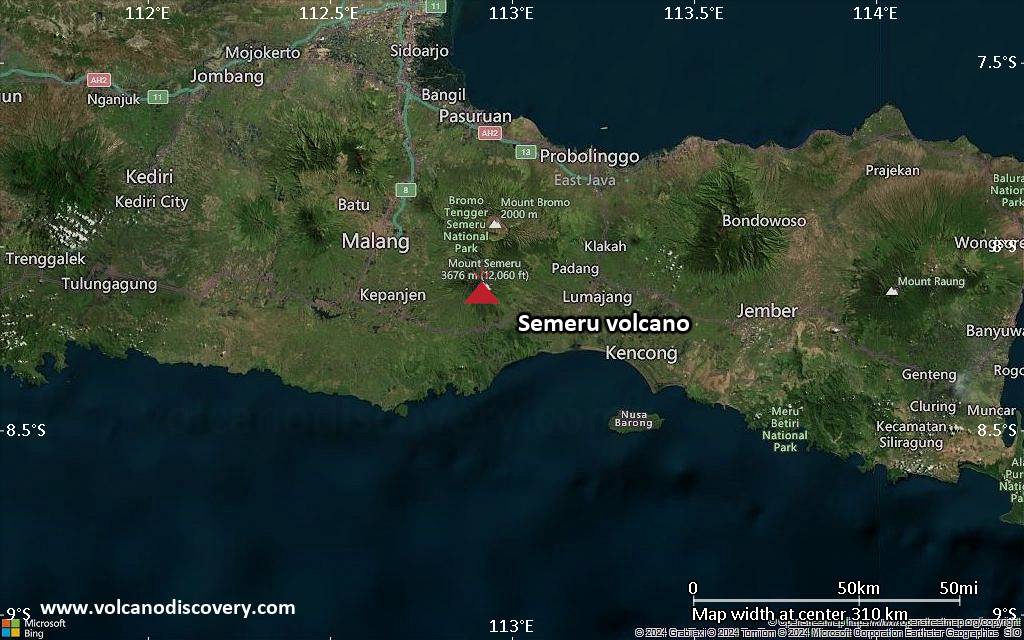
<!–div style="font-size:14px;text-align:center;border:3px solid blue;border-radius:5px;padding:3px;margin:5px;background:#eee"><a href="https://www.volcanoesandearthquakes.com/app/volcano-report.php?volcanoId=44" style="text-decoration:none" target="_blank" rel="noopener noreferrer nofollow" title="Share a volcano (activity) report, submit a photo or other interesting news!” onclick=”window.open(this.href,’Volcano Report’,’status=0,toolbar=0,location=0,directories=0,menubar=0,resizable=1,scrollbars=1,height=500,width=450′);return false”>Send Volcano Report</div–> Stratovolcano 3676 m (12,060 ft)
East Java, Indonesia, -8.11°S / 112.92°E
Current status: erupting (4 out of 5) Semeru volcano eruptions:
1818, 1829, 1830, 1832, 1836, 1838, 1842, 1844, 1845, 1848, 1849(?), 1851, 1856, 1857, 1865, 1866(?), 1887, 1887, 1888, 1889-91, 1892, 1893, 1893-94, 1895, 1896, 1897, 1899, 1899, 1900, 1901, 1903, 1904, 1905, 1907, 1908, 1909-10, 1910-11, 1911, 1912, 1913, 1941-42, 1945, 1946, 1946-47, 1950-64, 1967-ongoing
Typical eruption style
Explosive. Near constant strombolian activity, occasionally stronger explosions, lava flows and pyroclastic flows.

Click this link to continue reading the article on the source website.
RSS feed source: Volcano Discovery.com

…The Flood Warning is extended for the following rivers in Mississippi… Tombigbee River near Amory For the Tombigbee River…including Fulton, Bigbee, Amory, Aberdeen L & D…Minor flooding is forecast. * WHAT…Minor flooding is forecast. * WHERE…Tombigbee River near Amory. * WHEN…From Tuesday afternoon to early Thursday morning. * IMPACTS…At 22.0 feet, Lowland near the river is flooded. * ADDITIONAL DETAILS… – At 11:15 PM CDT Sunday the stage was 11.8 feet. – Forecast…The river is expected to rise above flood stage Tuesday afternoon to a crest of 21.1 feet Wednesday morning. It will then fall below flood stage Wednesday evening. – Flood stage is 20.0 feet. – http://www.weather.gov/safety/flood

Click this link to continue reading the article on the source website.

RSS feed source: Volcano Discovery.com

SVROUN The National Weather Service in Norman has issued a * Severe Thunderstorm Warning for… Northeastern Garvin County in southern Oklahoma… Northeastern Murray County in southern Oklahoma… * Until 1215 AM CDT. * At 1129 PM CDT, a severe thunderstorm was located 7 miles north of Sulphur, moving northwest at 30 mph. HAZARD…60 mph wind gusts and half dollar size hail. SOURCE…Radar indicated. IMPACT…Hail damage to vehicles is expected. Expect wind damage to roofs, siding, and trees. * Locations impacted include… Pauls Valley, Sulphur, Wynnewood, and Paoli.

Click this link to continue reading the article on the source website.