RSS feed source: Volcano Discovery.com

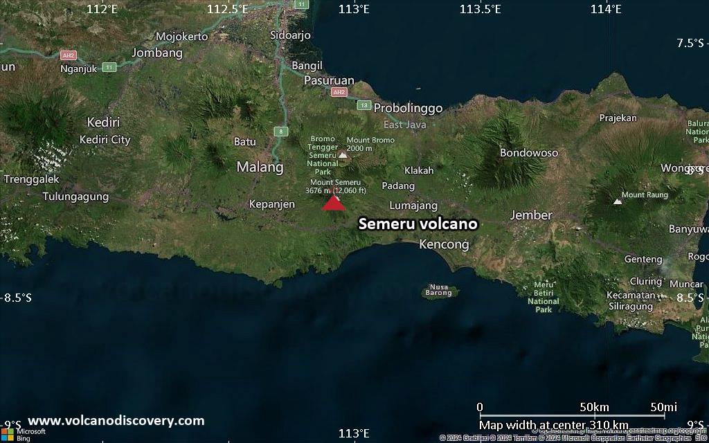
<!–div style="font-size:14px;text-align:center;border:3px solid blue;border-radius:5px;padding:3px;margin:5px;background:#eee"><a href="https://www.volcanoesandearthquakes.com/app/volcano-report.php?volcanoId=44" style="text-decoration:none" target="_blank" rel="noopener noreferrer nofollow" title="Share a volcano (activity) report, submit a photo or other interesting news!” onclick=”window.open(this.href,’Volcano Report’,’status=0,toolbar=0,location=0,directories=0,menubar=0,resizable=1,scrollbars=1,height=500,width=450′);return false”>Send Volcano Report</div–> Stratovolcano 3676 m (12,060 ft)
East Java, Indonesia, -8.11°S / 112.92°E
Current status: erupting (4 out of 5) Semeru volcano eruptions:
1818, 1829, 1830, 1832, 1836, 1838, 1842, 1844, 1845, 1848, 1849(?), 1851, 1856, 1857, 1865, 1866(?), 1887, 1887, 1888, 1889-91, 1892, 1893, 1893-94, 1895, 1896, 1897, 1899, 1899, 1900, 1901, 1903, 1904, 1905, 1907, 1908, 1909-10, 1910-11, 1911, 1912, 1913, 1941-42, 1945, 1946, 1946-47, 1950-64, 1967-ongoing
Typical eruption style
Explosive. Near constant strombolian activity, occasionally stronger explosions, lava flows and pyroclastic flows.

Click this link to continue reading the article on the source website.
RSS feed source: Volcano Discovery.com

At 730 PM CDT, a severe thunderstorm was located near Carter, or 24 miles southeast of Crandon, moving northeast at 50 mph. HAZARD…Quarter size hail. SOURCE…Radar indicated. IMPACT…Damage to vehicles is expected. This severe thunderstorm will remain over mainly rural areas of central Marinette, northern Oconto and east central Langlade Counties, including the following locations… Boot Lake Campground, Townsend, Caldron Falls Rese, Caldron Falls Reservoir, Mcclintock County Park, Governor Thompson State Park, Silver Cliff, Hollister, Langlade, and Lakewood.

Click this link to continue reading the article on the source website.

RSS feed source: Volcano Discovery.com

At 729 PM CDT, a severe thunderstorm was located 4 miles south of Effingham, moving east at 50 mph. HAZARD…60 mph wind gusts and quarter size hail. SOURCE…Radar indicated. IMPACT…Hail damage to vehicles is expected. Expect wind damage to roofs, siding, and trees. Locations impacted include… Valley Falls and Nortonville.

Click this link to continue reading the article on the source website.

RSS feed source: Volcano Discovery.com

SVRDMX The National Weather Service in Des Moines has issued a * Severe Thunderstorm Warning for… East central Kossuth County in north central Iowa… Northern Hancock County in north central Iowa… Western Winnebago County in north central Iowa… * Until 800 PM CDT. * At 729 PM CDT, a severe thunderstorm was located 5 miles north of Sexton, or 8 miles northeast of Algona, moving northeast at 60 mph. HAZARD…60 mph wind gusts and quarter size hail. SOURCE…Radar indicated. IMPACT…Hail damage to vehicles is expected. Expect wind damage to roofs, siding, and trees. * Locations impacted include… Hayfield, Miller, Crystal Lake, Woden, Titonka, Thompson, Forest City Municipal Airport, Buffalo Center, and

Click this link to continue reading the article on the source website.