RSS feed source: USGS Earthquake Hazards Program
Time2025-11-01 06:57:25 UTC2025-11-01 06:57:25 UTC at epicenterLocation20.166°N 122.159°EDepth143.21 km (88.99 mi)
Click this link to continue reading the article on the source website.
RSS feed source: USGS Earthquake Hazards Program
Time2025-11-01 06:57:25 UTC2025-11-01 06:57:25 UTC at epicenterLocation20.166°N 122.159°EDepth143.21 km (88.99 mi)
Click this link to continue reading the article on the source website.
RSS feed source: USGS Earthquake Hazards Program
Date and TimeMag
DepthDistanceLocationDetailsMap Nov 1, 06:10 am (GMT +9)
4.3
197 km78 km (48 mi) to the E Banda Sea, 27 km northwest of Pulau Dai Island, Maluku, Indonesia I FELT IT InfoOct 20, 04:03 pm (GMT +9)
4.0
186 km50 km (31 mi) to the E Banda Sea, 51 km west of Pulau Dai Island, Maluku, Indonesia 2 reportsInfoOct 18, 10:13 pm (Jayapura)
4.4
146 km91 km (56 mi) to the E Banda Sea, 21 km north of Pulau Dai Island, Maluku, Indonesia InfoOct 16, 04:04 am (GMT +9)
4.1
174 km38 km (24 mi) to the E Banda Sea, 62 km west of Pulau Dai Island, Maluku, Indonesia InfoOct 10, 07:02 pm (Jayapura)
5.4
169 km94 km (58 mi) to the E Banda Sea, 33 km north of Pulau Dai Island, Maluku, Indonesia 1 reportInfoOct 10, 05:21 am (GMT +9)
4.6
115 km99 km (61 mi) to the SW Banda Sea InfoOct 5, 04:02 am (Jayapura)
4.2
163 km54 km (33 mi) to the E Banda Sea, 56 km northwest of Pulau Dai Island, Maluku, Indonesia InfoNov 8, 2023 01:53 pm (GMT +9)
7.1
6 km129 km (80 mi) to the NE Banda Sea InfoMay 25, 2023 12:49 am (Jayapura)
6.2
158 km90 km (56 mi) to the NE Banda Sea 739 reportsInfoJan 10, 2023 02:47 am (Jayapura)
7.9
131 km151 km (94 mi) to the E Banda Sea, 101 km northeast of Pulau Wetan Island, Maluku, Indonesia 880 reportsInfoDec 30, 2021 03:25 am (Jayapura)
7.3
165 km138 km (86 mi) to the W 125 km NNE of Lospalos, Timor Leste 1221 reportsInfoJun 24, 2019 11:53 am (Jayapura)
7.3
214 km108 km (67 mi) to the N Banda Sea 186
Click this link to continue reading the article on the source website.
RSS feed source: USGS Earthquake Hazards Program
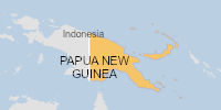
On 30/10/2025, a flood started in Papua New Guinea, lasting until 01/11/2025 (last update). The flood caused 21 deaths and 0 displaced .
Click this link to continue reading the article on the source website.
RSS feed source: USGS Earthquake Hazards Program
Synopsis
The Cyberinfrastructure for Sustained Scientific Innovation (CSSI) program seeks to enable funding opportunities that are flexible and responsive to the evolving and emerging needs in cyberinfrastructure (CI). The program continues to emphasize integrated CI services, quantitative metrics with targets for delivery and usage of these services, and community creation.
The CSSI program anticipates three classes of awards:
Elements: These awards target small groups that will create and deploy robust services for which there is a demonstrated need, and that will advance one or more significant areas of science and engineering. Framework Implementations: These awards target larger, interdisciplinary teams organized around the development and application of services aimed at solving common research problems faced by NSF researchers in one or more areas of science and engineering, and resulting in a sustainable community framework providing CI services to a diverse community or communities. Transition
Click this link to continue reading the article on the source website.