RSS feed source: Global Disaster Alert and Coordination Systems (GDACS).
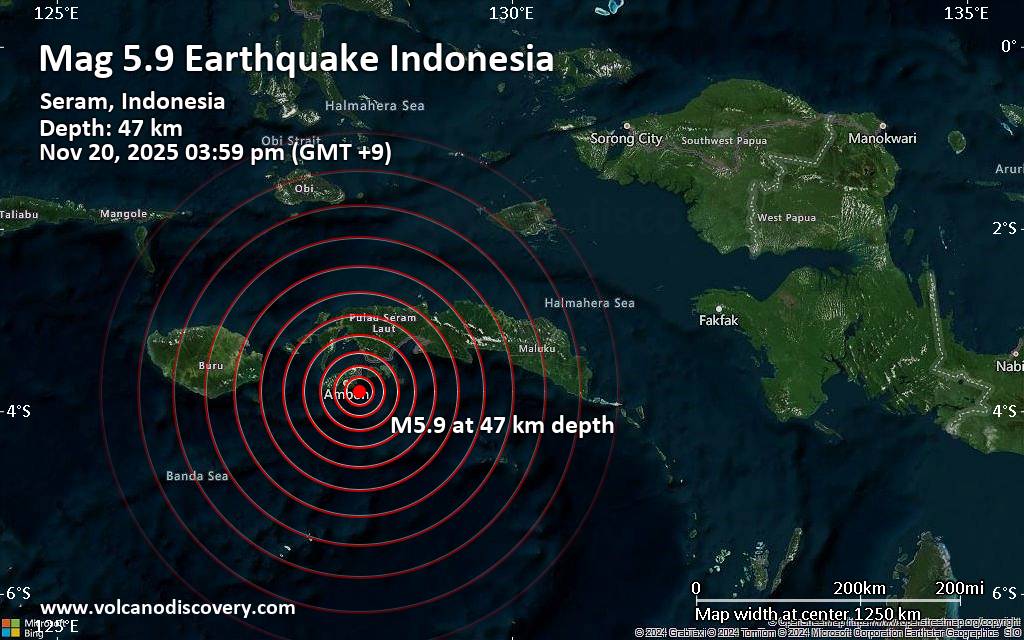
Date and TimeMag
DepthDistanceLocationDetailsMap Sep 22, 09:06 pm (Jayapura)
4.5
128 km29 km (18 mi) to the E Banda Sea, 17 km south of Pulau Saparua Island, Maluku, Indonesia 1 reportInfoSep 20, 03:54 pm (Jayapura)
4.8
10 km59 km (37 mi) to the W Banda Sea, 35 km west of Ambon, Kota Ambon, Maluku, Indonesia 4 reportsInfoSep 2, 10:17 pm (Jayapura)
4.2
10 km88 km (54 mi) to the NE Banda Sea, 24 km east of Amahai, Kabupaten Maluku Tengah, Maluku, Indonesia InfoSep 2, 10:10 pm (Jayapura)
4.4
10 km84 km (52 mi) to the NE Banda Sea, 19 km east of Amahai, Kabupaten Maluku Tengah, Maluku, Indonesia InfoSep 2, 11:02 am (GMT +9)
4.5
10 km51 km (31 mi) to the SE Banda Sea, 54 km south of Pulau Saparua Island, Maluku, Indonesia InfoJan 10, 01:47 am (Jayapura)
5.3
261 km93 km (58 mi) to the SE Banda Sea, 112 km southeast of Ambon, Kota Ambon, Maluku, Indonesia InfoJun 1, 2023 06:56 am (Jayapura)
5.5
95 km23 km (14 mi) to the NW Kabupaten Maluku Tengah, 23 km northeast of Ambon, Kota Ambon, Maluku, Indonesia InfoJan 25, 2020 09:38 am (Jayapura)
5.1
15 km80 km (49 mi) to the NW Kabupaten Seram Bagian Barat, 67 km northwest of Ambon, Indonesia InfoNov 12, 2019 07:10 pm (Jayapura)
5.1
39 km12 km (7.4 mi) to the NW 19 km northeast of Ambon, Kota Ambon, Maluku, Indonesia 14 reportsInfoSep 26, 2019 09:39 am (Jayapura)
5.3
10 km9.9 km (6.2 mi) to the NE Banda Sea, 33 km east of Ambon, Kota Ambon, Maluku, Indonesia 1 reportInfoSep 26, 2019 08:46 am (Jayapura)
6.4
10 km16 km (9.7 mi) to the N
Click this link to continue reading the article on the source website.