RSS feed source: Volcano Discovery.com--Global earthquake monitor

Mon, 18 Aug 2025, 20:49 | BY: EARTHQUAKEMONITOR

An earthquake of magnitude 5.2 occurred only 10 minutes ago 119 km northeast of Baukau, Timor-Leste, Indonesia’s Meteorology, Climatology, and Geophysical Agency reported.
The quake hit at a great depth of 389. km beneath the epicenter near Baukau, Baucau, Timor-Leste, early morning on Tuesday, August 19th, 2025, at 5:38 am local time. The exact magnitude, epicenter, and depth of the quake might be revised within the next few hours or minutes as seismologists review data and refine their calculations, or as other agencies issue their report.
Our monitoring service identified a second report from the European-Mediterranean Seismological Centre (EMSC) which listed the quake at magnitude 5.2 as well. Other agencies reporting the same quake include the citizen-seismograph network of RaspberryShake at magnitude 5.2, and the German Research Centre for Geosciences (GFZ) at magnitude 5.2.
Generally quakes of this magnitude are recorded by more than one agency and the results can vary, with subsequent reports that come in after the first one often showing more accuracy.
Towns or cities near the epicenter where the quake might have been felt as very weak shaking include Baukau (pop. 16,000) located 119 km from the epicenter, and Lospalos (pop. 17,200) 121 km away.
VolcanoDiscovery will automatically update magnitude and depth if these change and follow up if other significant news about the quake

Click this link to continue reading the article on the source website.

RSS feed source: Volcano Discovery.com--Global earthquake monitor

Date and TimeMag
DepthDistanceLocationDetailsMap Jul 23, 10:56 pm (Makassar)

4.0

158 km40 km (25 mi) to the E Banda Sea InfoJul 17, 01:02 am (GMT +9)

4.8

10 km96 km (59 mi) to the E Banda Sea InfoJul 11, 10:32 am (Jayapura)

4.5

139 km87 km (54 mi) to the SE Banda Sea, 30 km southwest of Pulau Maopora Island, Maluku, Indonesia InfoJul 11, 06:20 am (Jayapura)

4.2

161 km47 km (30 mi) to the E Banda Sea, 25 km northwest of Pulau Romang Island, Maluku, Indonesia InfoJul 9, 03:21 pm (GMT +9)

4.8

470 km100 km (62 mi) to the W Banda Sea, 84 km northwest of Pulau Wetar Island, Maluku, Indonesia InfoMay 15, 09:50 am (GMT +9)

5.9

469 km80 km (50 mi) to the W Banda Sea, 150 km west of Pulau Romang Island, Maluku, Indonesia 3 reportsInfoDec 30, 2021 03:25 am (Jayapura)

7.3

165 km88 km (55 mi) to the E Banda Sea, 19 km east of Pulau Romang Island, Maluku, Indonesia 1221 reportsInfoOct 19, 2020 02:11 pm (Universal Time)

5.2

388 km38 km (24 mi) to the NWnear Magnitude 5.2, Near of Ambon 1 reportInfoJun 24, 2019 11:53 am (Jayapura)

7.3

214 km289 km (180 mi) to the NE Banda Sea, 90 km west of Pulau Kekeh Besar Island, Maluku, Indonesia 186 reportsInfoJul 7, 2016 06:12 pm (Makassar)

5.2

32 km53 km (33 mi) to the S Banda Sea InfoFeb 1, 2015 02:30 am (Jayapura)

5.4

344 km107 km (66 mi) to the NE Banda Sea InfoJul 17, 2011 02:06 am (GMT +9)

5.9

249 km98 km (61 mi) to the NE 171 km NNE of Lospalos, Timor Leste InfoJul 28, 2010 12:54 am (GMT +8)

5.5

378 km46 km (28 mi) to

Click this link to continue reading the article on the source website.

RSS feed source: Volcano Discovery.com--Global earthquake monitor

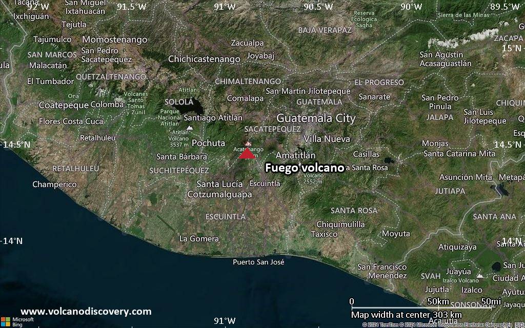
<!–div style="font-size:14px;text-align:center;border:3px solid blue;border-radius:5px;padding:3px;margin:5px;background:#eee"><a href="https://www.volcanoesandearthquakes.com/app/volcano-report.php?volcanoId=26" style="text-decoration:none" target="_blank" rel="noopener noreferrer nofollow" title="Share a volcano (activity) report, submit a photo or other interesting news!” onclick=”window.open(this.href,’Volcano Report’,’status=0,toolbar=0,location=0,directories=0,menubar=0,resizable=1,scrollbars=1,height=500,width=450′);return false”>Send Volcano Report</div–> Stratovolcano 3,763 m / 12,346 ft
Guatemala, 14.47°N / -90.88°W
Current status: erupting (4 out of 5) Fuego volcano eruptions:
1581, 1585, 1586, 1587, 1614, 1617, 1620, 1623, 1629, 1679(?), 1685, 1686, 1689(?), 1699, 1702, 1705, 1706, 1709(?), 1710,1717,1730, 1732, 1737, 1751(?), 1765(?), 1773(?), 1799, 1826, 1829, 1850(?), 1852(?), 1855, 1856, 1857, 1860, 1861(?), 1867(?), 1880, 1896, 1932, 1944, 1949, 1953, 1955, 1957, 1962, 1963, 1966, 1967, 1971, 1973, 1974, 1975, 1977, 1987, 1999, 2002 – ongoing
Typical eruption style
Dominantly explosive, construction of lava domes and extrusion of viscous lava flows. In near constant activity, at least during the past centuries.

Click this link to continue reading the article on the source website.
RSS feed source: Volcano Discovery.com--Global earthquake monitor

Mon, 18 Aug 2025, 20:20 | BY: EARTHQUAKEMONITOR

Worldwide earthquakes above magnitude 3 during the past 24 hours on 18 Aug 2025

Summary: 6 quakes 5.0+, 48 quakes 4.0+, 168 quakes 3.0+, 375 quakes 2.0+ (597 total)
This report is being updated every hour.
Magnitude 5+: 6 earthquakes
Magnitude 4+: 48 earthquakes
Magnitude 3+: 168 earthquakes
Magnitude 2+: 375 earthquakes
No quakes of magnitude 6 or higherTotal seismic energy estimate: 6.4 x 10¹³ joules (17.8 gigawatt hours, equivalent to 15308 tons of TNT or 1 atomic bombs!) | equivalent to ONE quake of magnitude 6.0 learn more10 largest earthquakes in the world (past 24 hours)#1: Mag 5.7 South Pacific Ocean, 375 km west of Isla Guamblin Island, Region Aysen, ChileMonday, Aug 18, 2025, at 02:10 am (GMT -5) – #2: Mag 5.5 South Pacific Ocean, 234 km southwest of Apia, Tuamasaga, SamoaMonday, Aug 18, 2025, at 08:48 pm (GMT +13) – #3: Mag 5.2 FijiTuesday, Aug 19, 2025, at 08:25 am (GMT +13) – #4: Mag 5.2 North Pacific Ocean, 200 km south of Petropavlovsk-Kamchatskiy, Kamchatka, RussiaMonday, Aug 18, 2025, at 09:12 pm (GMT +11) – #5: Mag 5.0 Maluku Sea, North Maluku, 60 km southeast of Bitung, Sulawesi Utara, IndonesiaMonday, Aug 18, 2025, at 06:05 pm (GMT +8) – #6: Mag 5.0 North Pacific Ocean, 57 km south of Ostrov Paramushir Island, Sakhalin Oblast, RussiaMonday, Aug 18, 2025, at

Click this link to continue reading the article on the source website.