RSS feed source: US National Weather Service

* IMPACTS…Abundant lightning on dry fuels resulting in the potential for numerous new fire starts. * AFFECTED AREA…In California, all of Fire weather zones 280, 281, 284, and 285, and in Oregon, all of Fire weather zones 621, 623, 624, and 625. * THUNDERSTORMS…Scattered thunderstorms with abundant lightning are expected. Storms are likely to be wet, but lightning strikes outside of precipitation cores are possible, and may cause many new fire starts. * OUTFLOW WINDS…Gusts of 35 to 50 mph could travel outward up to 25 miles from thunderstorm cores. * DETAILED URL…View the hazard area in detail at https://www.wrh.noaa.gov/map/?wfo=mfr

Click this link to continue reading the article on the source website.

RSS feed source: US National Weather Service

Date and TimeMag
DepthDistanceLocationDetailsMap Aug 23, 10:47 am (GMT -6)

4.3

53 km34 km (21 mi) to the N 62 km SW of Puerto Madero, Mexico  I FELT IT InfoAug 23, 12:37 am (GMT -6)

3.6

17 km70 km (44 mi) to the NW Offshore Chiapas, Mexico  I FELT IT

Info

Aug 21, 03:37 am (GMT -6)

4.0

87 km99 km (62 mi) to the N 26 km west of Tapachula, Estado de Chiapas, MexicoI FELT IT InfoAug 20, 03:03 pm (GMT -6)

4.0

12 km29 km (18 mi) to the E North Pacific Ocean, 75 km west of Champerico, GuatemalaI FELT IT InfoAug 20, 02:59 am (GMT -6)

4.0

10 km20 km (13 mi) to the SW Off Coast of Chiapas, Mexico  I FELT IT InfoAug 20, 12:29 am (GMT -6)

4.2

13 km70 km (44 mi) to the S North Pacific Ocean, 162 km southwest of Retalhuleu, GuatemalaI FELT IT InfoMay 12, 2024 05:39 am (GMT -6)

6.2

10 km28 km (17 mi) to the NE Mexico: 76 km al SUROESTE de CD HIDALGO, CHIS 312 reportsInfoNov 19, 2019 10:27 pm (GMT -6)

6.2

10 km24 km (15 mi) to the NW North Pacific Ocean, 98 km southwest of Brisas Barra de Suchiate, Mexico 44 reportsInfoFeb 1, 2019 10:19 am (Mexico City)

6.7

0 km83 km (52 mi) to the NE North Pacific Ocean, 33 km southwest of Tapachula, Estado de Chiapas, Mexico InfoSep 7, 2017 10:49 pm (GMT -6)

8.0

60 km151 km (94 mi) to the NW North Pacific Ocean, 87 km southwest of Topon, Estado de Chiapas, Mexico 317 reportsInfoApr 15, 2016 08:11 am (GMT -6)

6.0

10 km91 km

Click this link to continue reading the article on the source website.

RSS feed source: US National Weather Service

Sun, 24 Aug 2025, 10:30 | BY: VN

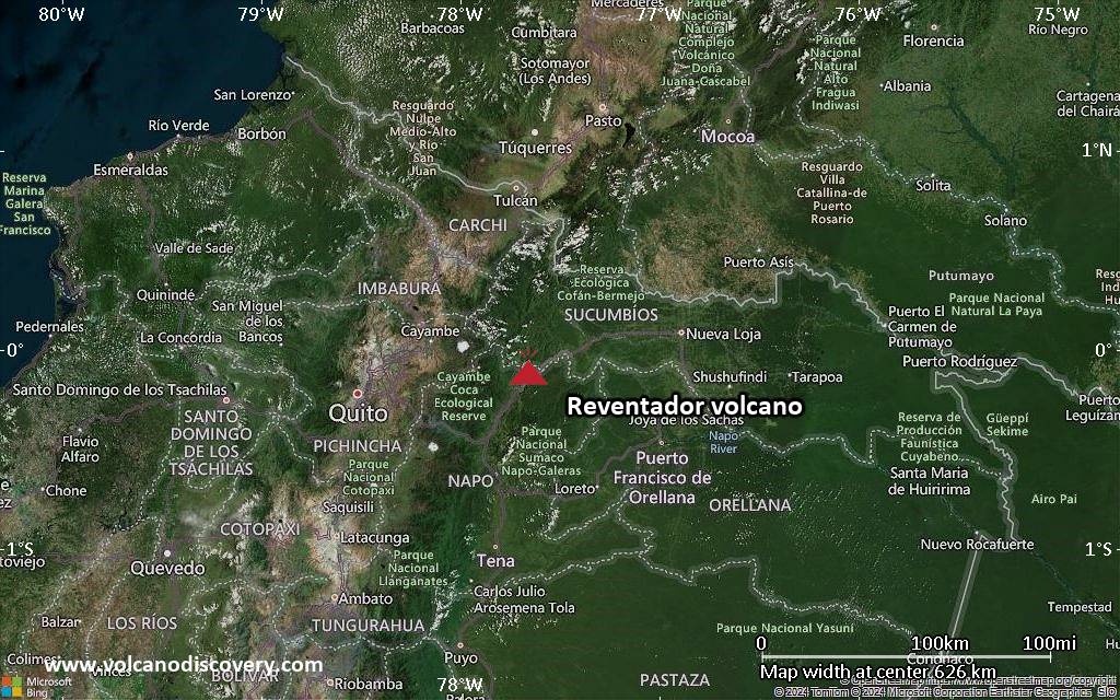
Explosive activity continues. Volcanic Ash Advisory Center (VAAC) Washington warned about a volcanic ash plume that rose up to estimated 15000 ft (4600 m) altitude or flight level 150 .
The full report is as follows:

FVXX20 at 10:25 UTC, 24/08/25 from KNES
VA ADVISORY
DTG: 20250824/1022Z

VAAC: WASHINGTON

VOLCANO: REVENTADOR 352010
PSN: S0005 W07739

AREA: ECUADOR

SUMMIT ELEV: 11686 FT [3562 M]

ADVISORY NR: 2025/810

INFO SOURCE: GOES-19. WEBCAM. NWP MODELS.

ERUPTION DETAILS: ONGOING VA EMS

OBS VA DTG: 24/0950Z

OBS VA CLD: SFC/FL150 N0001 W07750 – S0004 W07739
– S0005 W07739 – S0003 W07752 – N0001 W07750 MOV
NW 10KT

FCST VA CLD +6HR: 24/1600Z SFC/FL150 N0003 W07758
– S0004 W07740 – S0005 W07739 – S0002 W07759 –
N0003 W07758

FCST VA CLD +12HR: 24/2200Z SFC/FL150 N0004
W07756 – S0004 W07739 – S0005 W07739 – S0002
W07759 – N0004 W07756

FCST VA CLD +18HR: 25/0400Z SFC/FL150 N0003
W07757 – S0004 W07739 – S0005 W07739

Click this link to continue reading the article on the source website.
RSS feed source: US National Weather Service

* WHAT…Up to one foot of inundation above ground level in low-lying areas near shorelines and tidal waterways. * WHERE…Westmoreland and Northumberland Counties. * WHEN…Until 5 AM EDT Monday. * IMPACTS…Shallow flooding is expected in the most vulnerable locations near the waterfront and shoreline resulting in a low threat of property damage. Expect up to one foot of water above ground level in low lying, vulnerable areas. Some roads and low lying property including parking lots, parks and lawns near the waterfront will experience shallow flooding.

Click this link to continue reading the article on the source website.