RSS feed source: Volcano Discovery.com

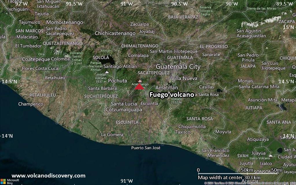
<!–div style="font-size:14px;text-align:center;border:3px solid blue;border-radius:5px;padding:3px;margin:5px;background:#eee"><a href="https://www.volcanoesandearthquakes.com/app/volcano-report.php?volcanoId=26" style="text-decoration:none" target="_blank" rel="noopener noreferrer nofollow" title="Share a volcano (activity) report, submit a photo or other interesting news!” onclick=”window.open(this.href,’Volcano Report’,’status=0,toolbar=0,location=0,directories=0,menubar=0,resizable=1,scrollbars=1,height=500,width=450′);return false”>Send Volcano Report</div–> Stratovolcano 3,763 m / 12,346 ft
Guatemala, 14.47°N / -90.88°W
Current status: erupting (4 out of 5) Fuego volcano eruptions:
1581, 1585, 1586, 1587, 1614, 1617, 1620, 1623, 1629, 1679(?), 1685, 1686, 1689(?), 1699, 1702, 1705, 1706, 1709(?), 1710,1717,1730, 1732, 1737, 1751(?), 1765(?), 1773(?), 1799, 1826, 1829, 1850(?), 1852(?), 1855, 1856, 1857, 1860, 1861(?), 1867(?), 1880, 1896, 1932, 1944, 1949, 1953, 1955, 1957, 1962, 1963, 1966, 1967, 1971, 1973, 1974, 1975, 1977, 1987, 1999, 2002 – ongoing
Typical eruption style
Dominantly explosive, construction of lava domes and extrusion of viscous lava flows. In near constant activity, at least during the past centuries.

Click this link to continue reading the article on the source website.
RSS feed source: Volcano Discovery.com

Sat, 30 Aug 2025, 19:50 | BY: EARTHQUAKEMONITOR

World map showing volcanoes with shallow (less than 50 km) earthquakes within 20 km radius during the past 24 hours on 30 Aug 2025 Number in brackets indicate nr of quakes.

Quakes detected near: Akuseki-jima (4 quakes between mag 2.1-2.2), Barva (2 quakes between mag 1.2-2.6), Biliran (1 quake mag 3.1), Cabalian (3 quakes between mag 2.3-3.1), Clear Lake (25 quakes between mag 0.2-2.0), Coso (2 quakes between mag 0.6-1.7)
El Chichón (3 quakes between mag 2.1-3.2), Erciyes Dagi (1 quake mag 3.0), Eyafjallajökull (2 quakes between mag 0.6-1.1), Hakone (1 quake mag 1.1), Irazu (10 quakes between mag 0.8-3.3), Katla (14 quakes between mag 0.0-2.2), Kilauea (1 quake mag 1.6), Klyuchevskoy (2 quakes between mag 1.0-1.8), Kolumbo (4 quakes between mag 0.8-1.8), Krísuvík (20 quakes between mag 0.0-3.1), Ljósufjöll (6 quakes between mag 0.0-1.3), Long Valley (1 quake mag 2.4), Masaya (1 quake mag 2.3), Methana (1 quake mag 1.8), Nii-jima (1 quake mag 1.8), Santorini (1 quake mag 1.1), Shishaldin (1 quake mag 1.3), Suwanose-jima (3 quakes between mag 1.3-1.7), Telica (2 quakes between mag 1.0-1.2), Tjörnes Fracture Zone (3 quakes between mag 0.5-1.3), To-shima (2 quakes between mag 1.6-2.2), Torfajökull (1 quake mag 1.1), Vatnafjöll (2 quakes between mag 0.7-1.3), Vesuvius (3 quakes between mag 0.1-1.5), Visokiy (1 quake mag 1.9), White Island

Click this link to continue reading the article on the source website.

RSS feed source: Volcano Discovery.com

Sat, 30 Aug 2025, 19:19 | BY: EARTHQUAKEMONITOR

A very shallow magnitude 4.9 earthquake was reported in the morning near Elko, Elko County, Nevada, USA.
According to the United States Geological Survey, the quake hit on Saturday, August 30th, 2025, at 11:59 am local time at a very shallow depth of 1.9 miles. Shallow earthquakes are felt more strongly than deeper ones as they are closer to the surface. The exact magnitude, epicenter, and depth of the quake might be revised within the next few hours or minutes as seismologists review data and refine their calculations, or as other agencies issue their report.
Our monitoring service identified a second report from The Incorporated Research Institutions for Seismology (IRIS) which listed the quake at magnitude 4.9 as well. Other agencies reporting the same quake include the European-Mediterranean Seismological Centre (EMSC) at magnitude 4.9, the German Research Centre for Geosciences (GFZ) at magnitude 4.8, and the citizen-seismograph network of RaspberryShake at magnitude 4.8.
Based on the preliminary seismic data, the quake should not have caused any significant damage, but was probably felt by many people as light vibration in the area of the epicenter.
Weak shaking might have been felt in Valmy (pop. 37) located 31 miles from the epicenter, Battle Mountain (pop. 3,600) 37 miles away, Carlin (pop. 2,300) 47 miles away, Winnemucca (pop. 7,900) 51

Click this link to continue reading the article on the source website.

RSS feed source: Volcano Discovery.com

Sat, 30 Aug 2025, 19:13 | BY: EARTHQUAKEMONITOR

An earthquake of magnitude 4.3 occurred only 9 minutes ago 56 miles northwest of Elko, Nevada, United States, the United States Geological Survey reported.
The quake hit at a very shallow depth of 6.1 miles beneath the epicenter near Elko, Elko County, Nevada, USA, around noon on Saturday, August 30th, 2025, at 12:03 pm local time. The exact magnitude, epicenter, and depth of the quake might be revised within the next few hours or minutes as seismologists review data and refine their calculations, or as other agencies issue their report.
Based on the preliminary seismic data, the quake should not have caused any significant damage, but was probably felt by many people as light vibration in the area of the epicenter.
Weak shaking might have been felt in Valmy (pop. 37) located 28 miles from the epicenter.
Other towns or cities near the epicenter where the quake might have been felt as very weak shaking include Battle Mountain (pop. 3,600) located 33 miles from the epicenter, Golconda (pop. 210) 39 miles away, Carlin (pop. 2,300) 44 miles away, Crescent Valley (pop. 390) 49 miles away, Winnemucca (pop. 7,900) 51 miles away, and Elko (pop. 20,300) 56 miles away.
VolcanoDiscovery will automatically update magnitude and depth if these change and follow up if other significant news about the quake

Click this link to continue reading the article on the source website.