RSS feed source: Volcano Discovery.com--Global earthquake monitor

Wednesday, Nov 26, 2025 08:37 | 1 hour ago | By: EarthquakeMonitor

A magnitude 4.6 earthquake near Miangas, Sulawesi Utara, Indonesia, was reported only 12 minutes ago by Indonesia’s Meteorology, Climatology, and Geophysical Agency, considered the main national agency that monitors seismic activity in Indonesia. The earthquake occurred at an intermediate depth of 87. km beneath the epicenter in the afternoon on Wednesday, November 26th, 2025, at 4:24 pm local time. The exact magnitude, epicenter, and depth of the quake might be revised within the next few hours or minutes as seismologists review data and refine their calculations, or as other agencies issue their report.
A second report was later issued by the citizen-seismograph network of RaspberryShake, which listed it as a magnitude 4.6 earthquake as well.
Towns or cities near the epicenter where the quake might have been felt as very weak shaking include Miangas (pop. 820) located 64 km from the epicenter.
VolcanoDiscovery will automatically update magnitude and depth if these change and follow up if other significant news about the quake become available. If you’re in the area, please send us your experience through our reporting mechanism, either online or via our mobile app. This will help us provide more first-hand updates to anyone around the globe who wants to know more about this quake.

If you felt it, report it through

Click this link to continue reading the article on the source website.

RSS feed source: Volcano Discovery.com--Global earthquake monitor

Date and TimeMag
DepthDistanceLocationDetailsMap Nov 24, 06:18 am (GMT +8)

4.3

5 km46 km (29 mi) to the W Philippine Sea, 93 km north of Pulau Karakelang Island, IndonesiaI FELT IT InfoNov 22, 07:00 pm (GMT +8)

4.8

8 km43 km (27 mi) to the SW Philippine Sea, 78 km north of Pulau Karakelang Island, IndonesiaI FELT IT InfoNov 19, 10:01 am (Makassar)

4.0

12 km100 km (62 mi) to the S Maluku Sea, 10 km northeast of Pulau Karakelang Island, Indonesia InfoNov 3, 12:34 am (GMT +8)

4.1

28 km29 km (18 mi) to the SE Philippine Sea, 88 km northeast of Pulau Karakelang Island, Indonesia InfoNov 1, 05:21 am (GMT +8)

5.0

10 km99 km (62 mi) to the N 116 km ESE of Pondaguitan, Philippines 2 reportsInfoOct 31, 12:06 pm (GMT +8)

4.6

21 km95 km (59 mi) to the W Talaud Islands, Indonesia InfoOct 26, 10:05 pm (GMT +8)

4.7

109 km53 km (33 mi) to the N Philippine Sea, 163 km southeast of Mati, Philippines InfoOct 24, 06:14 am (GMT +8)

4.7

38 km73 km (46 mi) to the N Philippine Sea, 156 km southeast of Mati, Philippines 1 reportInfoOct 10, 09:43 am (Manila)

7.4

58 km227 km (141 mi) to the N Philippine Sea, 24 km east of Manay, Philippines 451 reportsInfoJan 18, 2023 03:06 pm (Jayapura)

7.1

64 km273 km (169 mi) to the S Maluku Sea, 116 km south of Pulau Kaburuang Island, Sulawesi Utara, Indonesia 13 reportsInfoAug 11, 2021 05:46 pm (GMT +0)

7.0

63 km145 km (90 mi) to the N Philippine Sea, 74 km southeast of Mati, Philippines 617 reportsInfoJan 21, 2021 08:23 pm (GMT

Click this link to continue reading the article on the source website.

RSS feed source: Volcano Discovery.com--Global earthquake monitor

Wednesday, Nov 26, 2025 08:13 | 19 mins ago | By: EarthquakeMonitor

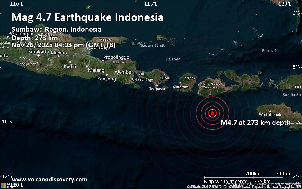
An earthquake of magnitude 4.7 occurred in the afternoon on Wednesday, November 26th, 2025, at 4:03 pm local time near Taliwang, West Sumbawa Regency, West Nusa Tenggara, Indonesia, as reported by Indonesia’s Meteorology, Climatology, and Geophysical Agency.
According to preliminary data, the quake was located at an intermediate to considerable depth of 273. km. The strength of the earthquake may have been tempered by its relative great depth below the surface, which makes it feel weaker in absolute terms. The exact magnitude, epicenter, and depth of the quake might be revised within the next few hours or minutes as seismologists review data and refine their calculations, or as other agencies issue their report.
A second report was later issued by the citizen-seismograph network of RaspberryShake, which listed it as a magnitude 4.7 earthquake as well.
According to preliminary calculations, we do not expect that the quake was felt by many people and did not cause any damage. In Taliwang (pop. 55,300, 116 km away), the quake was probably not felt.
VolcanoDiscovery will automatically update magnitude and depth if these change and follow up if other significant news about the quake become available. If you’re in the area, please send us your experience through our reporting mechanism, either online or via our mobile app.

Click this link to continue reading the article on the source website.
RSS feed source: Volcano Discovery.com--Global earthquake monitor

Date and TimeMag
DepthDistanceLocationDetailsMap Jul 13, 08:49 am (GMT +8)

4.2

10 km78 km (49 mi) to the SW Indian Ocean, 151 km south of Lombok Island, West Nusa Tenggara, Indonesia InfoJul 3, 09:34 am (GMT +8)

4.2

23 km34 km (21 mi) to the NW Indian Ocean, 88 km south of Taliwang, Indonesia InfoJun 15, 11:35 am (GMT +8)

4.1

10 km73 km (46 mi) to the NE Indian Ocean, 73 km south of Pulau Sumbawa Island, West Nusa Tenggara, Indonesia InfoMay 25, 02:58 am (GMT +8)

4.1

8 km76 km (47 mi) to the E Sumbawa Region, Indonesia InfoApr 23, 09:04 am (GMT +8)

4.1

14 km59 km (37 mi) to the E Indian Ocean, 92 km south of Pulau Sumbawa Island, West Nusa Tenggara, Indonesia 1 reportInfoMar 9, 12:31 pm (GMT +8)

4.8

65 km53 km (33 mi) to the NE Indian Ocean, 87 km south of Pulau Sumbawa Island, West Nusa Tenggara, Indonesia 18 reportsInfoAug 21, 2024 07:58 pm (GMT +8)

5.2

100 km93 km (58 mi) to the W Indian Ocean, 148 km south of Lombok Island, West Nusa Tenggara, Indonesia 183 reportsInfoJun 6, 2024 09:15 pm (Makassar)

5.1

10 km65 km (40 mi) to the NW Indian Ocean, 97 km southwest of Sumbawa Besar, Indonesia 143 reportsInfoDec 12, 2023 08:37 am (GMT +8)

5.1

35 km84 km (52 mi) to the SW Indian Ocean, 195 km south of Lombok Island, West Nusa Tenggara, Indonesia InfoJun 22, 2023 01:26 pm (GMT +8)

4.7

28 km83 km (52 mi) to the W Indian Ocean, 93 km south of Praya, Indonesia 3 reportsInfoApr 17, 2022 06:04 pm (GMT +8)

5.1

48 km73 km (46 mi)

Click this link to continue reading the article on the source website.