RSS feed source: Global Disaster Alert and Coordination Systems (GDACS).

Date and TimeMag
DepthDistanceLocationDetailsMap Sep 13, 01:29 pm (GMT -9)

4.5

36 km57 km (35 mi) to the SE North Pacific Ocean, 49 mi southeast of Amukta Island, Aleutians West Census Area, Alaska, United States InfoSep 3, 11:07 am (GMT -9)

4.2

35 km89 km (55 mi) to the E Bering Sea, 37 mi south of Herbert Island, Aleutians West Census Area, Alaska, United States InfoAug 30, 08:30 am (GMT -10)

4.1

8.7 km109 km (68 mi) to the E North Pacific Ocean, 59 mi south of Herbert Island, Aleutians West Census Area, Alaska, United States InfoAug 24, 01:15 pm (GMT -10)

4.3

10 km83 km (51 mi) to the SE North Pacific Ocean, 59 mi south of Yunaska Island, Aleutians West Census Area, Alaska, United States InfoAug 15, 03:47 pm (GMT -9)

4.2

10 km99 km (61 mi) to the E North Pacific Ocean, 55 mi southeast of Yunaska Island, Aleutians West Census Area, Alaska, United States InfoDec 5, 2024 01:48 am (GMT -10)

5.6

38 km36 km (22 mi) to the E North Pacific Ocean, 31 mi southeast of Amukta Island, Aleutians West Census Area, Alaska, United States 1 reportInfoJul 18, 2024 05:13 pm (GMT -10)

6.0

41 km35 km (22 mi) to the E 168 km SW of Nikolski, Alaska InfoMay 18, 2024 11:35 pm (GMT -10)

6.0

28 km36 km (22 mi) to the E North Pacific Ocean, 33 mi southeast of Amukta Island, Aleutians West Census Area, Alaska, United States InfoAug 16, 2020 10:05 am (GMT -10)

5.8

18 km109 km (67 mi) to the S North Pacific Ocean, 265 mi southwest of

Click this link to continue reading the article on the source website.

RSS feed source: Global Disaster Alert and Coordination Systems (GDACS).

Date and TimeMag
DepthDistanceLocationDetailsMap Nov 9, 06:24 pm (GMT +9)

4.7

29 km30 km (18 mi) to the SW North Pacific Ocean, 122 km east of Miyako, Iwate, JapanI FELT IT InfoNov 9, 07:20 pm (GMT +10)

4.2

30 km28 km (17 mi) to the SW North Pacific Ocean, 194 km east of Morioka, Iwate, JapanI FELT IT InfoNov 9, 09:16 am (Universal Time)
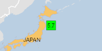
5.0

10 km43 km (27 mi) to the SW North Pacific Ocean, 109 km east of Miyako, Iwate, JapanI FELT IT InfoNov 9, 07:10 pm (GMT +10)

5.4

10 km18 km (11 mi) to the SW North Pacific Ocean, 192 km east of Morioka, Iwate, JapanI FELT IT1 reportInfoNov 9, 06:54 pm (GMT +10)

6.4

10 km22 km (14 mi) to the SW North Pacific Ocean, 191 km east of Morioka, Iwate, JapanI FELT IT1 reportInfoNov 9, 06:34 pm (GMT +10)

5.6

10 km20 km (12 mi) to the SW North Pacific Ocean, Aomori, 196 km east of Morioka, Iwate, JapanI FELT IT1 reportInfoNov 9, 06:14 pm (GMT +10)

5.9

10 km31 km (19 mi) to the S North Pacific Ocean, Hokkaido, 199 km east of Morioka, Iwate, JapanI FELT IT3 reportsInfoNov 9, 06:11 pm (GMT +10)

5.5

10 km28 km (17 mi) to the W 107 km E of Yamada, Japan  I FELT IT InfoNov 9, 06:03 pm (GMT +10)

6.8

10 km27 km (17 mi) to the S Iwate, 231 km east of Semboku, Akita, JapanI FELT IT24 reportsInfoFeb 20, 2015 01:25 pm (GMT

Click this link to continue reading the article on the source website.