RSS feed source: US National Weather Service
Mon, 27 Oct 2025, 17:50 | BY: EARTHQUAKEMONITOR
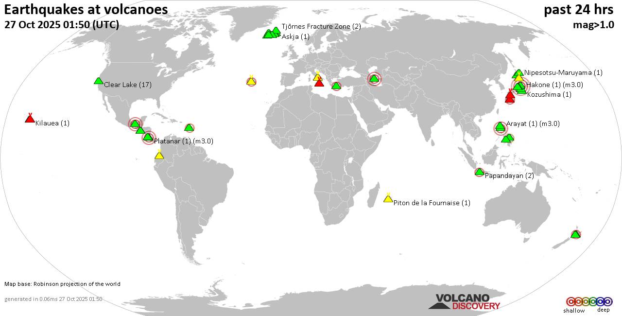
World map showing volcanoes with shallow (less than 50 km) earthquakes within 20 km radius during the past 24 hours on 27 Oct 2025 Number in brackets indicate nr of quakes.
Quakes detected near: Akita-Komagatake (1 quake mag 1.0), Akuseki-jima (1 quake mag 1.9), Apaneca Range (2 quakes between mag 1.8-2.1), Bardarbunga (7 quakes between mag 0.5-1.7), Brennisteinsfjöll (3 quakes between mag 0.2-1.9), Buzzard Creek (1 quake mag 2.0)
Campi Flegrei (Phlegrean Fields) (23 quakes between mag 0.1-1.4), Cerro Negro de Mayasquer (1 quake mag 1.9), Cerro Singüil (2 quakes between mag 2.1-2.3), Clear Lake (26 quakes between mag 0.2-2.0), Coso (4 quakes between mag 0.2-1.9), Cuernos de Negros (1 quake mag 3.0), El Chichón (7 quakes between mag 1.9-3.4), Grímsvötn (1 quake mag 1.8), Ibusuku (1 quake mag 1.1), Izalco (1 quake mag 1.8), Katla (3 quakes between mag 0.9-2.0), Kilauea (3 quakes between mag 1.9-2.4), Kirishima (4 quakes between mag 0.4-1.0), Kolumbo (1 quake mag 2.6), Komaga-take (1 quake mag 1.2), Krísuvík (19 quakes between mag 0.0-1.0), La Palma (1 quake mag 1.0), Ljósufjöll (20 quakes between mag 0.2-1.8), Loki-Fögrufjöll volcano (2 quakes between mag 1.3-1.6), Maunaloa (1 quake mag 2.0), Nantai (11 quakes between mag 0.1-2.4), Nipesotsu-Maruyama (1 quake mag 1.1), Quezaltepeque (1 quake mag 3.0), Ruapehu (1 quake mag 1.6), San Salvador
Click this link to continue reading the article on the source website.

