RSS feed source: US National Weather Service

At 410 PM MDT, Doppler radar was tracking a strong thunderstorm near Stonewall, or 24 miles west of Trinidad, moving east at 20 mph. HAZARD…Wind gusts up to 40 mph and penny size hail. SOURCE…Radar indicated. IMPACT…Gusty winds could knock down tree limbs and blow around unsecured objects. Minor hail damage to vegetation is possible. This storm will remain over mainly rural areas of southwestern Las Animas County.

Click this link to continue reading the article on the source website.

RSS feed source: US National Weather Service

<!–div style="font-size:14px;text-align:center;border:3px solid blue;border-radius:5px;padding:3px;margin:5px;background:#eee"><a href="https://www.volcanoesandearthquakes.com/app/volcano-report.php?volcanoId=44" style="text-decoration:none" target="_blank" rel="noopener noreferrer nofollow" title="Share a volcano (activity) report, submit a photo or other interesting news!” onclick=”window.open(this.href,’Volcano Report’,’status=0,toolbar=0,location=0,directories=0,menubar=0,resizable=1,scrollbars=1,height=500,width=450′);return false”>Send Volcano Report</div–> Stratovolcano 3676 m (12,060 ft)
East Java, Indonesia, -8.11°S / 112.92°E
Current status: erupting (4 out of 5) Semeru volcano eruptions:
1818, 1829, 1830, 1832, 1836, 1838, 1842, 1844, 1845, 1848, 1849(?), 1851, 1856, 1857, 1865, 1866(?), 1887, 1887, 1888, 1889-91, 1892, 1893, 1893-94, 1895, 1896, 1897, 1899, 1899, 1900, 1901, 1903, 1904, 1905, 1907, 1908, 1909-10, 1910-11, 1911, 1912, 1913, 1941-42, 1945, 1946, 1946-47, 1950-64, 1967-ongoing
Typical eruption style
Explosive. Near constant strombolian activity, occasionally stronger explosions, lava flows and pyroclastic flows.

Click this link to continue reading the article on the source website.

RSS feed source: US National Weather Service

Thu, 23 Oct 2025, 21:28 | BY: EARTHQUAKEMONITOR

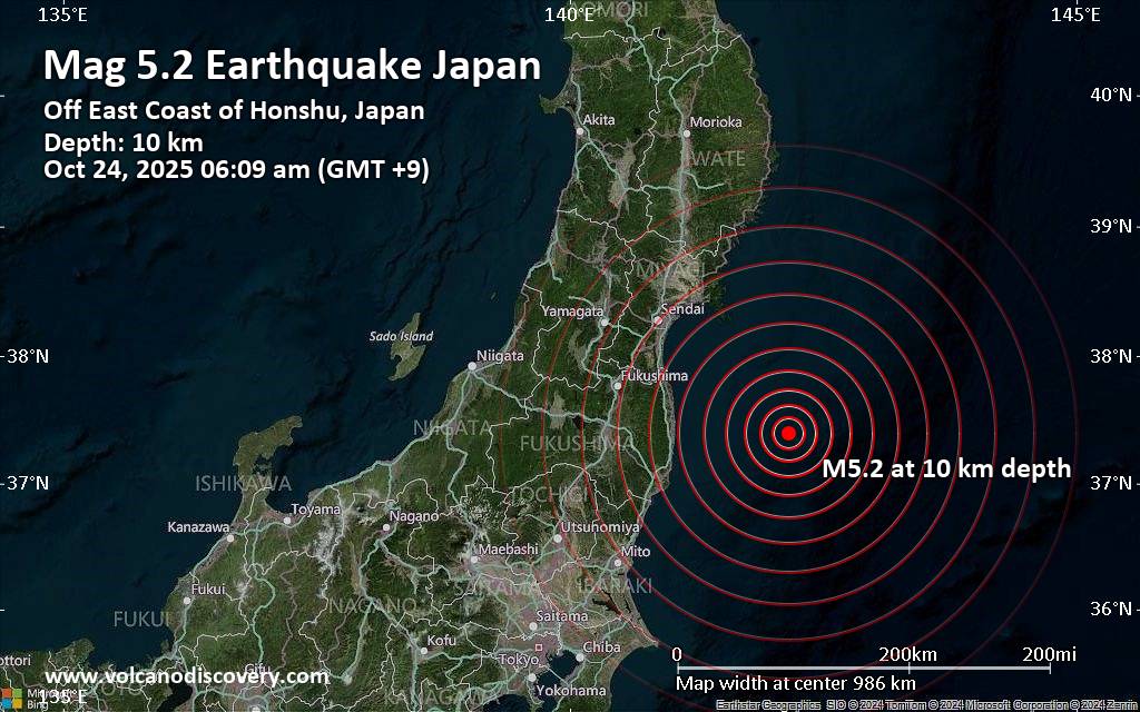
A magnitude 5.2 earthquake near Minami-Soma, Minamisōma Shi, Fukushima, Japan, was reported only 18 minutes ago by the German Research Centre for Geosciences (GFZ), considered one of the key international agencies that monitor seismic activity worldwide. The earthquake occurred at a shallow depth of 10. km beneath the epicenter early morning on Friday, October 24th, 2025, at 6:09 am local time. The exact magnitude, epicenter, and depth of the quake might be revised within the next few hours or minutes as seismologists review data and refine their calculations, or as other agencies issue their report.
A second report was later issued by France’s Réseau National de Surveillance Sismique (RéNaSS), which listed it as a magnitude 5.1 earthquake. Other agencies reporting the same quake include Japan’s National Research Institute for Earth Science and Disaster Resilience (NIED) at magnitude 5.2, and the citizen-seismograph network of RaspberryShake at magnitude 5.2.
Generally quakes of this magnitude are recorded by more than one agency and the results can vary, with subsequent reports that come in after the first one often showing more accuracy.
Based on the preliminary seismic data, the quake should not have caused any significant damage, but was probably felt by many people as light vibration in the area of the epicenter.
Weak shaking might have been felt in Minami-Soma

Click this link to continue reading the article on the source website.