RSS feed source: Volcano Discovery.com

<!–div style="font-size:14px;text-align:center;border:3px solid blue;border-radius:5px;padding:3px;margin:5px;background:#eee"><a href="https://www.volcanoesandearthquakes.com/app/volcano-report.php?volcanoId=62" style="text-decoration:none" target="_blank" rel="noopener noreferrer nofollow" title="Share a volcano (activity) report, submit a photo or other interesting news!” onclick=”window.open(this.href,’Volcano Report’,’status=0,toolbar=0,location=0,directories=0,menubar=0,resizable=1,scrollbars=1,height=500,width=450′);return false”>Send Volcano Report</div–> Stratovolcano 2891 m (9,485 ft)
Western Sumatra, Indonesia, -0.39°S / 100.46°E
Current status: erupting (4 out of 5) Marapi volcano eruptions:
2011-ongoing, 2004 (Aug), 2001, 2000, 1999, 1987-94, 1984, 1984, 1983, 1982, 1980, 1975-79, 1973, 1970-71, 1968(?), 1967, 1966, 1958, 1958, 1954-57, 1950-52, 1949, 1949, 1943, 1932, 1930, 1929, 1927, 1925, 1919, 1918, 1918, 1917, 1916, 1915, 1913, 1911, 1910, 1907-08, 1905, 1904, 1889, 1888, 1886, 1885, 1883, 1878(?), 1883, 1876-77, 1876, 1871, 1871, 1863, 1861, 1855-56, 1854, 1845, 1833-34, 1822, 1807, 1770
Typical eruption style
Small to moderate sized explosions

Click this link to continue reading the article on the source website.

RSS feed source: Volcano Discovery.com

Date and TimeMag
DepthDistanceLocationDetailsMap Aug 13, 11:09 pm (Manila)

4.1

32 km81 km (50 mi) to the E Philippine Sea, 135 km east of Sarangani Island, PhilippinesI FELT IT InfoAug 12, 01:08 pm (GMT +8)

5.3

141 km31 km (19 mi) to the SE Philippine Sea, 71 km east of Sarangani Island, PhilippinesI FELT IT7 reportsInfoAug 10, 05:18 am (Manila)

4.4

60 km95 km (59 mi) to the SW Province of Davao del Sur, Davao, 80 km south of General Santos, PhilippinesI FELT IT InfoJul 26, 12:23 am (Makassar)

4.3

90 km62 km (38 mi) to the SE Philippine Sea, 106 km east of Sarangani Island, Philippines InfoJul 25, 12:23 pm (GMT +8)

4.4

110 km38 km (24 mi) to the E 70 km SSE of Pondaguitan, Philippines InfoJul 23, 06:21 pm (Manila)

4.9

138 km72 km (45 mi) to the N Philippine Sea, 58 km south of Mati, Philippines 1 reportInfoJul 22, 10:48 am (GMT +8)

4.4

61 km78 km (48 mi) to the E Philippine Sea, 135 km east of Sarangani Island, Philippines InfoJan 9, 2024 04:48 am (GMT +8)

6.7

63 km101 km (63 mi) to the S Pulau-Pulau Talaud, Indonesia 59 reportsInfoOct 4, 2023 07:21 pm (GMT +8)

6.4

113 km55 km (34 mi) to the S Philippine Sea, 64 km east of Sarangani Island, Philippines 131 reportsInfoAug 11, 2021 05:46 pm (GMT +0)

7.0

63 km111 km (69 mi) to the NE Philippine Sea, 74 km southeast of Mati, Philippines 617 reportsInfoSep 6, 2020 11:23 pm (Manila)

6.3

128 km64 km (40 mi) to the NW Mindanao, Philippines 357 reportsInfoSep 29, 2019 10:02 am (Manila)

6.1

68 km63 km (39 mi) to the

Click this link to continue reading the article on the source website.

RSS feed source: Volcano Discovery.com

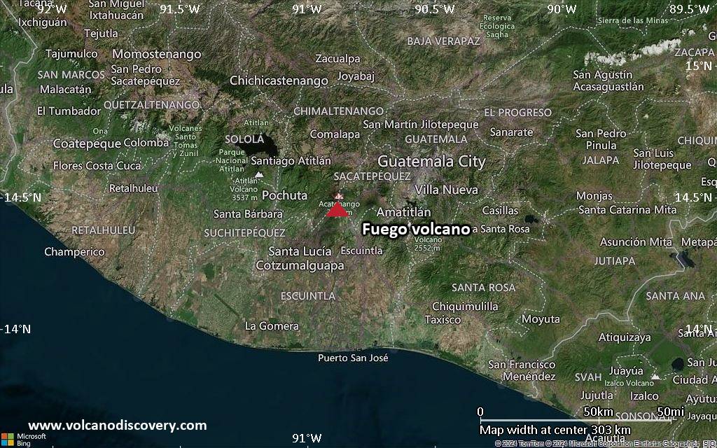
<!–div style="font-size:14px;text-align:center;border:3px solid blue;border-radius:5px;padding:3px;margin:5px;background:#eee"><a href="https://www.volcanoesandearthquakes.com/app/volcano-report.php?volcanoId=26" style="text-decoration:none" target="_blank" rel="noopener noreferrer nofollow" title="Share a volcano (activity) report, submit a photo or other interesting news!” onclick=”window.open(this.href,’Volcano Report’,’status=0,toolbar=0,location=0,directories=0,menubar=0,resizable=1,scrollbars=1,height=500,width=450′);return false”>Send Volcano Report</div–> Stratovolcano 3,763 m / 12,346 ft
Guatemala, 14.47°N / -90.88°W
Current status: erupting (4 out of 5) Fuego volcano eruptions:
1581, 1585, 1586, 1587, 1614, 1617, 1620, 1623, 1629, 1679(?), 1685, 1686, 1689(?), 1699, 1702, 1705, 1706, 1709(?), 1710,1717,1730, 1732, 1737, 1751(?), 1765(?), 1773(?), 1799, 1826, 1829, 1850(?), 1852(?), 1855, 1856, 1857, 1860, 1861(?), 1867(?), 1880, 1896, 1932, 1944, 1949, 1953, 1955, 1957, 1962, 1963, 1966, 1967, 1971, 1973, 1974, 1975, 1977, 1987, 1999, 2002 – ongoing
Typical eruption style
Dominantly explosive, construction of lava domes and extrusion of viscous lava flows. In near constant activity, at least during the past centuries.

Click this link to continue reading the article on the source website.