RSS feed source: Volcano Discovery.com--Global earthquake monitor

Tue, 26 Aug 2025, 23:20 | BY: EARTHQUAKEMONITOR

Worldwide earthquakes above magnitude 3 during the past 24 hours on 26 Aug 2025

Summary: 7 quakes 5.0+, 37 quakes 4.0+, 101 quakes 3.0+, 322 quakes 2.0+ (467 total)
Seismic activity has been moderate, with a number of notable earthquakes of magnitude 5.0 or greater. The most significant events occurred in the Pacific “Ring of Fire” region.
Notable Earthquakes (Magnitude 5.0 and above):
Numerous smaller earthquakes, primarily in the M4.0 range, were also widely reported across the globe, including in Kamchatka, Russia; Papua New Guinea; Italy; Ecuador; and Chile.
Magnitude 5+: 7 earthquakes
Magnitude 4+: 37 earthquakes
Magnitude 3+: 101 earthquakes
Magnitude 2+: 322 earthquakes
No quakes of magnitude 6 or higherTotal seismic energy estimate: 5.3 x 10¹³ joules (14.8 gigawatt hours, equivalent to 12752 tons of TNT or 0.8 atomic bombs!) | equivalent to ONE quake of magnitude 6.0 learn more10 largest earthquakes in the world (past 24 hours)#1: Mag 5.6 227 km E of Levuka, FijiTuesday, Aug 26, 2025, at 01:32 pm (Fiji time) – #2: Mag 5.4 17 km E of Novokayakent, RussiaTuesday, Aug 26, 2025, at 11:33 pm (Moscow time) – #3: Mag 5.1 90 km SSE of Sand Point, AlaskaMonday, Aug 25, 2025, at 09:03 pm (GMT -11) – #4: Mag 5.1 Western XizangTuesday, Aug 26, 2025, at 08:03 am (Shanghai time) – #5: Mag 5.0 Western XizangWednesday, Aug

Click this link to continue reading the article on the source website.

RSS feed source: Volcano Discovery.com--Global earthquake monitor

* WHAT…Flooding caused by excessive rainfall continues as additional thunderstorms roll through the area early this evening. * WHERE…A portion of central California, including the following county, Kern. * WHEN…Until 700 PM PDT. * IMPACTS…Minor flooding in low-lying and poor drainage areas. Water over roadways. * ADDITIONAL DETAILS… – At 515 PM PDT, Doppler radar indicated moderate to heavy rain due to thunderstorms. Minor flooding is ongoing or expected to begin shortly in the advisory area. – Additional rainfall amounts of 0.5 to 1 inch are expected over the area. This additional rain will result in minor flooding. – Some locations that will experience flooding include… mainly rural areas of East

Click this link to continue reading the article on the source website.

RSS feed source: Volcano Discovery.com--Global earthquake monitor

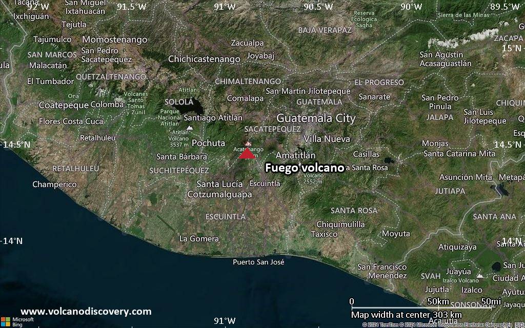
<!–div style="font-size:14px;text-align:center;border:3px solid blue;border-radius:5px;padding:3px;margin:5px;background:#eee"><a href="https://www.volcanoesandearthquakes.com/app/volcano-report.php?volcanoId=26" style="text-decoration:none" target="_blank" rel="noopener noreferrer nofollow" title="Share a volcano (activity) report, submit a photo or other interesting news!” onclick=”window.open(this.href,’Volcano Report’,’status=0,toolbar=0,location=0,directories=0,menubar=0,resizable=1,scrollbars=1,height=500,width=450′);return false”>Send Volcano Report</div–> Stratovolcano 3,763 m / 12,346 ft
Guatemala, 14.47°N / -90.88°W
Current status: erupting (4 out of 5) Fuego volcano eruptions:
1581, 1585, 1586, 1587, 1614, 1617, 1620, 1623, 1629, 1679(?), 1685, 1686, 1689(?), 1699, 1702, 1705, 1706, 1709(?), 1710,1717,1730, 1732, 1737, 1751(?), 1765(?), 1773(?), 1799, 1826, 1829, 1850(?), 1852(?), 1855, 1856, 1857, 1860, 1861(?), 1867(?), 1880, 1896, 1932, 1944, 1949, 1953, 1955, 1957, 1962, 1963, 1966, 1967, 1971, 1973, 1974, 1975, 1977, 1987, 1999, 2002 – ongoing
Typical eruption style
Dominantly explosive, construction of lava domes and extrusion of viscous lava flows. In near constant activity, at least during the past centuries.

Click this link to continue reading the article on the source website.
RSS feed source: Volcano Discovery.com--Global earthquake monitor

At 614 PM MDT, Doppler radar was tracking a strong thunderstorm 13 miles east of Nucla, or 26 miles west of Montrose, moving north at 20 mph. HAZARD…Wind gusts up to 40 mph and half inch hail. SOURCE…Radar indicated. IMPACT…Gusty winds could knock down tree limbs and blow around unsecured objects. Minor hail damage to vegetation is possible. This storm will remain over mainly rural areas of central Montrose County.

Click this link to continue reading the article on the source website.