RSS feed source: USGS Earthquake Hazards Program
Time2025-10-13 12:24:54 UTC2025-10-13 12:24:54 UTC at epicenterLocation7.111°N 126.988°EDepth54.95 km (34.14 mi)
Click this link to continue reading the article on the source website.
RSS feed source: USGS Earthquake Hazards Program
Time2025-10-13 12:24:54 UTC2025-10-13 12:24:54 UTC at epicenterLocation7.111°N 126.988°EDepth54.95 km (34.14 mi)
Click this link to continue reading the article on the source website.
RSS feed source: USGS Earthquake Hazards Program
PAGER – GREEN ShakeMap – VII DYFI? – VII
Time2025-10-12 17:05:59 UTC2025-10-12 17:05:59 UTC at epicenterLocation10.946°N 123.938°EDepth10.00 km (6.21 mi)
Click this link to continue reading the article on the source website.
RSS feed source: USGS Earthquake Hazards Program
Time2025-10-13 11:11:00 UTC2025-10-13 11:11:00 UTC at epicenterLocation7.248°N 141.605°EDepth10.00 km (6.21 mi)
Click this link to continue reading the article on the source website.
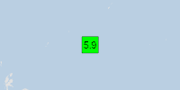
RSS feed source: USGS Earthquake Hazards Program
On 10/13/2025 11:11:00 AM, an earthquake occurred in Micronesia potentially affecting 3 thousand in MMI IV. The earthquake had Magnitude 5.9M, Depth:10km.
Click this link to continue reading the article on the source website.