RSS feed source: Volcano Discovery.com--Global earthquake monitor

Fri, 10 Oct 2025, 02:19 | BY: EARTHQUAKEMONITOR

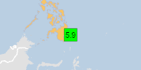
Just 10 minutes ago, a 6.2-magnitude earthquake struck near Lorengau, Manus District, Manus Province, Papua New Guinea. The tremor was recorded around noon on Friday, October 10th, 2025, at 12:08 pm local time, at a shallow depth of 10. km below the surface.
The event was filed by the European-Mediterranean Seismological Centre (EMSC), the first seismological agency to report it.
A second report was later issued by the citizen-seismograph network of RaspberryShake, which listed it as a magnitude 6.2 earthquake as well. A third agency, the German Research Centre for Geosciences (GFZ), reported the same quake at magnitude 6.1.
Based on the preliminary seismic data, the quake was probably felt by many people in the area of the epicenter. It should not have caused significant damage, other than objects falling from shelves, broken windows, etc.
In Lorengau (pop. 5,800) located 135 km from the epicenter, the quake should have been felt as light shaking.
VolcanoDiscovery will automatically update magnitude and depth if these change and follow up if other significant news about the quake become available. If you’re in the area, please send us your experience through our reporting mechanism, either online or via our mobile app. This will help us provide more first-hand updates to anyone around the globe who wants to know more about this quake.

If

Click this link to continue reading the article on the source website.

RSS feed source: Volcano Discovery.com--Global earthquake monitor

Date and TimeMag
DepthDistanceLocationDetailsMap Oct 10, 10:11 am (GMT +8)

5.6

63 km68 km (42 mi) to the SW Philippine Sea, 64 km east of Mati, PhilippinesI FELT IT7 reportsInfoOct 10, 09:51 am (GMT +8)

5.9

62 km53 km (33 mi) to the SW Philippine Sea, 40 km east of Manay, PhilippinesI FELT IT11 reportsInfoOct 10, 09:43 am (Manila)

7.4

58 km48 km (30 mi) to the SW Philippine Sea, 24 km east of Manay, PhilippinesI FELT IT300 reportsInfoOct 4, 01:53 pm (GMT +8)

4.0

10 km35 km (22 mi) to the NW Philippine Sea, 62 km northeast of Manay, PhilippinesI FELT IT InfoSep 18, 11:25 pm (GMT +8)

4.5

19 km67 km (42 mi) to the N Philippine Sea, Davao, 81 km east of Bislig, Philippines 1 reportInfoJul 14, 01:08 am (GMT +8)

5.1

10 km50 km (31 mi) to the SE 92 km E of Santiago, Philippines InfoMar 17, 11:41 pm (GMT +8)

5.2

35 km72 km (44 mi) to the NW 35 km ENE of Santa Maria, Philippines 5 reportsInfoDec 2, 2023 10:37 pm (Manila)

7.6

40 km133 km (83 mi) to the NW Philippine Sea, 36 km north of Bislig, Philippines 565 reportsInfoApr 19, 2022 09:23 am (GMT +8)

6.1

19 km31 km (19 mi) to the SW 41 km E of Santiago, Philippines 25 reportsInfoAug 11, 2021 05:46 pm (GMT +0)

7.0

63 km122 km (76 mi) to the S Mindanao, Philippines 617 reportsInfoSep 8, 2018 03:16 pm (Manila)

6.1

10 km65 km (41 mi) to the SW Mindanao, Philippines 182 reportsInfoSep 24, 2016 06:53 am (Manila)

6.2

54 km115 km (72 mi) to the SW Philippine Sea,

Click this link to continue reading the article on the source website.

RSS feed source: Volcano Discovery.com--Global earthquake monitor

Date and TimeMag
DepthDistanceLocationDetailsMap Aug 22, 12:43 pm (GMT -12)

5.0

62 km89 km (55 mi) to the SE South Pacific Ocean, 400 km south of Nuku’alofa, Tongatapu, Tonga InfoAug 22, 12:10 pm (GMT -12)

5.5

10 km97 km (60 mi) to the SE South of Tonga InfoAug 20, 02:37 am (GMT +12)

5.4

10 km61 km (38 mi) to the E South of the Fiji Islands InfoAug 18, 11:03 am (GMT -12)

5.6

35 km75 km (47 mi) to the SE South of Tonga InfoAug 16, 10:52 am (GMT -12)

5.5

35 km93 km (58 mi) to the SE South Pacific Ocean, 369 km south of ‘Eua Island, Eua, Tonga InfoFeb 7, 11:27 pm (GMT +13)

6.0

59 km46 km (29 mi) to the E South Pacific Ocean, 308 km southwest of ‘Eua Island, Eua, Tonga InfoJun 19, 2023 03:04 am (GMT +12)

5.9

10 km70 km (44 mi) to the E South Pacific Ocean, 289 km south of ‘Eua Island, Eua, Tonga InfoJun 16, 2023 08:11 pm (GMT +12)

6.0

20 km88 km (55 mi) to the NE South Pacific Ocean, 259 km south of ‘Eua Island, Eua, Tonga InfoJun 16, 2023 07:06 am (GMT +13)

7.2

179 km129 km (80 mi) to the NW South Pacific Ocean, 285 km southwest of Nuku’alofa, Tongatapu, Tonga 11 reportsInfoJun 1, 2020 11:25 am (GMT +12)

5.8

128 km16 km (10.1 mi) to the N South Pacific Ocean, 340 km southwest of Nuku’alofa, Tongatapu, Tonga InfoApr 2, 2018 05:57 pm (GMT +12)

6.1

92 km81 km (50 mi) to the SSouth of the Fiji Islands InfoSep 26, 2017 04:20 pm (GMT +12)

6.3

103 km58 km (36 mi) to the NW South of Fiji

Click this link to continue reading the article on the source website.