RSS feed source: Global Disaster Alert and Coordination Systems (GDACS).
Date and TimeMag
DepthDistanceLocationDetailsMap Mar 19, 09:08 am (GMT +5:30)
4.4
43 km80 km (50 mi) to the NW Andaman Sea, 37 km east of Sound Island, India InfoNov 20, 2024 09:51 am (Kolkata)
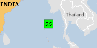
4.7
74 km72 km (45 mi) to the W97 km NNE of Bamboo Flat, India InfoOct 10, 2024 06:40 am (Kolkata)
4.2
80 km29 km (18 mi) to the SE India: Andaman Sea InfoSep 24, 2024 02:54 pm (GMT +5:30)
4.4
10 km63 km (39 mi) to the N India: Andaman Sea InfoJul 30, 2024 07:03 am (GMT +5:30)
4.5
47 km82 km (51 mi) to the N Andaman Sea, 68 km northeast of Sound Island, India InfoFeb 13, 2018 08:09 am (Kolkata)
5.2
58 km72 km (45 mi) to the W86 km NE of Bamboo Flat, India InfoOct 12, 2014 09:02 am (GMT +5:30)
5.1
124 km35 km (22 mi) to the N Andaman Islands, India Region InfoJun 19, 2010 04:39 am (Kolkata)
5.9
20 km109 km (68 mi) to the NW 170 km NNE of Bamboo Flat, India InfoAug 11, 2009 01:25 am (GMT +5:30)
7.5
24 km202 km (125 mi) to the NW Bay of Bengal, 50 km north of Landfall Island, India InfoJan 21, 2006 09:37 am (GMT +5:30)
5.6
44 km81 km (51 mi) to the NW Andaman Islands, India region InfoJan 29, 2005 11:14 am (Kolkata)
5.2
30 km109 km (68 mi) to the NW Andaman Islands, India region InfoDec 26, 2004 01:08 pm (Kolkata)
5.7
30 km108 km (67 mi) to the NW 161 km NNE of Bamboo Flat, India InfoMay 3, 2004 11:11 pm (Kolkata)
5.2
31 km93 km (57 mi) to the NW 161 km NNE of Bamboo Flat, India InfoApr 10, 2004 09:27 pm
Click this link to continue reading the article on the source website.