RSS feed source: Global Disaster Alert and Coordination Systems (GDACS).

Date and TimeMag
DepthDistanceLocationDetailsMap Jun 7, 09:31 am (GMT +11)

4.1

50 km73 km (45 mi) to the S East of Kuril Islands  I FELT IT InfoJun 3, 10:03 am (GMT +10)

4.4

40 km90 km (56 mi) to the NW Kuril Islands InfoApr 30, 03:44 am (GMT +11)

4.3

84 km119 km (74 mi) to the NW North Pacific Ocean, 31 km south of Ostrov Simushir Island, Sakhalin Oblast, Russia InfoFeb 24, 07:23 pm (GMT +10)

4.3

10 km54 km (34 mi) to the E East of the Kuril Islands InfoFeb 16, 05:43 pm (GMT +10)

5.2

10 km94 km (58 mi) to the S East of the Kuril Islands InfoSep 21, 2021 06:25 am (GMT +10)

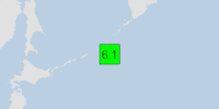
6.1

36 km82 km (51 mi) to the W North Pacific Ocean, Sakhalin Oblast, Russia 12 reportsInfoApr 19, 2013 02:05 pm (Sakhalin)

7.2

110 km204 km (127 mi) to the W 252 km ENE of Kuril’sk, Russia 1 reportInfoAug 5, 2010 09:48 am (GMT +10)

6.0

28 km26 km (16 mi) to the SW East of The Kuril Islands InfoFeb 6, 2010 02:44 pm (GMT +10)

6.0

30 km96 km (60 mi) to the NW Kuril Islands InfoJan 16, 2009 03:49 am (GMT +10)

7.4

36 km155 km (96 mi) to the NE North Pacific Ocean, 189 km southeast of Ostrov Rasshua Island, Sakhalin Oblast, Russia InfoMar 3, 2008 07:31 pm (GMT +10)

6.5

10 km38 km (23 mi) to the NW North Pacific Ocean, 116 km southeast of Ostrov Ketoy Island, Sakhalin Oblast, Russia InfoOct 25, 2007 11:50 pm (GMT +10)

6.1

20 km62 km (39 mi) to the E East of The Kuril Islands InfoJan 13, 2007 02:23 pm (GMT +10)

8.1

10 km85 km (53 mi) to

Click this link to continue reading the article on the source website.
RSS feed source: Global Disaster Alert and Coordination Systems (GDACS).

37 km (23 mi)

SW of epicenter

San Policarpo

(pop: 3,580)

III: Weak

Province of Eastern Samar, Eastern Visayas 43 km (27 mi)

W of epicenter

Arteche

(pop: 5,030)

III: Weak

Province of Eastern Samar, Eastern Visayas 46 km (28 mi)

SW of epicenter

Oras

(pop: 9,020)

III: Weak

Province of Eastern Samar, Eastern Visayas 50 km (31 mi)

SW of epicenter

Dolores

(pop: 9,270)

III: Weak

Province of Eastern Samar, Eastern Visayas 53 km (33 mi)

W of epicenter

Gamay

(pop: 9,130)

III: Weak

Province of Northern Samar, Eastern Visayas 59 km (37 mi)

W of epicenter

Mapanas

(pop: 3,570)

II: Very weak

Province of Northern Samar, Eastern Visayas 61 km (38 mi)

W of epicenter

Hipadpad

(pop: 3,800)

II: Very weak

Province of Eastern Samar, Eastern Visayas 65 km (41 mi)

W of epicenter

Maslog

(pop: 4,780)

II: Very weak

Province of Eastern Samar, Eastern Visayas 66 km (41 mi)

SW of epicenter

Taft

(pop: 4,420)

II: Very weak

Province of Eastern Samar, Eastern Visayas 72 km (45 mi)

SW of epicenter

Sulat

(pop: 4,680)

II: Very weak

Province of Eastern Samar, Eastern Visayas 76 km (47 mi)

W of epicenter

Palapag

(pop: 8,340)

II: Very weak

Province of Northern Samar, Eastern Visayas 80 km (50 mi)

W of epicenter

Click this link to continue reading the article on the source website.

RSS feed source: Global Disaster Alert and Coordination Systems (GDACS).

Aalto University is where science and art meet technology and business. We shape a sustainable future by making research breakthroughs in and across our disciplines, sparking the game changers of tomorrow and creating novel solutions to major global challenges. Our community is made up of 13 000 students, 400 professors, and more than 4 500 other faculty and staff working on our dynamic campus in Espoo, Greater Helsinki, Finland. Diversity is part of who we are, and we actively work to ensure our community’s diversity and inclusiveness. This is why we warmly encourage qualified candidates from all backgrounds to join our community.

The School of Chemical Engineering is one of the six schools of Aalto University. It combines natural sciences and engineering in a unique way.

We are now looking for a

Postdoctoral researcher in the field of the Life Cycle Assessment (LCA)

Click this link to continue reading the article on the source website.