RSS feed source: USGS Earthquake Hazards Program
Time2025-10-10 02:11:44 UTC2025-10-10 02:11:44 UTC at epicenterLocation6.995°N 126.797°EDepth63.46 km (39.43 mi)
Click this link to continue reading the article on the source website.
RSS feed source: USGS Earthquake Hazards Program
Time2025-10-10 02:11:44 UTC2025-10-10 02:11:44 UTC at epicenterLocation6.995°N 126.797°EDepth63.46 km (39.43 mi)
Click this link to continue reading the article on the source website.
RSS feed source: USGS Earthquake Hazards Program
PAGER – YELLOW ShakeMap – VIII DYFI? – IX
Time2025-10-10 01:43:59 UTC2025-10-10 01:43:59 UTC at epicenterLocation7.265°N 126.755°EDepth58.09 km (36.09 mi)
Click this link to continue reading the article on the source website.
RSS feed source: USGS Earthquake Hazards Program
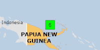
On 10/10/2025 2:08:10 AM, an earthquake occurred in Papua New Guinea potentially affecting 40 thousand in MMI IV. The earthquake had Magnitude 6M, Depth:10km.
Click this link to continue reading the article on the source website.
RSS feed source: USGS Earthquake Hazards Program
PAGER – GREEN ShakeMap – IV DYFI? – III
Time2025-10-10 01:51:15 UTC2025-10-10 01:51:15 UTC at epicenterLocation7.101°N 126.888°EDepth61.64 km (38.30 mi)
Click this link to continue reading the article on the source website.