RSS feed source: Volcano Discovery.com--Global earthquake monitor

Date and TimeMag
DepthDistanceLocationDetailsMap Aug 24, 10:41 pm (Santiago)

4.1

26 km90 km (56 mi) to the NE South Pacific Ocean, 79 km southwest of Ovalle, Provincia de Limari, Region de Coquimbo, Chile InfoJun 24, 12:08 am (GMT -5)

4.0

42 km16 km (10.2 mi) to the S South Pacific Ocean, 183 km northwest of Valparaiso, Valparaiso, Region de Valparaiso, Chile InfoMay 7, 07:00 pm (GMT -5)

4.1

10 km52 km (33 mi) to the NW South Pacific Ocean, 206 km southwest of La Serena, Provincia de Elqui, Region de Coquimbo, Chile 1 reportInfoFeb 21, 09:07 pm (Santiago)

4.2

65 km97 km (61 mi) to the E South Pacific Ocean, 52 km west of Illapel, Provincia de Choapa, Region de Coquimbo, Chile 1 reportInfoSep 9, 2024 01:24 pm (GMT -4)

4.1

20 km54 km (33 mi) to the SE South Pacific Ocean, 153 km north of Valparaiso, Valparaiso, Region de Valparaiso, Chile InfoSep 6, 2024 06:09 am (GMT -4)

4.3

8.8 km58 km (36 mi) to the SE101 km WSW of Illapel, Chile InfoSep 18, 2017 09:46 am (GMT -4)

5.7

29 km78 km (49 mi) to the SE Near Coast of Central Chile 75 reportsInfoDec 8, 2016 04:42 pm (Santiago)

6.5

28 km95 km (59 mi) to the E South Pacific Ocean, 47 km west of Illapel, Provincia de Choapa, Region de Coquimbo, Chile 7 reportsInfoSep 18, 2015 08:18 am (Universal Time)

5.5

6 km89 km (55 mi) to the SOff Coast of Central Chile InfoSep 17, 2015 10:19 am (GMT -4)

5.7

10 km89 km (55 mi) to the NE82 km WSW of Ovalle, Chile 3 reportsInfoSep 17, 2015 09:32 am

Click this link to continue reading the article on the source website.

RSS feed source: Volcano Discovery.com--Global earthquake monitor

Date and TimeMag
DepthDistanceLocationDetailsMap Nov 10, 10:33 am (Makassar)

3.5

17 km52 km (32 mi) to the N Maluku Sea, 22 km south of Pulau Karakelang Island, Sulawesi Utara, IndonesiaI FELT IT

Info

Nov 9, 03:44 am (Makassar)

3.7

27 km5.7 km (3.5 mi) to the N Philippine Sea, 11 km southwest of Pulau Kaburuang Island, IndonesiaI FELT IT

Info

Nov 5, 06:38 am (Makassar)

3.3

22 km64 km (40 mi) to the N Kabupaten Kepulauan Talaud, 375 km northeast of Manado, IndonesiaI FELT IT

Info

Nov 2, 10:50 pm (Makassar)

3.3

20 km12 km (7.6 mi) to the W Talaud Islands, Indonesia

Info

Nov 2, 02:21 pm (Makassar)

3.7

25 km25 km (15 mi) to the SE Talaud Islands, Indonesia

Info

Oct 26, 08:22 pm (GMT +8)

4.4

115 km78 km (48 mi) to the W Philippine Sea, 69 km west of Pulau Salibabu Island, Sulawesi Utara, Indonesia InfoOct 22, 02:09 pm (Makassar)

3.9

28 km92 km (57 mi) to the W Philippine Sea, 45 km east of Sangihe Besar Island, Sulawesi Utara, Indonesia

Info

Oct 12, 07:04 am (Makassar)

4.2

38 km39 km (24 mi) to the N Talaud Islands, Indonesia InfoOct 11, 12:10 am (Makassar)

4.2

37 km28 km (17 mi) to the N Kabupaten Kepulauan Talaud, 339 km northeast of Manado, Indonesia InfoOct 7, 07:58 am (GMT +8)

4.4

16 km79 km (49 mi) to the E Talaud Islands, Indonesia InfoJan 18, 2023 03:06 pm (Jayapura)

7.1

64 km105 km (65 mi) to the SE Indonesia: Di Laut 141 Km Tenggara Melonguane 13 reportsInfoJan 22, 2022 10:26 am (Makassar)

6.0

21 km7.9 km (4.9 mi) to the W 232 km SE of Sarangani, Philippines 2 reportsInfoJul 10, 2021 08:43 am (Makassar)

6.2

23 km75 km (47 mi)

Click this link to continue reading the article on the source website.
RSS feed source: Volcano Discovery.com--Global earthquake monitor

Monday, Nov 10, 2025 10:55 | 1 hour ago | By: EarthquakeMonitor

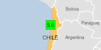
Just 5 minutes ago, a 5.7-magnitude earthquake struck near Antofagasta, Provincia de Antofagasta, Region de Antofagasta, Chile. The tremor was recorded in the morning on Monday, November 10th, 2025, at 7:49 am local time, at an intermediate depth of 128.70 km below the surface.
The event was filed by the European-Mediterranean Seismological Centre (EMSC), the first seismological agency to report it.
A second report was later issued by the German Research Centre for Geosciences (GFZ), which listed it as a magnitude 5.6 earthquake.
Based on the preliminary seismic data, the quake should not have caused any significant damage, but was probably felt by many people as light vibration in the area of the epicenter.
Weak shaking might have been felt in Antofagasta (pop. 352,600) located 29 km from the epicenter, and Mejillones (pop. 12,800) 34 km away.
VolcanoDiscovery will automatically update magnitude and depth if these change and follow up if other significant news about the quake become available. If you’re in the area, please send us your experience through our reporting mechanism, either online or via our mobile app. This will help us provide more first-hand updates to anyone around the globe who wants to know more about this quake.

If you felt it, report it through our site or app right now!

Download

Click this link to continue reading the article on the source website.