RSS feed source: Volcano Discovery.com--Global earthquake monitor

Date and TimeMag
DepthDistanceLocationDetailsMap Aug 23, 09:20 am (Port-au-Prince)

4.0

24 km68 km (42 mi) to the E North Atlantic Ocean, 36 km northwest of Port-de-Paix, Nord-Ouest, Haiti 1 reportInfoDec 6, 2024 01:42 pm (Port-au-Prince)

4.0

10 km44 km (27 mi) to the S 27 km WSW of Bombardopolis, Haiti InfoJul 28, 2023 12:09 am (Havana)

4.0

0 km85 km (53 mi) to the W 28 km south of Baracoa, Provincia de Guantanamo, Cuba InfoFeb 16, 2023 01:50 am (GMT -5)

5.4

10 km44 km (27 mi) to the S 37 km WSW of Bombardopolis, Haiti 47 reportsInfoMay 29, 2022 10:26 am (Port-au-Prince)

4.4

4 km94 km (58 mi) to the E Haiti Region InfoFeb 23, 2022 11:17 pm (Port-au-Prince)

4.1

10 km22 km (14 mi) to the E North Atlantic Ocean, 70 km west of Port-de-Paix, Nord-Ouest, Haiti InfoJan 24, 2022 03:52 pm (Port-au-Prince)

4.3

5 km78 km (48 mi) to the E Haiti Region InfoJan 23, 2022 07:06 am (Port-au-Prince)

4.3

10 km71 km (44 mi) to the E 14 km N of Anse Rouge, Haiti 4 reportsInfoAug 14, 2021 08:29 am (Port-au-Prince)

7.2

10 km175 km (109 mi) to the S Departement de Nippes, 39 km northeast of Les Cayes, Sud, Haiti 576 reportsInfoApr 29, 2020 06:22 am (Havana)

4.5

10 km51 km (32 mi) to the NW 8.6 km south of Maisí, Maisi, Guantanamo, Cuba 3 reportsInfoAug 4, 2019 07:34 pm (GMT -5)

4.3

10 km71 km (44 mi) to the SW Caribbean Sea, 77 km south of Maisi, Provincia de Guantanamo, Cuba InfoOct 16, 2018 10:05 pm (Port-au-Prince)

4.4

13 km76 km (47 mi) to the E North Atlantic Ocean, 20 km west of Ile de la Tortue

Click this link to continue reading the article on the source website.
RSS feed source: Volcano Discovery.com--Global earthquake monitor

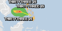
From 24/11/2025 to 24/11/2025, a Tropical Depression (maximum wind speed of 120 km/h) THIRTYTHREE-25 was active in NWPacific. The cyclone affects these countries: Philippines (vulnerability Medium). Estimated population affected by category 1 (120 km/h) wind speeds or higher is 0 (2.031 million in tropical storm).

Click this link to continue reading the article on the source website.

RSS feed source: Volcano Discovery.com--Global earthquake monitor

Monday, Nov 24, 2025 19:50 | 30 mins ago | By: EarthquakeMonitor

World map showing volcanoes with shallow (less than 50 km) earthquakes within 20 km radius during the past 24 hours on 24 Nov 2025 Number in brackets indicate nr of quakes.

Quakes detected near: Akuseki-jima (2 quakes between mag 1.6-1.7), Bardarbunga (2 quakes between mag 0.8-1.0), Clear Lake (32 quakes between mag 0.2-2.1), El Chichón (7 quakes between mag 1.8-3.0), Eldey (6 quakes between mag 1.1-2.5), Geureudong (1 quake mag 2.9)
Golden Trout Creek (1 quake mag 1.9), Hiuchi (1 quake mag 1.3), Hrómundartindur (6 quakes between mag 0.0-1.1), Izu-Tobu (1 quake mag 1.4), Katla (6 quakes between mag 0.4-1.1), Kilauea (1 quake mag 1.9), Kirishima (14 quakes between mag 0.2-1.8), Kolumbo (2 quakes between mag 1.5-2.1), Krísuvík (8 quakes between mag 0.1-1.1), Mauna Kea (1 quake mag 1.7), Nejapa-Miraflores (1 quake mag 3.0), Ontake-san (3 quakes between mag 0.3-2.3), Poco Leok (1 quake mag 2.1), Redoubt (1 quake mag 1.0), Sanbe (6 quakes between mag 0.4-1.5), Sousaki (2 quakes between mag 1.3-1.7), Spurr (1 quake mag 2.1), Terceira (5 quakes between mag 2.0-3.1), Tindfjallajökull (1 quake mag 1.7), Tjörnes Fracture Zone (6 quakes between mag 0.0-1.1), White Island (1 quake mag 2.5) (updated 19h50)

Note: Earthquakes within 20 km from and at depths less than 50 km under active volcanoes

Click this link to continue reading the article on the source website.

RSS feed source: Volcano Discovery.com--Global earthquake monitor

Monday, Nov 24, 2025 19:04 | 1 hour ago | By: EarthquakeMonitor

The German Research Centre for Geosciences (GFZ) reported a magnitude 4.8 quake in Indonesia near Tiakur, Southwest Maluku Regency, Maluku, only 20 minutes ago. The earthquake hit early morning on Tuesday, November 25th, 2025, at 3:43 am local time at a moderately shallow depth of 62. km. The exact magnitude, epicenter, and depth of the quake might be revised within the next few hours or minutes as seismologists review data and refine their calculations, or as other agencies issue their report.
Based on the preliminary seismic data, the quake should not have caused any significant damage, but was probably felt by many people as light vibration in the area of the epicenter.
Weak shaking might have been felt in Tiakur (pop. 5,200) located 66 km from the epicenter.
VolcanoDiscovery will automatically update magnitude and depth if these change and follow up if other significant news about the quake become available. If you’re in the area, please send us your experience through our reporting mechanism, either online or via our mobile app. This will help us provide more first-hand updates to anyone around the globe who wants to know more about this quake.

If you felt it, report it through our site or app right now!

Download and Upgrade the Volcanoes & Earthquakes app

Click this link to continue reading the article on the source website.