RSS feed source: Volcano Discovery.com--Global earthquake monitor

Date and TimeMag
DepthDistanceLocationDetailsMap Aug 30, 09:14 pm (Mexico City)

4.4

147 km9 km (5.6 mi) to the SE Estado de Oaxaca, 58 km northwest of Cintalapa de Figueroa, MexicoI FELT IT InfoAug 28, 06:01 pm (Merida)

4.1

158 km69 km (43 mi) to the SE 6 km south of Cintalapa de Figueroa, Estado de Chiapas, MexicoI FELT IT InfoAug 28, 12:03 am (Mexico City)

4.0

143 km6.9 km (4.3 mi) to the S Estado de Oaxaca, 63 km northwest of Cintalapa de Figueroa, MexicoI FELT IT1 reportInfoAug 24, 01:56 pm (Mexico City)

4.2

131 km83 km (52 mi) to the W 36 km north of Matias Romero, Estado de Oaxaca, MexicoI FELT IT InfoAug 23, 07:27 am (Mexico City)

4.0

128 km27 km (17 mi) to the S Estado de Oaxaca, 53 km west of Cintalapa de Figueroa, Estado de Chiapas, Mexico InfoAug 22, 01:58 am (Mexico City)

4.1

129 km21 km (13 mi) to the SW Estado de Oaxaca, 75 km northwest of Cintalapa de Figueroa, Mexico InfoAug 20, 11:01 am (Mexico City)

4.3

127 km54 km (33 mi) to the W 42 km northeast of Matias Romero, Estado de Oaxaca, Mexico InfoAug 5, 2024 01:03 pm (Mexico City)

5.5

127 km39 km (24 mi) to the S Estado de Oaxaca, 37 km west of Cintalapa de Figueroa, Estado de Chiapas, Mexico 30 reportsInfoOct 6, 2023 11:06 pm (Mexico City)

6.0

110 km99 km (61 mi) to the W Mexico: 12 Km Al NOROESTE De MATIAS ROMERO, OAX 127 reportsInfoJun 23, 2020 03:29 pm (Universal Time)

7.1

10 km185 km (115 mi) to the SW

Click this link to continue reading the article on the source website.
RSS feed source: Volcano Discovery.com--Global earthquake monitor

Date and TimeMag
DepthDistanceLocationDetailsMap Aug 30, 01:38 pm (GMT -7)

4.2

5 km17 km (10.8 mi) to the NW 69 km north of Santa Rosalia, Estado de Baja California Sur, MexicoI FELT IT InfoAug 5, 11:20 pm (GMT -7)

4.2

10 km56 km (35 mi) to the SE 63 km southwest of Guaymas, Estado de Sonora, Mexico 3 reportsInfoJun 30, 11:17 pm (GMT -7)

4.2

12 km48 km (30 mi) to the NW Estado de Baja California, 79 km north of Santa Rosalia, Mexico InfoJun 30, 11:04 pm (GMT -7)

4.4

12 km45 km (28 mi) to the NW 79 km north of Santa Rosalia, Estado de Baja California Sur, Mexico InfoJun 30, 10:51 pm (GMT -7)

4.3

14 km44 km (27 mi) to the NW 80 km north of Santa Rosalia, Estado de Baja California Sur, Mexico InfoNov 4, 2022 03:02 am (Hermosillo)

6.3

10 km62 km (38 mi) to the NW 170 km southwest of Hermosillo, Estado de Sonora, Mexico 209 reportsInfoJul 31, 2021 08:39 am (GMT -7)

5.5

5 km47 km (29 mi) to the SE 63 km southwest of Guaymas, Estado de Sonora, Mexico 53 reportsInfoAug 10, 2014 11:46 am (GMT -7)

4.9

10 km36 km (22 mi) to the SE 71 km southwest of Guaymas, Estado de Sonora, Mexico 1 reportInfoApr 12, 2012 12:15 am (Tijuana)

7.0

13 km155 km (96 mi) to the NW 70 km northeast of San Luis, Estado de Baja California, Mexico InfoSep 10, 2011 03:07 pm (GMT -7)

4.9

10 km41 km (25 mi) to the NW 124 km west of Guaymas, Estado de Sonora, Mexico InfoMay 24, 2011 12:01 pm (GMT

Click this link to continue reading the article on the source website.
RSS feed source: Volcano Discovery.com--Global earthquake monitor

Sun, 31 Aug 2025, 10:50 | BY: EARTHQUAKEMONITOR

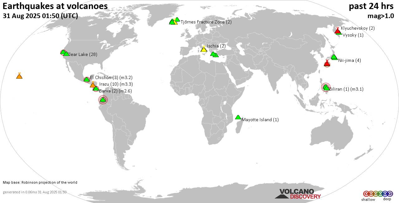
World map showing volcanoes with shallow (less than 50 km) earthquakes within 20 km radius during the past 24 hours on 31 Aug 2025 Number in brackets indicate nr of quakes.

Quakes detected near: Akuseki-jima (2 quakes between mag 2.2-2.2), Barva (3 quakes between mag 1.2-3.3), Biliran (1 quake mag 3.1), Campi Flegrei (Phlegrean Fields) (13 quakes between mag 0.1-1.8), Clear Lake (25 quakes between mag 0.2-2.0), Coso (4 quakes between mag 0.3-1.8)
El Chichón (5 quakes between mag 2.4-3.0), Eldey (38 quakes between mag 0.5-3.3), Eyafjallajökull (2 quakes between mag 0.6-1.1), Galeras (2 quakes between mag 1.1-3.6), Hakone (1 quake mag 1.1), Hofsjökull (2 quakes between mag 0.9-2.7), Hrómundartindur (2 quakes between mag 0.9-1.3), Irazu (11 quakes between mag 0.8-3.3), Ischia (2 quakes between mag 1.3-1.4), Katla (14 quakes between mag 0.0-2.2), Kilauea (1 quake mag 1.8), Klyuchevskoy (2 quakes between mag 1.5-1.7), Kolumbo (4 quakes between mag 0.8-2.0), Krísuvík (20 quakes between mag 0.0-3.1), Ljósufjöll (6 quakes between mag 0.0-1.5), Mayotte Island (1 quake mag 1.4), Methana (1 quake mag 1.8), Michoacán-Guanajuato (1 quake mag 2.7), Miyake-shima (1 quake mag 1.7), Mt Fuji (1 quake mag 1.1), Nemrut Dagi (2 quakes between mag 1.1-1.4), Nii-jima (3 quakes between mag 1.0-1.5), Santorini (1 quake mag 1.1), Sousaki (1 quake mag 2.4), Suwanose-jima (1 quake mag

Click this link to continue reading the article on the source website.

RSS feed source: Volcano Discovery.com--Global earthquake monitor

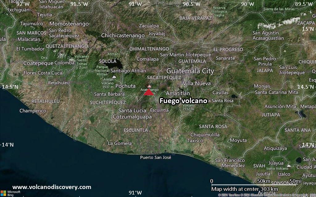
<!–div style="font-size:14px;text-align:center;border:3px solid blue;border-radius:5px;padding:3px;margin:5px;background:#eee"><a href="https://www.volcanoesandearthquakes.com/app/volcano-report.php?volcanoId=26" style="text-decoration:none" target="_blank" rel="noopener noreferrer nofollow" title="Share a volcano (activity) report, submit a photo or other interesting news!” onclick=”window.open(this.href,’Volcano Report’,’status=0,toolbar=0,location=0,directories=0,menubar=0,resizable=1,scrollbars=1,height=500,width=450′);return false”>Send Volcano Report</div–> Stratovolcano 3,763 m / 12,346 ft
Guatemala, 14.47°N / -90.88°W
Current status: erupting (4 out of 5) Fuego volcano eruptions:
1581, 1585, 1586, 1587, 1614, 1617, 1620, 1623, 1629, 1679(?), 1685, 1686, 1689(?), 1699, 1702, 1705, 1706, 1709(?), 1710,1717,1730, 1732, 1737, 1751(?), 1765(?), 1773(?), 1799, 1826, 1829, 1850(?), 1852(?), 1855, 1856, 1857, 1860, 1861(?), 1867(?), 1880, 1896, 1932, 1944, 1949, 1953, 1955, 1957, 1962, 1963, 1966, 1967, 1971, 1973, 1974, 1975, 1977, 1987, 1999, 2002 – ongoing
Typical eruption style
Dominantly explosive, construction of lava domes and extrusion of viscous lava flows. In near constant activity, at least during the past centuries.

Click this link to continue reading the article on the source website.