RSS feed source: Volcano Discovery.com--Global earthquake monitor

Date and TimeMag
DepthDistanceLocationDetailsMap Mar 6, 05:16 am (GMT +5)

5.0

10.5 km49 km (30 mi) to the SW Indian Ocean, British Indian Ocean Territory InfoMar 3, 08:47 am (GMT +5)

4.7

10 km67 km (42 mi) to the W Indian Ocean, British Indian Ocean Territory InfoJan 28, 02:40 am (GMT +5)

4.3

10 km48 km (30 mi) to the SWChagos Archipelago Region InfoSep 24, 2024 06:49 am (GMT +5)

4.4

10 km78 km (48 mi) to the NWChagos Archipelago Region InfoNov 30, 2023 12:26 am (GMT +5)

4.6

10 km81 km (50 mi) to the S Chagos Archipelago Region InfoJan 5, 2023 11:56 pm (GMT +5)

4.9

10 km96 km (60 mi) to the S Indian Ocean, British Indian Ocean Territory InfoMar 3, 2022 09:34 pm (GMT +5)

5.1

10 km82 km (51 mi) to the S Indian Ocean, British Indian Ocean Territory InfoJul 12, 2021 06:28 am (GMT +5)

5.0

10 km81 km (50 mi) to the SW Indian Ocean, British Indian Ocean Territory InfoJun 13, 2021 02:28 pm (GMT +5)

5.1

10 km57 km (36 mi) to the SW Indian Ocean, British Indian Ocean Territory 1 reportInfoApr 9, 2020 10:26 pm (GMT +5)

5.2

10 km87 km (54 mi) to the S Indian Ocean, 325 km northwest of Île Lubine, British Indian Ocean Territory InfoDec 1, 2019 10:48 am (GMT +5)

5.2

10 km73 km (45 mi) to the S Indian Ocean, 344 km northwest of Île Lubine, British Indian Ocean Territory 2 reportsInfoJan 17, 2019 03:52 pm (GMT +5)

5.0

10 km60 km (38 mi) to the NW Indian Ocean, British Indian Ocean Territory InfoMay 12, 2014 08:36 am (GMT +5)

5.2

10 km57 km (36 mi) to the SW Indian Ocean, British Indian

Click this link to continue reading the article on the source website.

RSS feed source: Volcano Discovery.com--Global earthquake monitor

Date and TimeMag
DepthDistanceLocationDetailsMap Mar 29, 11:44 am (Mazatlan)

4.0

4 km25 km (15 mi) to the N North Pacific Ocean, 72 km southwest of Ometepec, Guerrero, Mexico InfoMar 24, 10:51 am (GMT -7)

4.3

16 km28 km (17 mi) to the SE North Pacific Ocean, 77 km southwest of Cuajinicuilapa, Guerrero, Mexico InfoMar 19, 11:50 am (GMT -6)

4.0

3.5 km71 km (44 mi) to the E North Pacific Ocean, 37 km southwest of Pinotepa Nacional, Oaxaca, Mexico InfoMar 18, 12:39 am (GMT -7)

4.0

5 km56 km (35 mi) to the E North Pacific Ocean, 53 km southwest of Pinotepa Nacional, Oaxaca, Mexico InfoMar 14, 03:39 pm (Mexico City)

4.1

20 km96 km (60 mi) to the NW 38 km east of Acapulco de Juárez, Guerrero, Mexico 1 reportInfoFeb 14, 08:26 am (GMT -7)

4.8

10 km21 km (13 mi) to the E North Pacific Ocean, 82 km west of Pinotepa Nacional, Oaxaca, Mexico 1 reportInfoJan 31, 08:30 pm (GMT -7)

4.3

13 km25 km (15 mi) to the SE North Pacific Ocean, 76 km southwest of Cuajinicuilapa, Guerrero, Mexico InfoJan 13, 06:50 pm (GMT -7)

4.5

14 km28 km (18 mi) to the W North Pacific Ocean, 69 km south of Cruz Grande, Guerrero, Mexico InfoJan 8, 02:06 pm (GMT -7)

4.2

12 km63 km (39 mi) to the E North Pacific Ocean, 56 km southwest of Pinotepa Nacional, Oaxaca, Mexico InfoSep 7, 2021 08:47 pm (Mexico City)

7.1

10 km124 km (77 mi) to the NW North Pacific Ocean, 8 km south of Acapulco de Juárez, Guerrero, Mexico 405 reportsInfoMar 19, 2021 09:06 pm (Mexico City)

5.7

19 km35 km (22 mi) to the

Click this link to continue reading the article on the source website.

RSS feed source: Volcano Discovery.com--Global earthquake monitor

NSF Financial Assistance awards (grants and cooperative agreements) made on or after October 1, 2024, will be subject to the applicable set of award conditions, dated October 1, 2024, available on the NSF website. These terms and conditions are consistent with the revised guidance specified in the OMB Guidance for Federal Financial Assistance published in the Federal Register on April 22, 2024.

Click this link to continue reading the article on the source website.
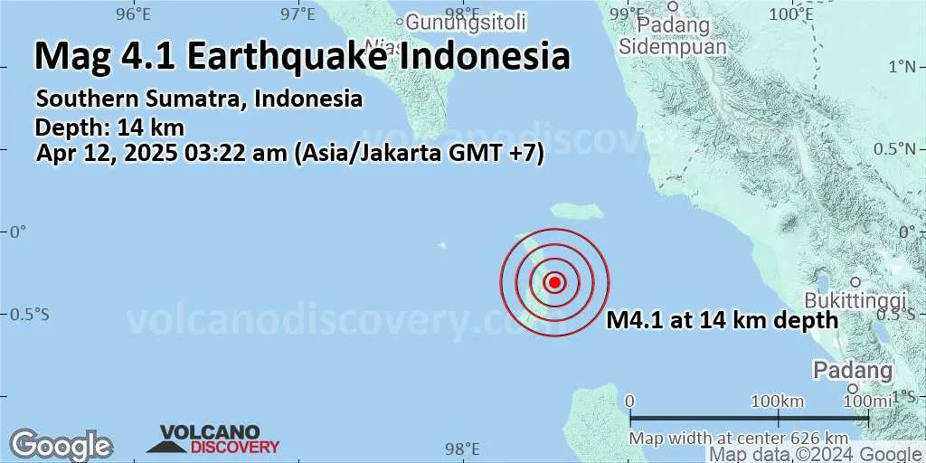
RSS feed source: Volcano Discovery.com--Global earthquake monitor

Support us – Help us upgrade our services! We truly love working to bring you the latest volcano and earthquake data from around the world. Maintaining our website and our free apps does require, however, considerable time and resources.
We need financing to increase hard- and software capacity as well as support our editor team. We’re aiming to achieve uninterrupted service wherever an earthquake or volcano eruption unfolds, and your donations can make it happen! Every donation will be highly appreciated. If you find the information useful and would like to support our team in integrating further features, write great content, and in upgrading our soft- and hardware, please make a donation (PayPal).

Planned features:

Improved multilanguage supportTsunami alertsFaster responsivenessThanks to your past donations, these features have been added recently:Design upgradeDetailed quake statsAdditional seismic data sourcesDownload and Upgrade the Volcanoes & Earthquakes app to get one of the fastest seismic and volcano alerts online:
Android | IOSThank you!

Click this link to continue reading the article on the source website.