RSS feed source: Volcano Discovery.com--Global earthquake monitor

Date and TimeMag
DepthDistanceLocationDetailsMap Jul 11, 09:17 pm (GMT +9)

4.2

354 km38 km (24 mi) to the NE Sea of Japan, 133 km west of Kanazawa, Ishikawa-ken, Japan InfoJun 11, 11:37 pm (GMT +9)

4.3

425 km52 km (32 mi) to the N Sea of Japan InfoMay 29, 01:58 am (GMT +9)

4.1

362 km56 km (35 mi) to the NE Japan: NW Off Hokuriku District InfoApr 13, 06:16 pm (GMT +9)

4.8

363 km50 km (31 mi) to the NE Japan: NW Off Hokuriku District 1 reportInfoMar 12, 04:59 am (GMT +9)

4.1

450 km82 km (51 mi) to the NE Sea of Japan, 134 km northwest of Kanazawa, Ishikawa-ken, Japan 1 reportInfoSep 19, 2024 05:30 am (GMT +9)

4.6

399 km101 km (63 mi) to the N SEA OF JAPAN InfoJan 1, 2024 04:10 pm (GMT +9)

7.5

10 km228 km (142 mi) to the E Ishikawa-ken, 85 km north of Takaoka, Toyama, Japan 191 reportsInfoSep 6, 2023 01:42 am (GMT +9)

4.6

387 km71 km (44 mi) to the NE Sea of Japan, 141 km northwest of Kanazawa, Ishikawa-ken, Japan InfoMar 26, 2022 05:24 pm (GMT +9)

4.6

372 km47 km (29 mi) to the E Japan: NW OFF HOKURIKU DISTRICT InfoApr 16, 2021 09:39 pm (GMT +9)

4.6

384 km49 km (30 mi) to the E NW OFF HOKURIKU DISTRICT, Japan InfoAug 13, 2020 08:23 am (GMT +9)

4.7

421 km92 km (57 mi) to the N Sea of Japan InfoFeb 15, 2017 07:41 pm (Universal Time)

5.0

367 km54 km (33 mi) to the NEnear Magnitude 5.0, Near of Kyoto InfoFeb 19, 2013 12:27 pm (Universal Time)

5.3

0 km81 km (51 mi) to the E near e of Magnitude 5.3, Near

Click this link to continue reading the article on the source website.

RSS feed source: Volcano Discovery.com--Global earthquake monitor

Volcanoes Today, 15 Aug 2025: Santiaguito volcano, Fuego, Klyuchevskoy, Popocatépetl, Semeru, Ibu, Reventador, Sangay

Fri, 15 Aug 2025, 19:00 1755284405 | BY: VN

Satellite image of Klyuchevskoy volcano on 15 Aug 2025

Satellite image of Kirishima volcano on 15 Aug 2025

Klyuchevskoy (Kamchatka): Explosive activity continues. Volcanic Ash Advisory Center (VAAC) Tokyo warned about a volcanic ash plume that rose up to estimated 36000 ft (11000 m) altitude or flight level 360 .
The full report is as follows: VA EMISSIONS CONTINUING OBS VA DTG:15/1420Z to 36000 ft (11000 m)

Kirishima (Kyushu): (15 Aug) Volcanic Ash Advisory Center Tokyo (VAAC) issued the following report: ERUPTED AT 20250815/0150Z OVER FL060 EXTD SW OBS VA DTG:15/0150Z

Suwanose-jima (Ryukyu Islands): Volcanic Ash Advisory Center Tokyo (VAAC) issued the following report: EXPLODED AT 20250815/1737Z VA CLD UNKNOWN OBS VA DTG:15/1730Z

Ibu (Halmahera, Indonesia): Volcanic Ash Advisory Center Darwin (VAAC) issued the following report: VA ERUPTION LAST

Click this link to continue reading the article on the source website.

RSS feed source: Volcano Discovery.com--Global earthquake monitor

At 359 PM EDT, Doppler radar was tracking a strong thunderstorm near Florida A and M. The strong thunderstorm is nearly stationary. HAZARD…Wind gusts up to 40 mph. SOURCE…Radar indicated. IMPACT…Gusty winds could knock down tree limbs and blow around unsecured objects. Locations impacted include… Tallahassee, Woodville, Tallahassee State College, Florida State University, Florida A and M, Doak Campbell Stadium, Lake Bradford, Leon Sinks, Gaither Community Center, Tallahassee Memorial Hosp, Walker Ford Community Center, South City, Eight Mile Pond, Griffin Heights, Bethel, Tallahassee Regional A/P, Governors Square Mall, Natural Bridge, Midtown, and Apalachee Ridge Estates.

Click this link to continue reading the article on the source website.

RSS feed source: Volcano Discovery.com--Global earthquake monitor

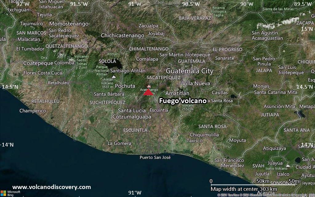
<!–div style="font-size:14px;text-align:center;border:3px solid blue;border-radius:5px;padding:3px;margin:5px;background:#eee"><a href="https://www.volcanoesandearthquakes.com/app/volcano-report.php?volcanoId=26" style="text-decoration:none" target="_blank" rel="noopener noreferrer nofollow" title="Share a volcano (activity) report, submit a photo or other interesting news!” onclick=”window.open(this.href,’Volcano Report’,’status=0,toolbar=0,location=0,directories=0,menubar=0,resizable=1,scrollbars=1,height=500,width=450′);return false”>Send Volcano Report</div–> Stratovolcano 3,763 m / 12,346 ft
Guatemala, 14.47°N / -90.88°W
Current status: erupting (4 out of 5) Fuego volcano eruptions:
1581, 1585, 1586, 1587, 1614, 1617, 1620, 1623, 1629, 1679(?), 1685, 1686, 1689(?), 1699, 1702, 1705, 1706, 1709(?), 1710,1717,1730, 1732, 1737, 1751(?), 1765(?), 1773(?), 1799, 1826, 1829, 1850(?), 1852(?), 1855, 1856, 1857, 1860, 1861(?), 1867(?), 1880, 1896, 1932, 1944, 1949, 1953, 1955, 1957, 1962, 1963, 1966, 1967, 1971, 1973, 1974, 1975, 1977, 1987, 1999, 2002 – ongoing
Typical eruption style
Dominantly explosive, construction of lava domes and extrusion of viscous lava flows. In near constant activity, at least during the past centuries.

Click this link to continue reading the article on the source website.