RSS feed source: US National Weather Service

* WHAT…Flooding caused by excessive rainfall continues. * WHERE…A portion of Deep South Texas, including the following county, Cameron. * WHEN…Until 215 PM CDT. * IMPACTS…Minor flooding in low-lying and poor drainage areas. Water over roadways. * ADDITIONAL DETAILS… – At 1251 PM CDT, Doppler radar indicated heavy rain due to thunderstorms. Minor flooding is ongoing or expected to begin shortly in the advisory area. Between 2 and 3 inches of rain have fallen. – Additional rainfall amounts of 1 to 2 inches are expected over the area. This additional rain will result in minor flooding. – Some locations that will experience flooding include… Brownsville, La Tina, Las Yescas, Las Yescas

Click this link to continue reading the article on the source website.

RSS feed source: US National Weather Service

Mon, 21 Apr 2025, 17:50 | BY: EARTHQUAKEMONITOR

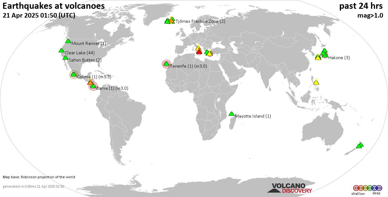
World map showing volcanoes with shallow (less than 50 km) earthquakes within 20 km radius during the past 24 hours on 21 Apr 2025 Number in brackets indicate nr of quakes.

Quakes detected near: Aracar (1 quake mag 3.0), Bardarbunga (4 quakes between mag 0.0-2.4), Brennisteinsfjöll (5 quakes between mag 0.1-1.0), Bulusan (1 quake mag 1.8), Cabalian (1 quake mag 2.1), Clear Lake (23 quakes between mag 0.2-1.4)
Coso (2 quakes between mag 1.0-1.1), Eldey (1 quake mag 1.0), Etna (1 quake mag 2.2), Fagradalsfjall (61 quakes between mag 0.1-1.0), Gede-Pangrango (1 quake mag 2.2), Geureudong (1 quake mag 2.0), Grímsvötn (1 quake mag 1.1), Hiuchi (2 quakes between mag 0.3-1.4), Hrómundartindur (8 quakes between mag 0.1-2.3), Jan Mayen (9 quakes between mag 0.8-1.7), Kamen (1 quake mag 1.2), Klyuchevskoy (3 quakes between mag 1.1-1.8), Kolumbo (24 quakes between mag 0.4-2.8), Kurikoma (6 quakes between mag 0.2-1.6), Ljósufjöll (9 quakes between mag 0.4-2.0), Mahagnao (1 quake mag 1.9), Mayotte Island (2 quakes between mag 1.0-1.1), Methana (2 quakes between mag 0.9-1.0), Milos (2 quakes between mag 1.9-2.4), Ndete Napu (1 quake mag 1.6), Poas (1 quake mag 1.9), Reporoa (3 quakes between mag 1.3-1.6), Rotorua (1 quake mag 1.5), Ruapehu (1 quake mag 1.2), Salton Buttes (5 quakes between mag 1.1-2.1), Soda Lakes (2 quakes between

Click this link to continue reading the article on the source website.
RSS feed source: US National Weather Service

…The Flood Warning is extended for the following rivers in Arkansas…Mississippi… Mississippi River at Helena For the Lower Mississippi River…including Tiptonville, Caruthersville, Osceola, Memphis, Tunica Mhoon Landing, Helena… Major flooding is forecast. * WHAT…Minor flooding is occurring and minor flooding is forecast. * WHERE…Mississippi River at Helena. * WHEN…Until Sunday morning. * IMPACTS…At 46.0 feet, In Mississippi, houses at Robson Towhead are being flooded. The settlement by Old River Chutes is going underwater. All locations on the northeast side of Desoto Lake are underwater. * ADDITIONAL DETAILS… – At 12:00 PM CDT Monday the stage was 46.5 feet. – Recent Activity…The maximum river stage in the 24 hours ending at 12:00

Click this link to continue reading the article on the source website.

RSS feed source: US National Weather Service

…The Flood Warning continues for the following rivers in Arkansas… St Francis River Diversion Ditch at Madison For the Saint Francis River…including Saint Francis, Lake City, Madison…Moderate flooding is forecast. * WHAT…Moderate flooding is occurring and moderate flooding is forecast. * WHERE…St Francis River Diversion Ditch at Madison. * WHEN…Until further notice. * IMPACTS…At 35.0 feet, Homes and numerous secondary roads are threatened. * ADDITIONAL DETAILS… – At 12:00 PM CDT Monday the stage was 35.2 feet. – Recent Activity…The maximum river stage in the 24 hours ending at 12:00 PM CDT Monday was 35.5 feet. – Forecast…The river will drop below moderate flood stage Wednesday and is expected to remain

Click this link to continue reading the article on the source website.